Kesselberg
Located in Calau, Landkreis Oberspreewald-Lausitz Coordinates: 51°42′13″ N 13°56′42″ E
- Elevation
- 166 m
- above sea level
- Local time
- UTC+01:00
- Europe/Berlin · UTC+01:00
- Airports
- DRS Dresden Airport65 km
- BER Berlin Brandenburg Airport79 km
About Kesselberg
Kesselberg is a mountain. Location: Calau, Landkreis Oberspreewald-Lausitz. Elevation: 166 m. The best months to visit are June–August. The nearest airport is Dresden Airport (65 km). Nearby sights include Kuhrings Berg and Tibenzberg.
Photos of Kesselberg
-
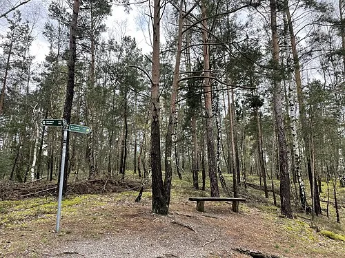
Kuhrings Berg Assenmacher · CC BY-SA 4.0

Climate of Kesselberg
Best months for sightseeingBest months for sightseeing: June–August.
This month · November
A cold month
Day 7° · Night 1° · Rain 48 mm
- Hottest month
- July (day 23°)
- Coldest month
- January (night -3°)
- Wettest month
- July (74 mm)
- Driest month
- April (33 mm)
Bars: average monthly low and high temperature. Below: precipitation. Monthly averages for 1970–2000 at about 18 km resolution, adjusted for elevation. Highlighted months are mild and relatively dry. Source: WorldClim 2.1 (CC BY 4.0).
Show values as a table
| Month | Jan | Feb | Mar | Apr | May | Jun | Jul | Aug | Sep | Oct | Nov | Dec |
|---|---|---|---|---|---|---|---|---|---|---|---|---|
| Average high (°C) | 2° | 3° | 8° | 12° | 18° | 21° | 23° | 23° | 18° | 13° | 7° | 3° |
| Average low (°C) | -3° | -3° | 0° | 3° | 7° | 11° | 12° | 12° | 9° | 5° | 1° | -2° |
| Precipitation (mm) | 42 | 38 | 45 | 33 | 54 | 53 | 74 | 67 | 52 | 38 | 48 | 45 |
How to get to Kesselberg
The nearest airport is Dresden Airport (DRS), 65 km to the south as the crow flies. The nearest large city is Dresden, 74 km to the south.
Airports
- Dresden Airport (DRS) Dresden 65 kmsouth
- Berlin Brandenburg Airport (BER) Berlin 79 kmnorth
- Leipzig/Halle Airport (LEJ) Schkeuditz 123 kmwest
Nearby large cities
- Dresden Population: 564.9K 74 kmsouth
- Potsdam Population: 184.8K 98 kmnorthwest
- Berlin Population: 3.4M 98 kmnorth
- Leipzig Population: 505K 116 kmwest
- Chemnitz Population: 247.2K 120 kmsouthwest
Straight-line distances; road distances are longer. Airport data: OurAirports.
Day trips from Kesselberg
Within 100 km: 413 historic and cultural sites, 1,534 natural sites, 822 lakes, rivers and coasts.
0–25 km113 places
- Wergteich Lake 12 kmE
- Unterteich Lake 20 kmE
- Stoßdorfer See Lake 17 kmNW
- Seeser Teich Lake 9 kmN
25–60 km794 places
- Lutzke River 57 kmNE
- Buschteich Lake 47 kmSE
- Obersee Lake 46 kmSE
- Meierei-See Lake 35 kmN
60–100 km1,862 places
- Erzgebirge Mountain 90 kmS
- Schlachtensee Lake 96 kmNW
- Pirna-Sonnenstein Mountain 84 kmS
- Vosí vrch Mountain 96 kmS
Straight-line distances.
Nearest towns and villages
-
 Cabel Village, Calau1.7 km N
-
Settinchen Village, Calau1.7 km W
-
Kalawa Town, Calau4.5 km N
-
 Bronkow Village, Landkreis Oberspreewald-Lausitz4.6 km SW
-
Weinberg Village, Calau1.7 km NW
-
 Luckaitztal Village, Landkreis Oberspreewald-Lausitz4.4 km SE
Nearby attractions & nature
Everything nearby-
Kuhrings Berg Mountain, Calau2.1 km NE
-
Tibenzberg Mountain, Luckaitztal2.7 km SE
-
Kemmener Forst Natural site, Brandenburg3.4 km NW
-
Kreuzberg Mountain, Bronkow3.9 km SW
-
Calauer Stadtforst Natural site, Brandenburg4.2 km NE
-
Großer Großmannsberg Mountain, Calau6.5 km W
-
Kleiner Großmannsberg Mountain, Calau6.6 km W
-
Neu Döberner Forst Natural site, Brandenburg6.5 km SE
Sources & licences
Data last updated: · 2 independent sources