Angermünde, Kirche St. Marien
Located in Angermünde, Landkreis Uckermark Coordinates: 53°01′09″ N 14°00′10″ E
- Local time
- UTC+01:00
- Europe/Berlin · UTC+01:00
- Elevation
- 52 m
- above sea level
- Airports
- BER Berlin Brandenburg Airport81 km
- SZZ Solidarity Szczecin–Goleniów Airport87 km
About Angermünde, Kirche St. Marien
Angermünde, Kirche St. Marien is a tourist attraction. Location: Angermünde, Landkreis Uckermark. The best months to visit are June–August. The nearest airport is Berlin Brandenburg Airport (81 km). Nearby sights include Burgwall and Ehemalige Klosterkirche.
Photos of Angermünde, Kirche St. Marien
-
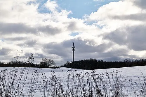
Telegraphenberg Leonhard Lenz · CC0

Climate of Angermünde, Kirche St. Marien
Best months for sightseeingBest months for sightseeing: June–August.
This month · November
A cold month
Day 7° · Night 1° · Rain 40 mm
- Hottest month
- August (day 24°)
- Coldest month
- January (night -3°)
- Wettest month
- June (61 mm)
- Driest month
- February (28 mm)
Bars: average monthly low and high temperature. Below: precipitation. Monthly averages for 1970–2000 at about 18 km resolution, adjusted for elevation. Highlighted months are mild and relatively dry. Source: WorldClim 2.1 (CC BY 4.0).
Show values as a table
| Month | Jan | Feb | Mar | Apr | May | Jun | Jul | Aug | Sep | Oct | Nov | Dec |
|---|---|---|---|---|---|---|---|---|---|---|---|---|
| Average high (°C) | 2° | 3° | 7° | 12° | 18° | 21° | 23° | 24° | 19° | 13° | 7° | 3° |
| Average low (°C) | -3° | -3° | 0° | 3° | 7° | 11° | 13° | 12° | 9° | 5° | 1° | -1° |
| Precipitation (mm) | 34 | 28 | 33 | 33 | 51 | 61 | 60 | 57 | 44 | 34 | 40 | 38 |
How to get to Angermünde, Kirche St. Marien
The nearest airport is Berlin Brandenburg Airport (BER), 81 km to the southwest as the crow flies. The nearest large city is Berlin, 68 km to the southwest.
Airports
- Berlin Brandenburg Airport (BER) Berlin 81 kmsouthwest
- Solidarity Szczecin–Goleniów Airport (SZZ) Szczecin(Glewice) 87 kmnortheast
- Heringsdorf Airport (HDF) Zirchow 96 kmnorth
Nearby large cities
- Berlin Population: 3.4M 68 kmsouthwest
- Potsdam Population: 184.8K 94 kmsouthwest
- Rostock Population: 198.3K 171 kmnorthwest
- Magdeburg Population: 244.3K 189 kmsouthwest
- Leipzig Population: 505K 218 kmsouthwest
Straight-line distances; road distances are longer. Airport data: OurAirports.
Day trips from Angermünde, Kirche St. Marien
Within 100 km: 440 historic and cultural sites, 1,550 natural sites, 1,491 lakes, rivers and coasts.
0–25 km326 places
- Strandbad Beach 4 kmW
- Burgwallinsel Island 20 kmNW
- Wolletzseeinseln Island 7 kmW
- Mopssee Lake 7 kmSW
25–60 km1,104 places
- Der Raatz Island 50 kmW
- Langes Werder Island 52 kmNW
- Fischers Werder Island 52 kmNW
- Hohes Werder Island 51 kmNW
60–100 km2,051 places
- Schlachtensee Lake 83 kmSW
- Valentinswerder Island 72 kmSW
- Scharfenberg Island 71 kmSW
- Dahme River River 70 kmSW
Straight-line distances.
Nearby attractions & nature
Everything nearby-
Burgwall Historic site, Angermünde0.2 km N
-
Ehemalige Klosterkirche Historic site, Angermünde0.4 km SE
-
Pulverturm Landmark, Angermünde0.5 km S
-
Welk- und Heimatmuseum Angermünde Museum, Angermünde1.2 km SW
-
Mündesee Lake, Brandenburg1 km E
-
Mudrow-See Lake, Angermünde2.1 km SE
-
Naturerlebnispark Natural site, Angermünde3.2 km NW
-
Dobberzinersee Lake, Angermünde3 km E
Nearest towns and villages
-
Angermünde Town, Angermünde0.5 km SW
-
Dobberzin Village, Angermünde2.1 km E
-
Kerkow Village, Angermünde2.2 km NW
-
Sternfelde Village, Angermünde2.9 km SW
Sources & licences
Data last updated: