- Elevation
- 485 m
- above sea level
- Local time
- UTC+01:00
- Europe/Berlin · UTC+01:00
- Airports
- FRA Frankfurt Main Airport88 km
- ERF Erfurt-Weimar Airport114 km
About Kleiner Nickus
Kleiner Nickus is a mountain. Location: Sinntal, Main-Kinzig-Kreis. Elevation: 485 m. The best months to visit are June–August. The nearest airport is Frankfurt Main Airport (88 km). Nearby sights include Stoppelsberg and Großer Nickus.
Photos of Kleiner Nickus
-
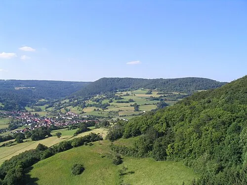
Stoppelsberg J. Braukmann Milseburg · CC BY-SA 3.0 -
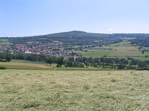
Haag J. Braukmann Milseburg · CC BY-SA 3.0 -
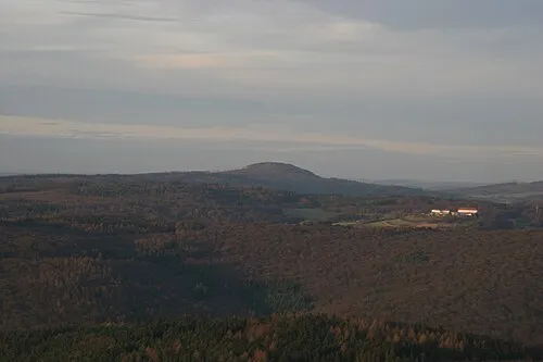
Große Haube J. Braukmann Milseburg · CC BY-SA 3.0 -

Frauenstein Albrecht Köhler · CC BY 4.0


Climate of Kleiner Nickus
Best months for sightseeingBest months for sightseeing: June–August.
This month · November
A cold month
Day 5° · Night 1° · Rain 87 mm
- Hottest month
- July (day 22°)
- Coldest month
- January (night -3°)
- Wettest month
- December (108 mm)
- Driest month
- April (60 mm)
Bars: average monthly low and high temperature. Below: precipitation. Monthly averages for 1970–2000 at about 18 km resolution, adjusted for elevation. Highlighted months are mild and relatively dry. Source: WorldClim 2.1 (CC BY 4.0).
Show values as a table
| Month | Jan | Feb | Mar | Apr | May | Jun | Jul | Aug | Sep | Oct | Nov | Dec |
|---|---|---|---|---|---|---|---|---|---|---|---|---|
| Average high (°C) | 1° | 3° | 7° | 11° | 17° | 20° | 22° | 22° | 17° | 11° | 5° | 3° |
| Average low (°C) | -3° | -3° | 0° | 2° | 7° | 10° | 12° | 12° | 8° | 4° | 1° | -2° |
| Precipitation (mm) | 90 | 74 | 79 | 60 | 70 | 76 | 86 | 64 | 72 | 83 | 87 | 108 |
How to get to Kleiner Nickus
The nearest airport is Frankfurt Main Airport (FRA), 88 km to the southwest as the crow flies. The nearest large city is Würzburg, 64 km to the south.
Airports
- Frankfurt Main Airport (FRA) Frankfurt am Main 88 kmsouthwest
- Erfurt-Weimar Airport (ERF) Erfurt 114 kmnortheast
- Kassel Airport (KSF) Calden 122 kmnorth
Nearby large cities
- Würzburg Population: 133.7K 64 kmsouth
- Offenbach Population: 119.2K 71 kmwest
- Frankfurt am Main Population: 650K 76 kmwest
- Darmstadt Population: 167K 91 kmsouthwest
- Wiesbaden Population: 288.8K 107 kmwest
Straight-line distances; road distances are longer. Airport data: OurAirports.
Day trips from Kleiner Nickus
Within 100 km: 1,001 historic and cultural sites, 5,189 natural sites, 805 lakes, rivers and coasts.
0–25 km424 places
- Kinzigtalsperre Lake 20 kmW
- Zornberg Mountain 17 kmNE
- Zöllersberg Mountain 22 kmSW
- Ziegenberg Mountain 14 kmW
25–60 km1,783 places
- Felda River 59 kmNW
- Eitra River 53 kmN
- Unterer Metzenweiher Lake 26 kmN
- Sennfelder See Lake 52 kmSE
60–100 km4,788 places
- Umpfer River 89 kmS
- Uzbach River 95 kmS
- Ohe River 86 kmNW
- Lumda River 78 kmNW
Straight-line distances.
Nearest towns and villages
-
 Oberzell Village, Sinntal1.8 km SE
-
Neuenmühle Village, Sinntal3.3 km SW
-
Geisberg Village, Sinntal3.4 km SW
-
Kalbach Village, Landkreis Fulda6.8 km N
-
Weichersbach Village, Sinntal3.6 km S
-
 Schwarzenfels Village, Sinntal4.8 km S
Nearby attractions & nature
Everything nearby-
Stoppelsberg Mountain, Sinntal1.9 km SW
-
Großer Nickus Mountain, Sinntal0.9 km N
-
Forst Mottgers-Nord Natural site, Hesse1 km NW
-
Hirschberg Mountain, Sinntal1.8 km S
-
Haag Mountain, Sinntal2.9 km SE
-
Kleine Sinn River, Bavaria1.2 km SE
-
Sandberg Mountain, Sinntal3.3 km E
-
Hoherain Mountain, Kalbach3 km N
Sources & licences
Data last updated: