- Elevation
- 322 m
- above sea level
- Local time
- UTC+01:00
- Europe/Berlin · UTC+01:00
- Airports
- FRA Frankfurt Main Airport18 km
- MHG Mannheim-City Airport74 km
About Pannenberg
Pannenberg is a mountain. Location: Eppstein, Main-Taunus-Kreis. Elevation: 322 m. The best months to visit are June–August. The nearest airport is Frankfurt Main Airport (18 km). Nearby sights include Seienberg and Judenkopf.
Photos of Pannenberg
-
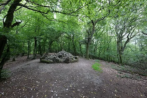
Staufen Leonhard Lenz · CC0 -
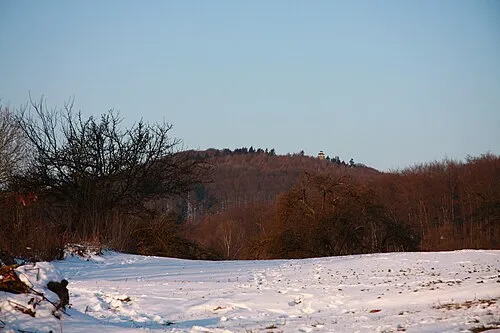
Kellerskopf Wo st 01 · CC BY-SA 3.0 de -
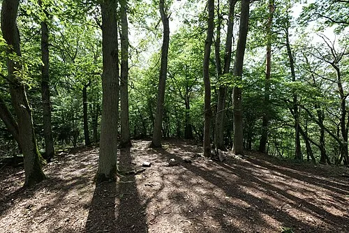
Hahnenkopf Leonhard Lenz · CC0


Climate of Pannenberg
Best months for sightseeingBest months for sightseeing: June–August.
This month · November
A cold month
Day 7° · Night 1° · Rain 53 mm
- Hottest month
- July (day 23°)
- Coldest month
- January (night -2°)
- Wettest month
- July (67 mm)
- Driest month
- February (42 mm)
Bars: average monthly low and high temperature. Below: precipitation. Monthly averages for 1970–2000 at about 18 km resolution, adjusted for elevation. Highlighted months are mild and relatively dry. Source: WorldClim 2.1 (CC BY 4.0).
Show values as a table
| Month | Jan | Feb | Mar | Apr | May | Jun | Jul | Aug | Sep | Oct | Nov | Dec |
|---|---|---|---|---|---|---|---|---|---|---|---|---|
| Average high (°C) | 3° | 4° | 9° | 13° | 18° | 21° | 23° | 23° | 18° | 12° | 7° | 4° |
| Average low (°C) | -2° | -2° | 1° | 3° | 8° | 11° | 13° | 12° | 9° | 5° | 1° | -1° |
| Precipitation (mm) | 47 | 42 | 48 | 45 | 60 | 63 | 67 | 49 | 52 | 56 | 53 | 59 |
How to get to Pannenberg
The nearest airport is Frankfurt Main Airport (FRA), 18 km to the southeast as the crow flies. The nearest large city is Wiesbaden, 10 km to the southwest.
Airports
- Frankfurt Main Airport (FRA) Frankfurt am Main 18 kmsoutheast
- Mannheim-City Airport (MHG) Mannheim 74 kmsouth
- Frankfurt-Hahn Airport (HHN) Frankfurt am Main (Lautzenhausen) 82 kmwest
Nearby large cities
- Wiesbaden Population: 288.8K 10 kmsouthwest
- Mainz Population: 222.9K 18 kmsouth
- Frankfurt am Main Population: 650K 23 kmeast
- Offenbach Population: 119.2K 29 kmeast
- Darmstadt Population: 167K 36 kmsoutheast
Straight-line distances; road distances are longer. Airport data: OurAirports.
Day trips from Pannenberg
Within 100 km: 930 historic and cultural sites, 4,337 natural sites, 805 lakes, rivers and coasts.
0–25 km425 places
- Petersaue Island 14 kmSW
- Mariannenaue Island 24 kmSW
- Königsklinger Aue Island 21 kmSW
- Langenaue Island 20 kmS
25–60 km1,648 places
- Modau River 36 kmS
- Aar River 37 kmNW
- Rüdesheimer Aue Island 36 kmSW
- Kisselwörth Island 25 kmS
60–100 km3,999 places
- Elsenz River 88 kmS
- Weibe River 90 kmNW
- Ohe River 77 kmN
- Lumda River 61 kmN
Straight-line distances.
Nearest towns and villages
-
Eppstein Town, Eppstein2.1 km NE
-
Bremthal Village, Eppstein1.1 km NW
-
Vockenhausen Village, Eppstein1.9 km NE
-
Kelkheim (Taunus) Village, Main-Taunus-Kreis5.6 km E
-
Niederjosbach Village, Eppstein2.6 km NW
-
Wildsachsen Village, Hofheim am Taunus, Kreisstadt2 km S
Nearby attractions & nature
Everything nearby-
Seienberg Mountain, Hofheim am Taunus, Kreisstadt1.2 km SW
-
Judenkopf Mountain, Hofheim am Taunus, Kreisstadt1.7 km E
-
Forst Hofheim Natural site, Hesse2.2 km NE
-
Staufen Mountain, Kelkheim (Taunus)3.6 km E
-
Daisbach River, Hesse1.6 km NE
-
Dattenbach River, Hesse1.7 km NE
-
Oberberg Mountain, Wiesbaden3.6 km S
-
Hahnenkopf Mountain, Hofheim am Taunus, Kreisstadt3.9 km E
Sources & licences
Data last updated: · 2 independent sources