- Elevation
- 529 m
- above sea level
- Local time
- UTC+01:00
- Europe/Berlin · UTC+01:00
- Airports
- CGN Cologne Bonn Airport82 km
- PAD Paderborn Lippstadt Airport88 km
About Gispel
Gispel is a mountain. Location: Dietzhölztal, Lahn-Dill-Kreis. Elevation: 529 m. The best months to visit are June–August. The nearest airport is Cologne Bonn Airport (82 km). Nearby sights include Eichholzkopf and Sasenberg.
Photos of Gispel
-
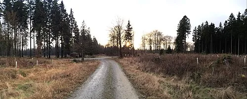
Jagdberg Wikihunter99 · CC BY-SA 3.0 -
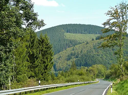
Eichholzkopf Kurt + Else Dietrich · CC BY-SA 3.0 -
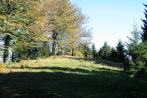
Burg Alexander Blecher, blecher.info , all 452 pictures , overview · CC BY-SA 4.0


Climate of Gispel
Best months for sightseeingBest months for sightseeing: June–August.
This month · November
A wet month
Day 6° · Night 0° · Rain 104 mm
- Hottest month
- July (day 21°)
- Coldest month
- February (night -3°)
- Wettest month
- December (123 mm)
- Driest month
- April (71 mm)
Bars: average monthly low and high temperature. Below: precipitation. Monthly averages for 1970–2000 at about 18 km resolution, adjusted for elevation. Highlighted months are mild and relatively dry. Source: WorldClim 2.1 (CC BY 4.0).
Show values as a table
| Month | Jan | Feb | Mar | Apr | May | Jun | Jul | Aug | Sep | Oct | Nov | Dec |
|---|---|---|---|---|---|---|---|---|---|---|---|---|
| Average high (°C) | 2° | 3° | 7° | 11° | 16° | 19° | 21° | 20° | 16° | 11° | 6° | 3° |
| Average low (°C) | -3° | -3° | -1° | 2° | 6° | 9° | 11° | 10° | 7° | 4° | 0° | -2° |
| Precipitation (mm) | 114 | 81 | 98 | 71 | 75 | 83 | 87 | 74 | 83 | 92 | 104 | 123 |
How to get to Gispel
The nearest airport is Cologne Bonn Airport (CGN), 82 km to the west as the crow flies. The nearest large city is Siegen, 20 km to the west.
Airports
- Cologne Bonn Airport (CGN) Köln (Cologne) 82 kmwest
- Paderborn Lippstadt Airport (PAD) Büren 88 kmnorth
- Dortmund Airport (DTM) Dortmund 89 kmnorthwest
Nearby large cities
- Siegen Population: 107.2K 20 kmwest
- Koblenz Population: 107.3K 75 kmsouthwest
- Hagen Population: 199K 82 kmnorthwest
- Bergisch Gladbach Population: 106.2K 84 kmwest
- Wiesbaden Population: 288.8K 84 kmsouth
Straight-line distances; road distances are longer. Airport data: OurAirports.
Day trips from Gispel
Within 100 km: 723 historic and cultural sites, 4,698 natural sites, 820 lakes, rivers and coasts.
0–25 km608 places
- Breitenbachtalsperre Lake 23 kmNW
- Obernaustausee Lake 14 kmNW
- Ziegenberg Mountain 10 kmW
- Ziegenberg Mountain 18 kmE
25–60 km1,928 places
- Else River 53 kmNW
- Weibe River 31 kmW
- Valme River 58 kmN
- Ohe River 28 kmE
60–100 km3,705 places
- Wande River 85 kmNE
- Erpe River 86 kmNE
- Else River 84 kmNW
- Naure River 92 kmNE
Straight-line distances.
Nearest towns and villages
-
Ewersbach Village, Dietzhölztal1.1 km S
-
Mandeln Village, Dietzhölztal2.2 km E
-
Straßebersbach Neighbourhood, Dietzhölztal1.4 km SE
-
Steinbrücken Village, Dietzhölztal2.3 km SE
-
Bergebersbach Neighbourhood, Dietzhölztal1.6 km S
-
Rittershausen Village, Dietzhölztal1.9 km W
Nearby attractions & nature
Everything nearby-
Eichholzkopf Mountain, Dietzhölztal1.7 km NW
-
Sasenberg Mountain, Dietzhölztal2 km SE
-
Hausberg Mountain, Dietzhölztal2.2 km SW
-
Eichwäldchen Mountain, Dietzhölztal2.1 km NE
-
Rippelnberg Mountain, Dietzhölztal2.7 km S
-
Homberg Mountain, Eschenburg2.7 km E
-
Hauberg Mountain, Dietzhölztal2.8 km E
-
Speckmann Mountain, Haiger2.9 km SW
Sources & licences
Data last updated: · 2 independent sources