- Elevation
- 583 m
- above sea level
- Local time
- UTC+01:00
- Europe/Berlin · UTC+01:00
- Airports
- CGN Cologne Bonn Airport74 km
- FRA Frankfurt Main Airport75 km
About Hohenroth
Hohenroth is a village. Location: Driedorf, Lahn-Dill-Kreis. Elevation: 583 m. The best months to visit are June–August. The nearest airport is Cologne Bonn Airport (74 km). Nearby sights include Großefeld and Höllberg.
Photos of Hohenroth
-
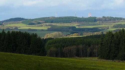
Salzburger Kopf Kurt + Else Dietrich · CC BY-SA 3.0 -
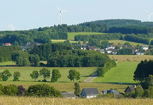
Ketzerstein Kurt + Else Dietrich · CC BY-SA 3.0 -
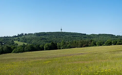
Höllberg Jörg Braukmann · CC BY-SA 4.0


Climate of Hohenroth
Best months for sightseeingBest months for sightseeing: June–August.
This month · November
A cold month
Day 5° · Night 0° · Rain 83 mm
- Hottest month
- July (day 21°)
- Coldest month
- February (night -4°)
- Wettest month
- December (96 mm)
- Driest month
- April (59 mm)
Bars: average monthly low and high temperature. Below: precipitation. Monthly averages for 1970–2000 at about 18 km resolution, adjusted for elevation. Highlighted months are mild and relatively dry. Source: WorldClim 2.1 (CC BY 4.0).
Show values as a table
| Month | Jan | Feb | Mar | Apr | May | Jun | Jul | Aug | Sep | Oct | Nov | Dec |
|---|---|---|---|---|---|---|---|---|---|---|---|---|
| Average high (°C) | 1° | 3° | 7° | 11° | 16° | 19° | 21° | 21° | 16° | 11° | 5° | 3° |
| Average low (°C) | -4° | -4° | -1° | 1° | 6° | 9° | 11° | 10° | 7° | 3° | 0° | -2° |
| Precipitation (mm) | 83 | 65 | 77 | 59 | 67 | 75 | 76 | 62 | 70 | 76 | 83 | 96 |
How to get to Hohenroth
The nearest airport is Cologne Bonn Airport (CGN), 74 km to the west as the crow flies. The nearest large city is Siegen, 27 km to the north.
Airports
- Cologne Bonn Airport (CGN) Köln (Cologne) 74 kmwest
- Frankfurt Main Airport (FRA) Frankfurt am Main 75 kmsoutheast
- Frankfurt-Hahn Airport (HHN) Frankfurt am Main (Lautzenhausen) 99 kmsouthwest
Nearby large cities
- Siegen Population: 107.2K 27 kmnorth
- Koblenz Population: 107.3K 51 kmsouthwest
- Wiesbaden Population: 288.8K 62 kmsouth
- Frankfurt am Main Population: 650K 70 kmsoutheast
- Mainz Population: 222.9K 74 kmsouth
Straight-line distances; road distances are longer. Airport data: OurAirports.
Day trips from Hohenroth
Within 100 km: 765 historic and cultural sites, 4,614 natural sites, 829 lakes, rivers and coasts.
0–25 km451 places
- Krombachtalsperre Lake 2 kmS
- Dreifelder Weiher Lake 23 kmW
- Wiesensee Lake 12 kmSW
- Zinnberg Mountain 15 kmSE
25–60 km1,927 places
- Weibe River 32 kmNW
- Ohe River 43 kmNE
- Lumda River 40 kmE
- Aar River 32 kmS
60–100 km3,830 places
- Else River 97 kmNW
- Else River 68 kmN
- Valme River 82 kmN
- Ogge River 79 kmNE
Straight-line distances.
Nearby attractions & nature
Everything nearby-
Großefeld Mountain, Driedorf0.5 km NW
-
Höllberg Mountain, Driedorf1 km E
-
Fernmeldeturm Hohenroth Landmark, Driedorf0.9 km E
-
Krimberg Mountain, Rehe1.3 km S
-
Auf der Baar Mountain, Driedorf2 km N
-
Auf dem Scheid Mountain, Driedorf2.9 km S
Sources & licences
Data last updated: