- Elevation
- 372 m
- above sea level
- Local time
- UTC+01:00
- Europe/Berlin · UTC+01:00
- Airports
- FRA Frankfurt Main Airport73 km
- CGN Cologne Bonn Airport94 km
About Himberg
Himberg is a mountain. Location: Hohenahr, Lahn-Dill-Kreis. Elevation: 372 m. The best months to visit are June–August. The nearest airport is Frankfurt Main Airport (73 km). Nearby sights include Roßberg and Steinberg.
Photos of Himberg
-
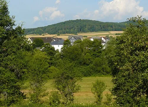
Koppe Kurt + Else Dietrich · CC BY-SA 3.0 -
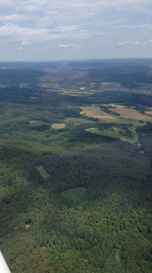
Alteburg Santasantaxxx · CC BY-SA 4.0


Climate of Himberg
Best months for sightseeingBest months for sightseeing: June–August.
This month · November
A cold month
Day 6° · Night 1° · Rain 82 mm
- Hottest month
- July (day 22°)
- Coldest month
- February (night -3°)
- Wettest month
- December (98 mm)
- Driest month
- April (59 mm)
Bars: average monthly low and high temperature. Below: precipitation. Monthly averages for 1970–2000 at about 18 km resolution, adjusted for elevation. Highlighted months are mild and relatively dry. Source: WorldClim 2.1 (CC BY 4.0).
Show values as a table
| Month | Jan | Feb | Mar | Apr | May | Jun | Jul | Aug | Sep | Oct | Nov | Dec |
|---|---|---|---|---|---|---|---|---|---|---|---|---|
| Average high (°C) | 3° | 4° | 8° | 12° | 17° | 20° | 22° | 22° | 18° | 12° | 6° | 4° |
| Average low (°C) | -2° | -3° | 0° | 2° | 7° | 10° | 12° | 11° | 8° | 5° | 1° | -1° |
| Precipitation (mm) | 86 | 64 | 77 | 59 | 69 | 73 | 73 | 62 | 68 | 76 | 82 | 98 |
How to get to Himberg
The nearest airport is Frankfurt Main Airport (FRA), 73 km to the south as the crow flies. The nearest large city is Siegen, 36 km to the northwest.
Airports
- Frankfurt Main Airport (FRA) Frankfurt am Main 73 kmsouth
- Cologne Bonn Airport (CGN) Köln (Cologne) 94 kmwest
- Paderborn Lippstadt Airport (PAD) Büren 104 kmnorth
Nearby large cities
- Siegen Population: 107.2K 36 kmnorthwest
- Frankfurt am Main Population: 650K 65 kmsouth
- Wiesbaden Population: 288.8K 68 kmsouth
- Offenbach Population: 119.2K 69 kmsouth
- Koblenz Population: 107.3K 71 kmsouthwest
Straight-line distances; road distances are longer. Airport data: OurAirports.
Day trips from Himberg
Within 100 km: 662 historic and cultural sites, 5,023 natural sites, 821 lakes, rivers and coasts.
0–25 km459 places
- Ohe River 21 kmNE
- Lumda River 19 kmE
- Krombachtalsperre Lake 23 kmW
- Zinnberg Mountain 19 kmSW
25–60 km1,955 places
- Weibe River 46 kmNW
- Liese River 51 kmN
- Felda River 44 kmE
- Aar River 47 kmSW
60–100 km4,092 places
- Wande River 94 kmNE
- Erpe River 95 kmNE
- Else River 73 kmNW
- Valme River 76 kmN
Straight-line distances.
Nearest towns and villages
-
Bischoffen Village, Lahn-Dill-Kreis2 km N
-
Bischoffen Village, Bischoffen2 km N
-
Mittenaar Village, Lahn-Dill-Kreis3.7 km W
-
Altenkirchen Village, Hohenahr1.3 km E
-
Mittenaar Town, Mittenaar4.6 km NW
-
 Mudersbach Village, Hohenahr3.4 km E
Nearby attractions & nature
Everything nearby-
Roßberg Mountain, Hohenahr1.3 km NE
-
Steinberg Mountain, Mittenaar1.5 km N
-
Hellberg Mountain, Bischoffen2 km N
-
Hohenroth Mountain, Hohenahr2.5 km SE
-
Windfeld Mountain, Mittenaar2.6 km W
-
Hörrkopf Mountain, Mittenaar2.8 km SW
-
Buchenberg Mountain, Aßlar2.9 km SE
-
Gebrannter Berg Mountain, Ehringshausen3.2 km SW
Sources & licences
Data last updated: · 2 independent sources