Vogelsbergkreis
Located in Regierungsbezirk Gießen, Hesse Coordinates: 50°39′07″ N 9°16′10″ E
- Population
- 101,163
- 101.2K
- Elevation
- 371 m
- above sea level
- Local time
- UTC+01:00
- Europe/Berlin · UTC+01:00
- Places inside
- 19
- listed under Vogelsbergkreis
- Airports
- KSF Kassel Airport86 km
- FRA Frankfurt Main Airport86 km
About Vogelsbergkreis
Vogelsbergkreis is a municipality. Location: Regierungsbezirk Gießen, Hesse. Population: 101,163. Elevation: 371 m. The best months to visit are June–August. The nearest airport is Kassel Airport (86 km). Nearby sights include Ohgrund and Heiligenwald.
Climate of Vogelsbergkreis
Best months for sightseeingBest months for sightseeing: June–August.
This month · November
A cold month
Day 6° · Night 1° · Rain 97 mm
- Hottest month
- July (day 22°)
- Coldest month
- February (night -2°)
- Wettest month
- December (116 mm)
- Driest month
- April (72 mm)
Bars: average monthly low and high temperature. Below: precipitation. Monthly averages for 1970–2000 at about 18 km resolution, adjusted for elevation. Highlighted months are mild and relatively dry. Source: WorldClim 2.1 (CC BY 4.0).
Show values as a table
| Month | Jan | Feb | Mar | Apr | May | Jun | Jul | Aug | Sep | Oct | Nov | Dec |
|---|---|---|---|---|---|---|---|---|---|---|---|---|
| Average high (°C) | 2° | 3° | 7° | 12° | 17° | 19° | 22° | 22° | 17° | 12° | 6° | 3° |
| Average low (°C) | -2° | -2° | 1° | 3° | 7° | 10° | 12° | 12° | 9° | 5° | 1° | -1° |
| Precipitation (mm) | 100 | 75 | 88 | 72 | 79 | 90 | 97 | 74 | 86 | 93 | 97 | 116 |
How to get to Vogelsbergkreis
The nearest airport is Kassel Airport (KSF), 86 km to the north as the crow flies. The nearest large city is Offenbach, 71 km to the southwest.
Airports
- Kassel Airport (KSF) Calden 86 kmnorth
- Frankfurt Main Airport (FRA) Frankfurt am Main 86 kmsouthwest
- Paderborn Lippstadt Airport (PAD) Büren 116 kmnorthwest
Nearby large cities
- Offenbach Population: 119.2K 71 kmsouthwest
- Frankfurt am Main Population: 650K 73 kmsouthwest
- Kassel Population: 197.2K 76 kmnorth
- Siegen Population: 107.2K 91 kmwest
- Wiesbaden Population: 288.8K 96 kmsouthwest
Straight-line distances; road distances are longer. Airport data: OurAirports.
Day trips from Vogelsbergkreis
Within 100 km: 570 historic and cultural sites, 5,666 natural sites, 735 lakes, rivers and coasts.
0–25 km340 places
- Felda River 15 kmW
- Lanzenhainer Weier Lake 12 kmS
- Niddasee Lake 22 kmSW
- Zieglerskuppe Mountain 22 kmNE
25–60 km2,123 places
- Ohe River 43 kmW
- Lumda River 40 kmW
- Eitra River 37 kmNE
- Unterer Metzenweiher Lake 38 kmE
60–100 km4,508 places
- Wande River 86 kmN
- Erpe River 86 kmN
- Valme River 100 kmNW
- Ogge River 74 kmNW
Straight-line distances.
Vogelsbergkreis and similar cities
Side by side with cities of similar size in the same country: population, elevation and climate.
| Measure | Vogelsbergkreis | Trier | Erlangen | Moers |
|---|---|---|---|---|
| Population | 101.2K | 100.1K | 102.7K | 103.5K |
| Elevation | 371 m | 141 m | 290 m | 29 m |
| Summer day (hottest month) | 22° | 24° | 24° | 24° |
| Winter night (coldest month) | -2° | 0° | -3° | 1° |
| Annual rainfall | 1,067 mm | 817 mm | 745 mm | 770 mm |
| Best months | Jun–Aug | Jun–Sep | May–Sep | Jun–Sep |
| Distance | — | 213 km | 171 km | 205 km |
Climate values are 1970–2000 monthly averages; straight-line distance.
Places in Vogelsbergkreis
19 places- 1 Alsfeld 15.3K
- 2 Lauterbach (Hessen), Kreisstadt 13K
- 3 Schotten 9.6K
- 4 Schlitz 9.3K
- 5 Mücke 9.3K
- 6 Homberg (Ohm) 7K
- 7 Herbstein 4.6K
- 8 Grebenhain 4.4K
- 9 Wartenberg 3.5K
- 10 Kirtorf 3.1K
- 11 Freiensteinau 3K
- 12 Schwalmtal 2.8K
- 13 Ulrichstein 2.7K
- 14 Gemünden (Felda) 2.6K
- 15 Romrod 2.6K
- 16 Grebenau 2.3K
- 17 Lautertal 2.2K
- 18 Feldatal 2.2K
- 19 Antrifttal 1.8K
Bar: population relative to the most populous place in this list.
Nearby attractions & nature
Everything nearby-
Ohgrund Natural site, Hesse6.8 km S
-
Heiligenwald Natural site, Hesse5.8 km S
-
Lohrain Natural site, Hesse6.3 km SW
-
Kühnholz Natural site, Hesse8 km S
-
Göringer Grund Natural site, Hesse10 km NW
-
Kammberg Mountain, Hesse11 km W
-
Schlitz River, Hesse8.4 km SE
-
Zeilbach River, Hesse8.4 km W
Other cities and towns in Regierungsbezirk Gießen
-
Lauterbach Town, Lauterbach (Hessen), Kreisstadt9.3 km E
-
Alsfeld Town, Alsfeld11 km N
-
Giessen Municipality, Regierungsbezirk Gießen33 km W
-
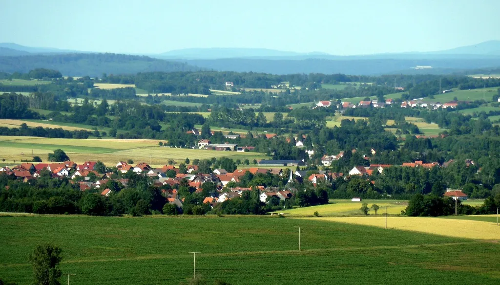 Grebenhain Town, Grebenhain19 km S
-
Herbstein Town, Herbstein11 km SE
-
Landkreis Marburg-Biedenkopf Municipality, Regierungsbezirk Gießen41 km NW
Sources & licences
Data last updated: