- Elevation
- 321 m
- above sea level
- Local time
- UTC+01:00
- Europe/Berlin · UTC+01:00
- Airports
- FRA Frankfurt Main Airport99 km
- ERF Erfurt-Weimar Airport102 km
About Lütter
Lütter is a village. Location: Eichenzell, Landkreis Fulda. Elevation: 321 m. The best months to visit are June–August. The nearest airport is Frankfurt Main Airport (99 km). Nearby sights include Lütterbach and Burghardser Kopf.
Photos of Lütter
-
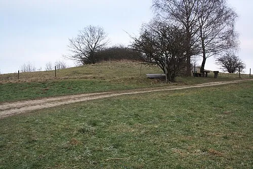
Motzküppel Verum · CC BY-SA 3.0

Climate of Lütter
Best months for sightseeingBest months for sightseeing: June–August.
This month · November
A cold month
Day 6° · Night 2° · Rain 87 mm
- Hottest month
- July (day 23°)
- Coldest month
- January (night -2°)
- Wettest month
- December (108 mm)
- Driest month
- April (60 mm)
Bars: average monthly low and high temperature. Below: precipitation. Monthly averages for 1970–2000 at about 18 km resolution, adjusted for elevation. Highlighted months are mild and relatively dry. Source: WorldClim 2.1 (CC BY 4.0).
Show values as a table
| Month | Jan | Feb | Mar | Apr | May | Jun | Jul | Aug | Sep | Oct | Nov | Dec |
|---|---|---|---|---|---|---|---|---|---|---|---|---|
| Average high (°C) | 2° | 4° | 8° | 12° | 18° | 21° | 23° | 23° | 18° | 12° | 6° | 4° |
| Average low (°C) | -2° | -2° | 1° | 3° | 8° | 11° | 13° | 13° | 9° | 5° | 2° | -1° |
| Precipitation (mm) | 90 | 74 | 79 | 60 | 70 | 76 | 86 | 64 | 72 | 83 | 87 | 108 |
How to get to Lütter
The nearest airport is Frankfurt Main Airport (FRA), 99 km to the southwest as the crow flies. The nearest large city is Würzburg, 77 km to the south.
Airports
- Frankfurt Main Airport (FRA) Frankfurt am Main 99 kmsouthwest
- Erfurt-Weimar Airport (ERF) Erfurt 102 kmnortheast
- Kassel Airport (KSF) Calden 108 kmnorth
Nearby large cities
- Würzburg Population: 133.7K 77 kmsouth
- Offenbach Population: 119.2K 82 kmsouthwest
- Frankfurt am Main Population: 650K 86 kmsouthwest
- Kassel Population: 197.2K 95 kmnorth
- Darmstadt Population: 167K 104 kmsouthwest
Straight-line distances; road distances are longer. Airport data: OurAirports.
Day trips from Lütter
Within 100 km: 950 historic and cultural sites, 5,335 natural sites, 815 lakes, rivers and coasts.
0–25 km469 places
- Unterer Metzenweiher Lake 10 kmN
- Oberer Metzenweiher Lake 10 kmN
- Metzenweiher Lake 10 kmN
- Zornberg Mountain 14 kmSE
25–60 km1,833 places
- Felda River 47 kmNE
- Felda River 55 kmNW
- Eitra River 37 kmN
- Sennfelder See Lake 60 kmSE
60–100 km4,798 places
- Ohe River 83 kmNW
- Lumda River 77 kmW
- Frieda River 83 kmN
- Baune River 87 kmN
Straight-line distances.
Nearby attractions & nature
Everything nearby-
Lütterbach River, Hesse0.7 km SW
-
Burghardser Kopf Mountain, Eichenzell2.6 km SW
-
Motzküppel Mountain, Ebersburg3 km NE
-
Roßberg Mountain, Ebersburg2.9 km S
-
Steinhauk Mountain, Eichenzell3.6 km W
-
Lenzenberg Mountain, Ebersburg3.2 km E
Sources & licences
Data last updated: