Fritzlar, Dom- und Kaiserstadt
Located in Schwalm-Eder-Kreis, Regierungsbezirk Kassel Coordinates: 51°07′33″ N 9°16′49″ E
- Population
- 14,493
- 14.5K
- Elevation
- 173 m
- above sea level
- Local time
- UTC+01:00
- Europe/Berlin · UTC+01:00
- Places inside
- 35
- listed under Fritzlar, Dom- und Kaiserstadt
- Airports
- KSF Kassel Airport33 km
- PAD Paderborn Lippstadt Airport71 km
About Fritzlar, Dom- und Kaiserstadt
Fritzlar, Dom- und Kaiserstadt is a village. Location: Schwalm-Eder-Kreis, Regierungsbezirk Kassel. Population: 14,493. Elevation: 173 m. The best months to visit are June–August. The nearest airport is Kassel Airport (33 km). Nearby sights include Elbe and Fritzlar-Waberner Becken.
Photos of Fritzlar, Dom- und Kaiserstadt
-
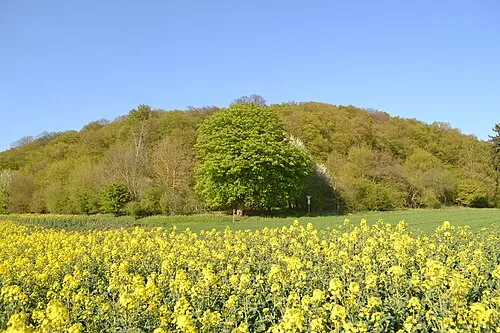
Nenkel Nickedemus · CC BY-SA 4.0

Climate of Fritzlar, Dom- und Kaiserstadt
Best months for sightseeingBest months for sightseeing: June–August.
This month · November
A cold month
Day 7° · Night 2° · Rain 55 mm
- Hottest month
- July (day 23°)
- Coldest month
- February (night -2°)
- Wettest month
- June (72 mm)
- Driest month
- February (38 mm)
Bars: average monthly low and high temperature. Below: precipitation. Monthly averages for 1970–2000 at about 18 km resolution, adjusted for elevation. Highlighted months are mild and relatively dry. Source: WorldClim 2.1 (CC BY 4.0).
Show values as a table
| Month | Jan | Feb | Mar | Apr | May | Jun | Jul | Aug | Sep | Oct | Nov | Dec |
|---|---|---|---|---|---|---|---|---|---|---|---|---|
| Average high (°C) | 3° | 4° | 9° | 13° | 18° | 21° | 23° | 23° | 19° | 13° | 7° | 4° |
| Average low (°C) | -2° | -2° | 1° | 3° | 7° | 11° | 12° | 12° | 9° | 5° | 2° | 0° |
| Precipitation (mm) | 48 | 38 | 47 | 46 | 65 | 72 | 63 | 56 | 56 | 52 | 55 | 57 |
How to get to Fritzlar, Dom- und Kaiserstadt
The nearest airport is Kassel Airport (KSF), 33 km to the north as the crow flies. The nearest large city is Kassel, 26 km to the northeast.
Airports
- Kassel Airport (KSF) Calden 33 kmnorth
- Paderborn Lippstadt Airport (PAD) Büren 71 kmnorthwest
- Erfurt-Weimar Airport (ERF) Erfurt 119 kmeast
Nearby large cities
- Kassel Population: 197.2K 26 kmnortheast
- Göttingen Population: 122.1K 64 kmnortheast
- Paderborn Population: 142.2K 75 kmnorthwest
- Siegen Population: 107.2K 92 kmwest
- Bielefeld Population: 331.9K 113 kmnorthwest
Straight-line distances; road distances are longer. Airport data: OurAirports.
Day trips from Fritzlar, Dom- und Kaiserstadt
Within 100 km: 418 historic and cultural sites, 5,806 natural sites, 796 lakes, rivers and coasts.
0–25 km465 places
- Baune River 18 kmNE
- Eder Stausee Lake 19 kmNW
- Ziegenkopf Mountain 12 kmSE
- Ziegenkopf Mountain 17 kmSW
25–60 km2,121 places
- Wande River 34 kmN
- Erpe River 35 kmN
- Ohe River 56 kmSW
- Ogge River 39 kmW
60–100 km4,434 places
- Else River 99 kmW
- Valme River 67 kmNW
- Lumda River 68 kmSW
- Grimke River 81 kmNW
Straight-line distances.
Places in Fritzlar, Dom- und Kaiserstadt
35 placesBar: population relative to the most populous place in this list.
Cities & villages11
- Cappel · Village
- Geismar · Village
- Haddamar · Village
- Lohne · Village
- Obermöllrich · Village
- Rothhelmshausen · Village
- Sauerbrunnen · Village
- Ungedanken · Village
- Wehren · Village
- Werkel · Village
- Züschen · Village
Mountains & nature20
- Barthel · Mountain
- Biening · Mountain
- Büraberg · Mountain
- Dachsberg · Mountain
- Das Helle · Mountain
- Eckerichswarte · Mountain
- Hasenberg · Mountain
- Heidekopf · Mountain
- Hermannsberg · Mountain
- Herrberg · Mountain
- Hinterberg · Mountain
- Hoheberg · Mountain
- Johanneskirchenkopf · Mountain
- Jungfernkopf · Mountain
- Lohrberg · Mountain
- Mittelberg · Mountain
- Mühlenberg · Mountain
- Steinberg · Mountain
- Vorderberg · Mountain
- Wolfskopf · Mountain
Heritage & sights3
- Fritzlar Dom · Attraction
- Fritzlar, Stadtkirche (Minoritenkirche) · Attraction
- Holzheim · Historic site
Nearby attractions & nature
Everything nearby-
Elbe River, Hesse2.3 km W
-
Fritzlar-Waberner Becken Natural site, Hesse2.8 km E
-
Das Hebed Mountain, Borken (Hessen)5.7 km SW
-
Wehrengrund Natural site, Hesse5.8 km N
-
Forst Fritzlar Natural site, Hesse5 km E
-
Dosenberg Mountain, Wabern6.4 km SE
Other cities and towns in Schwalm-Eder-Kreis
-
Großenenglis Village, Borken (Hessen)5.3 km S
-
Dorla Village, Gudensberg5.4 km NE
-
 Kleinenglis Village, Borken (Hessen)6.2 km S
-
 Obervorschütz Village, Gudensberg6.3 km NE
Sources & licences
Data last updated: