- Elevation
- 399 m
- above sea level
- Local time
- UTC+01:00
- Europe/Berlin · UTC+01:00
- Airports
- KSF Kassel Airport57 km
- PAD Paderborn Lippstadt Airport94 km
About Harth
Harth is a mountain. Location: Neukirchen, Schwalm-Eder-Kreis. Elevation: 399 m. The best months to visit are June–August. The nearest airport is Kassel Airport (57 km). Nearby sights include Thonkuppe and Braunsberg.
Photos of Harth
-
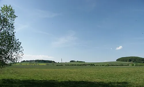
Waldknüll 2micha · CC BY-SA 3.0

Climate of Harth
Best months for sightseeingBest months for sightseeing: June–August.
This month · November
A cold month
Day 6° · Night 1° · Rain 65 mm
- Hottest month
- July (day 22°)
- Coldest month
- February (night -3°)
- Wettest month
- June (76 mm)
- Driest month
- February (47 mm)
Bars: average monthly low and high temperature. Below: precipitation. Monthly averages for 1970–2000 at about 18 km resolution, adjusted for elevation. Highlighted months are mild and relatively dry. Source: WorldClim 2.1 (CC BY 4.0).
Show values as a table
| Month | Jan | Feb | Mar | Apr | May | Jun | Jul | Aug | Sep | Oct | Nov | Dec |
|---|---|---|---|---|---|---|---|---|---|---|---|---|
| Average high (°C) | 2° | 3° | 7° | 12° | 17° | 20° | 22° | 22° | 17° | 12° | 6° | 3° |
| Average low (°C) | -3° | -3° | 0° | 2° | 7° | 10° | 12° | 11° | 8° | 5° | 1° | -1° |
| Precipitation (mm) | 56 | 47 | 56 | 55 | 72 | 76 | 76 | 66 | 62 | 60 | 65 | 65 |
How to get to Harth
The nearest airport is Kassel Airport (KSF), 57 km to the north as the crow flies. The nearest large city is Kassel, 47 km to the north.
Airports
- Kassel Airport (KSF) Calden 57 kmnorth
- Paderborn Lippstadt Airport (PAD) Büren 94 kmnorthwest
- Frankfurt Main Airport (FRA) Frankfurt am Main 113 kmsouthwest
Nearby large cities
- Kassel Population: 197.2K 47 kmnorth
- Göttingen Population: 122.1K 81 kmnortheast
- Siegen Population: 107.2K 93 kmwest
- Offenbach Population: 119.2K 98 kmsouthwest
- Frankfurt am Main Population: 650K 100 kmsouthwest
Straight-line distances; road distances are longer. Airport data: OurAirports.
Day trips from Harth
Within 100 km: 477 historic and cultural sites, 5,892 natural sites, 745 lakes, rivers and coasts.
0–25 km356 places
- Knüllteich Lake 6 kmE
- Zieglerskuppe Mountain 12 kmSE
- Ziegenkopf Mountain 19 kmN
- Ziegenkopf Mountain 15 kmNW
25–60 km2,166 places
- Wande River 59 kmN
- Erpe River 60 kmN
- Ohe River 48 kmW
- Ogge River 56 kmNW
60–100 km4,592 places
- Valme River 84 kmNW
- Naure River 71 kmN
- Frieda River 63 kmNE
- Elpe River 83 kmNW
Straight-line distances.
Nearest towns and villages
-
Seigertshausen Village, Neukirchen1 km NE
-
Neukirchen Town, Neukirchen3.9 km S
-
Riebelsdorf Village, Neukirchen4.1 km SW
-
Rückershausen Village, Neukirchen3.7 km SW
-
Christerode Village, Neukirchen4.4 km SE
-
Hauptschwenda Village, Neukirchen4.4 km E
Nearby attractions & nature
Everything nearby-
Thonkuppe Mountain, Neukirchen1.5 km S
-
Braunsberg Mountain, Frielendorf1.7 km NW
-
Eichwaldskopf Mountain, Neukirchen2.4 km SE
-
Leidenberg Mountain, Frielendorf2.6 km N
-
Leidesberg Mountain, Frielendorf2.9 km W
-
Judenstein Mountain, Frielendorf3.2 km NE
-
Hornsberg Mountain, Schwalmstadt3.4 km W
-
Forst Neukirchen Natural site, Hesse2.7 km E
Sources & licences
Data last updated: · 2 independent sources