- Elevation
- 332 m
- above sea level
- Local time
- UTC+01:00
- Europe/Berlin · UTC+01:00
- Airports
- KSF Kassel Airport51 km
- ERF Erfurt-Weimar Airport69 km
About Neuerode
Neuerode is a village. Location: Meinhard, Werra-Meißner-Kreis. Elevation: 332 m. The best months to visit are June–August. The nearest airport is Kassel Airport (51 km). Nearby sights include Ferneberg and Meinhard.
Photos of Neuerode
-
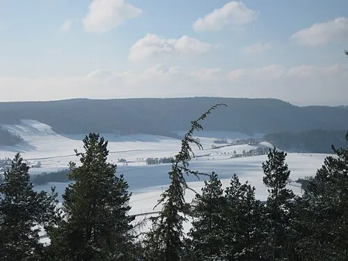
Rachelsberg 79.214er · CC BY-SA 3.0 -
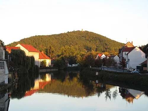
Großer Leuchtberg Jörg Braukmann · CC BY-SA 3.0 -
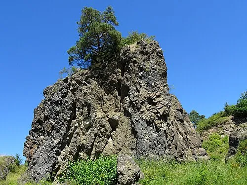
Blaue Kuppe Heinz K. S · CC BY-SA 4.0 -
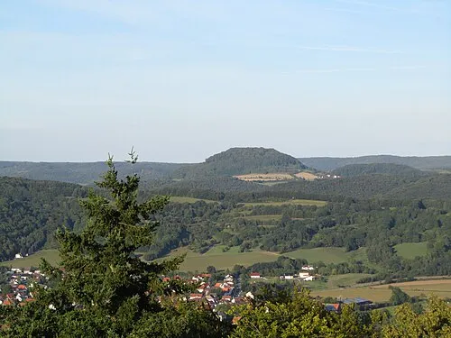
Hülfensberg Jörg Braukmann · CC BY-SA 3.0


Climate of Neuerode
Best months for sightseeingBest months for sightseeing: June–August.
This month · November
A cold month
Day 6° · Night 1° · Rain 68 mm
- Hottest month
- July (day 22°)
- Coldest month
- February (night -3°)
- Wettest month
- June (81 mm)
- Driest month
- February (50 mm)
Bars: average monthly low and high temperature. Below: precipitation. Monthly averages for 1970–2000 at about 18 km resolution, adjusted for elevation. Highlighted months are mild and relatively dry. Source: WorldClim 2.1 (CC BY 4.0).
Show values as a table
| Month | Jan | Feb | Mar | Apr | May | Jun | Jul | Aug | Sep | Oct | Nov | Dec |
|---|---|---|---|---|---|---|---|---|---|---|---|---|
| Average high (°C) | 3° | 3° | 8° | 12° | 17° | 20° | 22° | 22° | 17° | 12° | 6° | 4° |
| Average low (°C) | -3° | -3° | 0° | 2° | 7° | 10° | 12° | 11° | 8° | 5° | 1° | -1° |
| Precipitation (mm) | 62 | 50 | 63 | 53 | 68 | 81 | 77 | 66 | 65 | 61 | 68 | 74 |
How to get to Neuerode
The nearest airport is Kassel Airport (KSF), 51 km to the northwest as the crow flies. The nearest large city is Göttingen, 36 km to the north.
Airports
- Kassel Airport (KSF) Calden 51 kmnorthwest
- Erfurt-Weimar Airport (ERF) Erfurt 69 kmsoutheast
- Paderborn Lippstadt Airport (PAD) Büren 109 kmnorthwest
Nearby large cities
- Göttingen Population: 122.1K 36 kmnorth
- Kassel Population: 197.2K 40 kmwest
- Erfurt Population: 218.8K 74 kmeast
- Paderborn Population: 142.2K 106 kmnorthwest
- Salzgitter Population: 105K 107 kmnorth
Straight-line distances; road distances are longer. Airport data: OurAirports.
Day trips from Neuerode
Within 100 km: 429 historic and cultural sites, 5,611 natural sites, 827 lakes, rivers and coasts.
0–25 km522 places
- Frieda River 6 kmSE
- Zwickelsberg Mountain 18 kmSE
- Zungenkopf Mountain 10 kmSW
- Zipfel Mountain 21 kmS
25–60 km2,039 places
- Felda River 42 kmS
- Eitra River 51 kmSW
- Baune River 41 kmW
- Vollmarshäuser Teich Lake 34 kmW
60–100 km4,306 places
- Buchenwald concentration camp Historic site 86 kmE
- Wande River 69 kmW
- Erpe River 69 kmW
- Schalk River 73 kmN
Straight-line distances.
Nearby attractions & nature
Everything nearby-
Ferneberg Mountain, Meinhard1.4 km N
-
Meinhard Mountain, Meinhard1.2 km E
-
Deutscher Kopf Mountain, Meinhard1.6 km W
-
Hasselkuppe Mountain, Meinhard1.8 km E
-
Uhlenkuppe Mountain, Meinhard3.3 km NW
-
Hohestein Mountain, Meinhard3.2 km N
Sources & licences
Data last updated: