- Elevation
- 40 m
- above sea level
- Local time
- UTC+01:00
- Europe/Berlin · UTC+01:00
- Airports
- FMO Münster Osnabrück Airport59 km
- BRE Bremen Airport70 km
About Sünderbruch
Sünderbruch is a village. Location: Marl, Landkreis Diepholz. Elevation: 40 m. The best months to visit are June–August. The nearest airport is Münster Osnabrück Airport (59 km). Nearby sights include Naturschutzgebiet Ochsenmoor and Hunte.
Photos of Sünderbruch
-
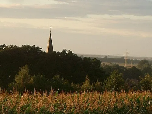
Dielinger Klei Kokp18 · CC BY-SA 3.0

Climate of Sünderbruch
Best months for sightseeingBest months for sightseeing: June–August.
This month · November
A cold month
Day 8° · Night 3° · Rain 62 mm
- Hottest month
- August (day 23°)
- Coldest month
- February (night -1°)
- Wettest month
- June (78 mm)
- Driest month
- February (46 mm)
Bars: average monthly low and high temperature. Below: precipitation. Monthly averages for 1970–2000 at about 18 km resolution, adjusted for elevation. Highlighted months are mild and relatively dry. Source: WorldClim 2.1 (CC BY 4.0).
Show values as a table
| Month | Jan | Feb | Mar | Apr | May | Jun | Jul | Aug | Sep | Oct | Nov | Dec |
|---|---|---|---|---|---|---|---|---|---|---|---|---|
| Average high (°C) | 4° | 5° | 9° | 13° | 18° | 21° | 23° | 23° | 19° | 14° | 8° | 5° |
| Average low (°C) | -1° | -1° | 2° | 4° | 8° | 11° | 13° | 12° | 10° | 6° | 3° | 1° |
| Precipitation (mm) | 65 | 46 | 61 | 47 | 55 | 78 | 66 | 63 | 66 | 62 | 62 | 72 |
How to get to Sünderbruch
The nearest airport is Münster Osnabrück Airport (FMO), 59 km to the southwest as the crow flies. The nearest large city is Osnabrück, 31 km to the southwest.
Airports
- Münster Osnabrück Airport (FMO) Greven 59 kmsouthwest
- Bremen Airport (BRE) Bremen 70 kmnortheast
- Hannover Airport (HAJ) Hannover 90 kmeast
Nearby large cities
- Osnabrück Population: 166.5K 31 kmsouthwest
- Bielefeld Population: 331.9K 51 kmsouth
- Bremen Population: 546.5K 73 kmnortheast
- Oldenburg Population: 159.2K 75 kmnorth
- Münster Population: 308.3K 76 kmsouthwest
Straight-line distances; road distances are longer. Airport data: OurAirports.
Day trips from Sünderbruch
Within 100 km: 272 historic and cultural sites, 1,772 natural sites, 803 lakes, rivers and coasts.
0–25 km157 places
- Dümmer Lake 5 kmN
- Bergsee Lake 13 kmNW
- Heidesee Lake 20 kmNW
- Schwarzer Brink Mountain 21 kmS
25–60 km876 places
- Goten Lake 40 kmNW
- Thülsfelder Talsperre Lake 58 kmNW
- Schwarzes Schlatt Lake 55 kmN
- Langes Schlatt Lake 56 kmNW
60–100 km1,814 places
- Sundern Natural site 99 kmNE
- Warnau River 97 kmNE
- Werse River 67 kmSW
- Ohe River 98 kmE
Straight-line distances.
Nearby attractions & nature
Everything nearby-
Naturschutzgebiet Ochsenmoor Natural site, Marl2.4 km W
-
Hunte River, Lower Saxony3.8 km NW
-
Naturschutzgebiet Hohe Sieben Natural site, Hüde3.7 km N
-
Naturschutzgebiet Sette Natural site, Brockum4.1 km E
-
Dielinger Klei Mountain, Stemwede4.2 km S
-
Naturschutzgebiet Evershorst Natural site, Hüde4.7 km NE
Sources & licences
Data last updated: