- Elevation
- 35 m
- above sea level
- Local time
- UTC+01:00
- Europe/Berlin · UTC+01:00
- Airports
- HAM Hamburg Helmut Schmidt Airport36 km
- LBC Lübeck Blankensee Airport74 km
About Silberkamp
Silberkamp is a village. Location: Marxen, Landkreis Harburg. Elevation: 35 m. The best months to visit are June–August. The nearest airport is Hamburg Helmut Schmidt Airport (36 km). Nearby sights include Moorbach and Sülsberg.
Photos of Silberkamp
-
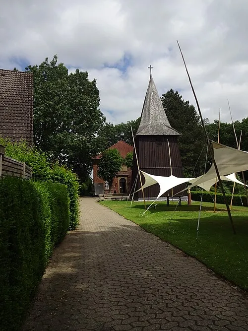
St. Martin ClausNe · CC BY-SA 4.0 -
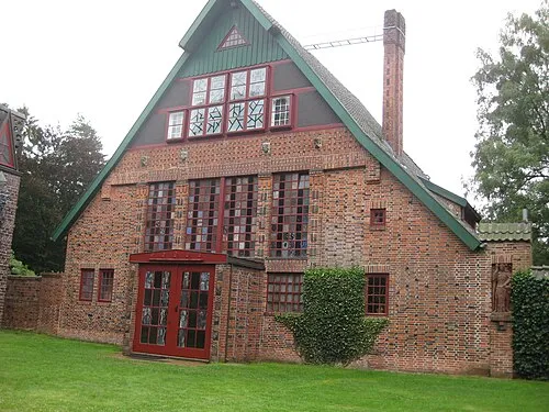
Kunststätte Bossard Renate007 · CC BY-SA 3.0


Climate of Silberkamp
Best months for sightseeingBest months for sightseeing: June–August.
This month · November
A cold month
Day 7° · Night 2° · Rain 67 mm
- Hottest month
- August (day 22°)
- Coldest month
- January (night -2°)
- Wettest month
- December (75 mm)
- Driest month
- February (46 mm)
Bars: average monthly low and high temperature. Below: precipitation. Monthly averages for 1970–2000 at about 18 km resolution, adjusted for elevation. Highlighted months are mild and relatively dry. Source: WorldClim 2.1 (CC BY 4.0).
Show values as a table
| Month | Jan | Feb | Mar | Apr | May | Jun | Jul | Aug | Sep | Oct | Nov | Dec |
|---|---|---|---|---|---|---|---|---|---|---|---|---|
| Average high (°C) | 3° | 4° | 8° | 12° | 18° | 20° | 22° | 22° | 18° | 13° | 7° | 4° |
| Average low (°C) | -2° | -1° | 1° | 3° | 8° | 11° | 13° | 12° | 9° | 6° | 2° | 0° |
| Precipitation (mm) | 68 | 46 | 61 | 50 | 55 | 74 | 70 | 66 | 65 | 61 | 67 | 75 |
How to get to Silberkamp
The nearest airport is Hamburg Helmut Schmidt Airport (HAM), 36 km to the north as the crow flies. The nearest large city is Lübeck, 78 km to the northeast.
Airports
- Hamburg Helmut Schmidt Airport (HAM) Hamburg 36 kmnorth
- Lübeck Blankensee Airport (LBC) Lübeck 74 kmnortheast
- Bremen Airport (BRE) Bremen 86 kmwest
Nearby large cities
- Lübeck Population: 212.2K 78 kmnortheast
- Bremen Population: 546.5K 84 kmwest
- Bremerhaven Population: 118.6K 99 kmwest
- Hanover Population: 515.1K 105 kmsouth
- Wolfsburg Population: 123.1K 111 kmsoutheast
Straight-line distances; road distances are longer. Airport data: OurAirports.
Day trips from Silberkamp
Within 100 km: 395 historic and cultural sites, 2,982 natural sites, 1,156 lakes, rivers and coasts.
0–25 km334 places
- Alte Süderelbe Lake 25 kmN
- Alte Süderelbe Lake 24 kmN
- Brunausee Lake 22 kmS
- Neuländer See Lake 17 kmN
25–60 km1,598 places
- Viertbusch Natural site 32 kmNE
- Sundern Natural site 58 kmS
- Warnau River 53 kmSW
- Pagensand Island 54 kmNW
60–100 km2,601 places
- Wiehe River 84 kmS
- Spock River 98 kmN
- Leine River 70 kmSW
- Aubek River 85 kmN
Straight-line distances.
Nearby attractions & nature
Everything nearby-
Moorbach River, Lower Saxony0.7 km SW
-
Sülsberg Mountain, Marxen1.8 km NW
-
Brünger Berg Mountain, Marxen2.6 km NE
-
Hornsberg Mountain, Hanstedt2.2 km SE
-
Krähenberg Mountain, Asendorf2.4 km SW
-
St. Martin Attraction, Jesteburg2.8 km W
Sources & licences
Data last updated: