- Elevation
- 10 m
- above sea level
- Local time
- UTC+01:00
- Europe/Berlin · UTC+01:00
- Airports
- HAM Hamburg Helmut Schmidt Airport26 km
- LBC Lübeck Blankensee Airport66 km
About Karoxbostel
Karoxbostel is a village. Location: Seevetal, Landkreis Harburg. Elevation: 10 m. The best months to visit are June–August. The nearest airport is Hamburg Helmut Schmidt Airport (26 km). Nearby sights include Hitzenberg and Peperdieksberg.
Photos of Karoxbostel
-
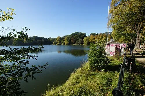
Außenmühlenteich flamenc · CC BY-SA 3.0 -
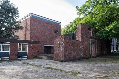
Dreifaltigkeitskirche Ajepbah · CC BY-SA 3.0 de


Climate of Karoxbostel
Best months for sightseeingBest months for sightseeing: June–August.
This month · November
A cold month
Day 8° · Night 3° · Rain 59 mm
- Hottest month
- August (day 23°)
- Coldest month
- January (night -1°)
- Wettest month
- June (70 mm)
- Driest month
- February (40 mm)
Bars: average monthly low and high temperature. Below: precipitation. Monthly averages for 1970–2000 at about 18 km resolution, adjusted for elevation. Highlighted months are mild and relatively dry. Source: WorldClim 2.1 (CC BY 4.0).
Show values as a table
| Month | Jan | Feb | Mar | Apr | May | Jun | Jul | Aug | Sep | Oct | Nov | Dec |
|---|---|---|---|---|---|---|---|---|---|---|---|---|
| Average high (°C) | 3° | 4° | 8° | 12° | 18° | 21° | 22° | 23° | 18° | 13° | 8° | 5° |
| Average low (°C) | -1° | -1° | 1° | 4° | 8° | 11° | 13° | 13° | 10° | 6° | 3° | 0° |
| Precipitation (mm) | 60 | 40 | 54 | 45 | 51 | 70 | 68 | 63 | 63 | 57 | 59 | 68 |
How to get to Karoxbostel
The nearest airport is Hamburg Helmut Schmidt Airport (HAM), 26 km to the north as the crow flies. The nearest large city is Lübeck, 69 km to the northeast.
Airports
- Hamburg Helmut Schmidt Airport (HAM) Hamburg 26 kmnorth
- Lübeck Blankensee Airport (LBC) Lübeck 66 kmnortheast
- Bremen Airport (BRE) Bremen 90 kmsouthwest
Nearby large cities
- Lübeck Population: 212.2K 69 kmnortheast
- Bremen Population: 546.5K 88 kmsouthwest
- Bremerhaven Population: 118.6K 97 kmwest
- Kiel Population: 252.7K 104 kmnorth
- Hanover Population: 515.1K 115 kmsouth
Straight-line distances; road distances are longer. Airport data: OurAirports.
Day trips from Karoxbostel
Within 100 km: 396 historic and cultural sites, 2,999 natural sites, 1,255 lakes, rivers and coasts.
0–25 km372 places
- Viertbusch Natural site 25 kmNE
- Gurlittinsel Island 18 kmN
- Billerhuder Insel Island 17 kmN
- Binnen-Alster Lake 18 kmN
25–60 km1,509 places
- Rhinplate Island 59 kmNW
- Pagensand Island 47 kmNW
- Hanskalbsand Island 28 kmNW
- Schwarztonnensand Island 50 kmNW
60–100 km2,769 places
- Sundern Natural site 68 kmS
- Warnau River 63 kmSW
- Wiehe River 94 kmS
- Spock River 88 kmN
Straight-line distances.
Nearby attractions & nature
Everything nearby-
Hitzenberg Mountain, Seevetal2 km N
-
Peperdieksberg Mountain, Seevetal2.8 km W
-
Hallonen Mountain, Seevetal2.9 km SE
-
Pulvermühlenteich Lake, Seevetal3 km NE
-
Rübenberg Mountain, Seevetal4.9 km SE
-
Lichtberg Mountain, Seevetal5.2 km S
Other cities and towns in Seevetal
-
Metzendorf Village, Seevetal3.6 km W
-
Hörsten Village, Seevetal4.2 km NE
-
 Fleestedt Village, Seevetal2 km NW
-
Emmelndorf Village, Seevetal1.4 km W
-
Glüsingen Village, Seevetal1.9 km NE
-
Horst Village, Seevetal3.3 km SE
Sources & licences
Data last updated: