
- Elevation
- 22 m
- above sea level
- Local time
- UTC+01:00
- Europe/Berlin · UTC+01:00
- Airports
- HAJ Hannover Airport38 km
- BRE Bremen Airport56 km
About Bierde
Bierde is a village. Location: Böhme, Landkreis Heidekreis. Elevation: 22 m.
Bierde is a village in the municipality of Böhme, Lower Saxony, that is part of Heidekreis district in the German state of Lower Saxony.
Source: Wikipedia · CC BY-SA 4.0
At a glance
- Area
- 14 km²
Source: Wikidata
Photos of Bierde
-
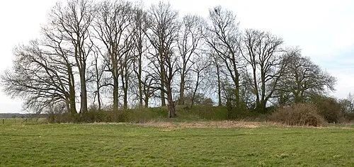
Bunkenburg AxelHH at German Wikipedia · Public domain

Climate of Bierde
Best months for sightseeingBest months for sightseeing: June–August.
This month · November
A cold month
Day 8° · Night 2° · Rain 59 mm
- Hottest month
- August (day 23°)
- Coldest month
- February (night -2°)
- Wettest month
- June (73 mm)
- Driest month
- February (44 mm)
Bars: average monthly low and high temperature. Below: precipitation. Monthly averages for 1970–2000 at about 18 km resolution, adjusted for elevation. Highlighted months are mild and relatively dry. Source: WorldClim 2.1 (CC BY 4.0).
Show values as a table
| Month | Jan | Feb | Mar | Apr | May | Jun | Jul | Aug | Sep | Oct | Nov | Dec |
|---|---|---|---|---|---|---|---|---|---|---|---|---|
| Average high (°C) | 4° | 5° | 8° | 13° | 19° | 21° | 23° | 23° | 18° | 13° | 8° | 5° |
| Average low (°C) | -1° | -2° | 1° | 3° | 8° | 10° | 12° | 12° | 9° | 6° | 2° | 0° |
| Precipitation (mm) | 61 | 44 | 56 | 46 | 51 | 73 | 64 | 63 | 57 | 55 | 59 | 70 |
How to get to Bierde
The nearest airport is Hannover Airport (HAJ), 38 km to the south as the crow flies. The nearest large city is Hanover, 49 km to the south.
Airports
- Hannover Airport (HAJ) Hannover 38 kmsouth
- Bremen Airport (BRE) Bremen 56 kmnorthwest
- Hamburg Helmut Schmidt Airport (HAM) Hamburg 100 kmnorth
Nearby large cities
- Hanover Population: 515.1K 49 kmsouth
- Bremen Population: 546.5K 57 kmnorthwest
- Braunschweig Population: 244.7K 90 kmsoutheast
- Salzgitter Population: 105K 93 kmsoutheast
- Wolfsburg Population: 123.1K 95 kmsoutheast
Straight-line distances; road distances are longer. Airport data: OurAirports.
Day trips from Bierde
Within 100 km: 387 historic and cultural sites, 2,675 natural sites, 824 lakes, rivers and coasts.
0–25 km259 places
- Sundern Natural site 15 kmE
- Warnau River 14 kmNE
- Leine River 9 kmSE
- Wiedesee Lake 23 kmW
25–60 km1,135 places
- Badeinsel Island 37 kmS
- Lake Steinhude Lake 37 kmS
- Rothenküler Teich Lake 41 kmS
- Pastorensee Lake 45 kmNW
60–100 km2,492 places
- Viertbusch Natural site 98 kmNE
- Wiehe River 60 kmSE
- Ohe River 69 kmS
- Harrier Sand Island 89 kmNW
Straight-line distances.
Nearby attractions & nature
Everything nearby-
Bierder Burg Historic site, Böhme0.6 km S
-
Krummer Berg Mountain, Böhme1.2 km E
-
Bierder Koppel Natural site, Lower Saxony0.8 km SE
-
Ahe Natural site, Lower Saxony2 km SE
-
Schlenke Natural site, Lower Saxony2.3 km E
-
Bunkenburg Historic site, Ahlden (Aller), Flecken4.5 km SE
Sources & licences
Data last updated: · 2 independent sources