Katzenbusch
Located in Bad Gandersheim, Landkreis Northeim Coordinates: 51°53′00″ N 10°02′00″ E
- Elevation
- 129 m
- above sea level
- Local time
- UTC+01:00
- Europe/Berlin · UTC+01:00
- Airports
- KSF Kassel Airport68 km
- HAJ Hannover Airport69 km
About Katzenbusch
Katzenbusch is a mountain. Location: Bad Gandersheim, Landkreis Northeim. Elevation: 129 m. The best months to visit are June–August. The nearest airport is Kassel Airport (68 km). Nearby sights include Eterna and Clusberg.
Climate of Katzenbusch
Best months for sightseeingBest months for sightseeing: June–August.
This month · November
A cold month
Day 7° · Night 2° · Rain 61 mm
- Hottest month
- August (day 23°)
- Coldest month
- February (night -2°)
- Wettest month
- June (76 mm)
- Driest month
- February (47 mm)
Bars: average monthly low and high temperature. Below: precipitation. Monthly averages for 1970–2000 at about 18 km resolution, adjusted for elevation. Highlighted months are mild and relatively dry. Source: WorldClim 2.1 (CC BY 4.0).
Show values as a table
| Month | Jan | Feb | Mar | Apr | May | Jun | Jul | Aug | Sep | Oct | Nov | Dec |
|---|---|---|---|---|---|---|---|---|---|---|---|---|
| Average high (°C) | 3° | 4° | 8° | 12° | 18° | 20° | 22° | 23° | 18° | 13° | 7° | 4° |
| Average low (°C) | -2° | -2° | 1° | 3° | 8° | 11° | 12° | 12° | 9° | 6° | 2° | 0° |
| Precipitation (mm) | 62 | 47 | 60 | 52 | 65 | 76 | 70 | 68 | 58 | 55 | 61 | 71 |
How to get to Katzenbusch
The nearest airport is Kassel Airport (KSF), 68 km to the southwest as the crow flies. The nearest large city is Göttingen, 39 km to the south.
Airports
- Kassel Airport (KSF) Calden 68 kmsouthwest
- Hannover Airport (HAJ) Hannover 69 kmnorth
- Paderborn Lippstadt Airport (PAD) Büren 102 kmwest
Nearby large cities
- Göttingen Population: 122.1K 39 kmsouth
- Salzgitter Population: 105K 40 kmnortheast
- Braunschweig Population: 244.7K 54 kmnortheast
- Hanover Population: 515.1K 58 kmnorth
- Kassel Population: 197.2K 73 kmsouthwest
Straight-line distances; road distances are longer. Airport data: OurAirports.
Day trips from Katzenbusch
Within 100 km: 432 historic and cultural sites, 4,175 natural sites, 800 lakes, rivers and coasts.
0–25 km533 places
- Unter Hahnebalzer Teich Lake 21 kmSE
- Prinzenteich Lake 23 kmSE
- Ober Hahnebalzer Teich Lake 21 kmSE
- Innerstestausee Lake 17 kmE
25–60 km1,767 places
- Schalk River 28 kmE
- Ohe River 39 kmNW
- Aue River 56 kmE
- Aue River 53 kmE
60–100 km3,107 places
- Wande River 82 kmSW
- Erpe River 81 kmSW
- Wiehe River 79 kmN
- Sarre River 93 kmE
Straight-line distances.
Nearest towns and villages
-
Bad Gandersheim Town, Bad Gandersheim1.4 km SW
-
 Clus Village, Bad Gandersheim1.8 km W
-
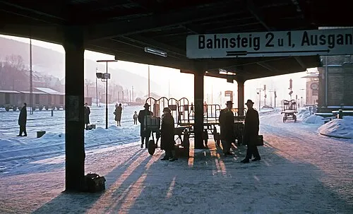 Kreiensen Town, Einbeck5.8 km SW
-
Wolperode Village, Bad Gandersheim1.7 km E
-
Wrescherode Village, Bad Gandersheim2.4 km S
-
Ackenhausen Village, Bad Gandersheim2.5 km E
Nearby attractions & nature
Everything nearby-
Eterna River, Lower Saxony<0.1 km N
-
Clusberg Mountain, Bad Gandersheim1.1 km W
-
Brunshausen Kloster und Museum Museum, Bad Gandersheim0.1 km SW
-
Schanze Mountain, Bad Gandersheim2.3 km E
-
Bad Gandersheim Concentration Camp Historic site, Bad Gandersheim0.4 km SW
-
Wadenberg Mountain, Bad Gandersheim3.4 km W
-
Meine River, Lower Saxony2.2 km SE
-
Steinbrink Mountain, Bad Gandersheim3.9 km SE
Sources & licences
Data last updated: · 2 independent sources