- Elevation
- 232 m
- above sea level
- Local time
- UTC+01:00
- Europe/Berlin · UTC+01:00
- Airports
- KSF Kassel Airport61 km
- HAJ Hannover Airport72 km
About Dorensberg
Dorensberg is a mountain. Location: Einbeck, Landkreis Northeim. Elevation: 232 m. The best months to visit are June–August. The nearest airport is Kassel Airport (61 km). Nearby sights include Königsberg and Knollen.
Climate of Dorensberg
Best months for sightseeingBest months for sightseeing: June–August.
This month · November
A cold month
Day 7° · Night 2° · Rain 59 mm
- Hottest month
- August (day 22°)
- Coldest month
- February (night -2°)
- Wettest month
- June (69 mm)
- Driest month
- February (46 mm)
Bars: average monthly low and high temperature. Below: precipitation. Monthly averages for 1970–2000 at about 18 km resolution, adjusted for elevation. Highlighted months are mild and relatively dry. Source: WorldClim 2.1 (CC BY 4.0).
Show values as a table
| Month | Jan | Feb | Mar | Apr | May | Jun | Jul | Aug | Sep | Oct | Nov | Dec |
|---|---|---|---|---|---|---|---|---|---|---|---|---|
| Average high (°C) | 3° | 4° | 8° | 12° | 17° | 20° | 22° | 22° | 18° | 13° | 7° | 4° |
| Average low (°C) | -2° | -2° | 0° | 3° | 7° | 10° | 12° | 11° | 8° | 5° | 2° | -1° |
| Precipitation (mm) | 61 | 46 | 55 | 47 | 63 | 69 | 66 | 63 | 54 | 51 | 59 | 66 |
How to get to Dorensberg
The nearest airport is Kassel Airport (KSF), 61 km to the southwest as the crow flies. The nearest large city is Göttingen, 33 km to the south.
Airports
- Kassel Airport (KSF) Calden 61 kmsouthwest
- Hannover Airport (HAJ) Hannover 72 kmnorth
- Paderborn Lippstadt Airport (PAD) Büren 96 kmwest
Nearby large cities
- Göttingen Population: 122.1K 33 kmsouth
- Salzgitter Population: 105K 47 kmnortheast
- Braunschweig Population: 244.7K 62 kmnortheast
- Hanover Population: 515.1K 62 kmnorth
- Kassel Population: 197.2K 66 kmsouthwest
Straight-line distances; road distances are longer. Airport data: OurAirports.
Day trips from Dorensberg
Within 100 km: 421 historic and cultural sites, 4,251 natural sites, 810 lakes, rivers and coasts.
0–25 km514 places
- Unter Hahnebalzer Teich Lake 24 kmE
- Prinzenteich Lake 25 kmE
- Ober Hahnebalzer Teich Lake 24 kmE
- Innerstestausee Lake 23 kmE
25–60 km1,817 places
- Schalk River 32 kmE
- Ohe River 42 kmNW
- Aue River 59 kmE
- Zillerbachtalsperre Lake 56 kmE
60–100 km3,151 places
- Wande River 75 kmSW
- Erpe River 74 kmSW
- Wiehe River 86 kmN
- Sarre River 98 kmE
Straight-line distances.
Nearest towns and villages
-
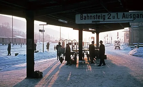 Kreiensen Town, Einbeck2.3 km N
-
Haieshausen Village, Einbeck0.7 km NE
-
Ippensen Village, Einbeck1 km NW
-
 Salzderhelden Village, Einbeck5.2 km SW
-
Olxheim Village, Einbeck1.3 km W
-
Garlebsen Village, Einbeck1.4 km W
Nearby attractions & nature
Everything nearby-
Königsberg Mountain, Einbeck<0.1 km N
-
Knollen Mountain, Einbeck1.9 km N
-
Hainberg Mountain, Einbeck1.9 km S
-
Aue River, Lower Saxony0.9 km N
-
Moosberg Mountain, Einbeck1.9 km S
-
Wambach River, Lower Saxony1.1 km W
-
Oyershäuser Berg Mountain, Einbeck2 km E
-
Ortberg Mountain, Einbeck3 km SE
Sources & licences
Data last updated: · 2 independent sources