
- Population
- 8,895
- 8.9K
- Elevation
- 82 m
- above sea level
- Local time
- UTC+01:00
- Europe/Berlin · UTC+01:00
- Places inside
- 8
- listed under Bad Laer
- Airports
- FMO Münster Osnabrück Airport27 km
- PAD Paderborn Lippstadt Airport66 km
About Bad Laer
Bad Laer is a village. Location: Landkreis Osnabrück, Lower Saxony. Population: 8,895. Elevation: 82 m.
Bad Laer (German pronunciation: [baːt ˈlaːɐ̯]) is a municipality and health resort in the district of Osnabrück, in Lower Saxony, Germany. It is situated in the Teutoburg Forest, approx. 20 km south of Osnabrück. The municipality includes Bad Laer and five outlying districts Remsede, Müschen, Hardensetten, Westerwiede and Winkelsetten.
Source: Wikipedia · CC BY-SA 4.0
Photos of Bad Laer
-
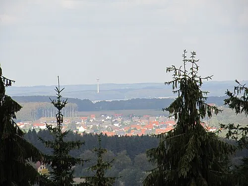
Hohnsberg Sail over · CC BY-SA 3.0 -
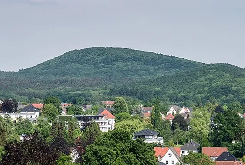
Großer Freeden Basotxerri · CC BY-SA 4.0


Places bordering Bad Laer
- Bad Rothenfelde
- Bad Iburg
Population of Bad Laer over time
| 2010 | 9,144 | |
|---|---|---|
| 2015 | 9,268 | |
| 2016 | 9,293 | |
| 2017 | 9,264 | |
| 2019 | 9,228 | |
| 2021 | 9,140 | |
| 2022 | 9,221 | |
| 2023 | 9,203 | |
| 2024 | 8,895 | |
| 2025 | 8,828 |
Censuses and official estimates; source: Wikidata.
Climate of Bad Laer
Best months for sightseeingBest months for sightseeing: June–August.
This month · November
A cold month
Day 8° · Night 3° · Rain 71 mm
- Hottest month
- August (day 22°)
- Coldest month
- February (night -1°)
- Wettest month
- December (80 mm)
- Driest month
- April (46 mm)
Bars: average monthly low and high temperature. Below: precipitation. Monthly averages for 1970–2000 at about 18 km resolution, adjusted for elevation. Highlighted months are mild and relatively dry. Source: WorldClim 2.1 (CC BY 4.0).
Show values as a table
| Month | Jan | Feb | Mar | Apr | May | Jun | Jul | Aug | Sep | Oct | Nov | Dec |
|---|---|---|---|---|---|---|---|---|---|---|---|---|
| Average high (°C) | 4° | 5° | 9° | 13° | 18° | 20° | 22° | 22° | 18° | 13° | 8° | 5° |
| Average low (°C) | -1° | -1° | 2° | 4° | 8° | 11° | 13° | 12° | 10° | 6° | 3° | 1° |
| Precipitation (mm) | 74 | 52 | 65 | 46 | 62 | 74 | 78 | 72 | 67 | 65 | 71 | 80 |
How to get to Bad Laer
The nearest airport is Münster Osnabrück Airport (FMO), 27 km to the west as the crow flies. The nearest large city is Osnabrück, 20 km to the north.
Airports
- Münster Osnabrück Airport (FMO) Greven 27 kmwest
- Paderborn Lippstadt Airport (PAD) Büren 66 kmsoutheast
- Dortmund Airport (DTM) Dortmund 72 kmsouthwest
Nearby large cities
- Osnabrück Population: 166.5K 20 kmnorth
- Bielefeld Population: 331.9K 32 kmeast
- Münster Population: 308.3K 35 kmsouthwest
- Hamm Population: 179K 50 kmsouth
- Paderborn Population: 142.2K 63 kmsoutheast
Straight-line distances; road distances are longer. Airport data: OurAirports.
Day trips from Bad Laer
Within 100 km: 220 historic and cultural sites, 2,264 natural sites, 746 lakes, rivers and coasts.
0–25 km200 places
- Rubbenbruchsee Lake 22 kmN
- Sonnenhügel Mountain 21 kmNW
- Silberberg Mountain 15 kmNW
- Liener Berg Mountain 9 kmNW
25–60 km705 places
- Werse River 28 kmW
- Grimke River 58 kmSE
- Ahse River 50 kmS
- Kleines Heiliges Meer Lake 41 kmNW
60–100 km2,325 places
- Else River 82 kmSW
- Else River 98 kmS
- Valme River 85 kmS
- Naure River 94 kmSE
Straight-line distances.
Places in Bad Laer
8 placesBar: population relative to the most populous place in this list.
Cities & villages5
- Kram-Brook · Village
- Müschen · Village
- Remsede · Village
- Westerwiede · Village
- Winkelsetten · Village
Mountains & nature2
- Kleiner Berg · Mountain
- Laerhöhe · Mountain
Nearby attractions & nature
Everything nearby-
Hölle Natural site, Lower Saxony3.7 km NW
-
Südbach River, Lower Saxony3.6 km N
-
Großer Freeden Mountain, Bad Iburg6.6 km N
-
Hohnsberg Mountain, Bad Iburg7.2 km N
-
Remseder Bach River, Lower Saxony4.7 km W
-
Salzbach River, North Rhine-Westphalia5 km SW
Other cities and towns in Landkreis Osnabrück
-
 Dissen am Teutoburger Wald Village, Landkreis Osnabrück8.2 km E
-
Hilter am Teutoburger Wald Village, Landkreis Osnabrück8.4 km NE
-
Glane Village, Bad Iburg5.6 km N
-
Schierloh Village, Glandorf4 km SW
-
Aschendorf Village, Bad Rothenfelde4.3 km E
-
Visbeck Village, Bad Iburg4.4 km N
Sources & licences
Data last updated: · 2 independent sources