- Elevation
- 42 m
- above sea level
- Local time
- UTC+01:00
- Europe/Berlin · UTC+01:00
- Airports
- FMO Münster Osnabrück Airport53 km
- BRE Bremen Airport75 km
About Schwege
Schwege is a village. Location: Bohmte, Landkreis Osnabrück. Elevation: 42 m. The best months to visit are June–August. The nearest airport is Münster Osnabrück Airport (53 km). Nearby sights include Elze and Bornbach.
Photos of Schwege
-
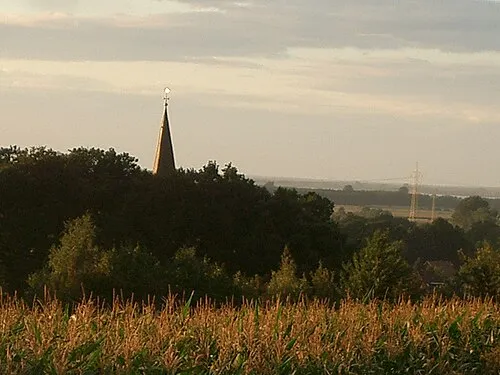
Dielinger Klei Kokp18 · CC BY-SA 3.0

Climate of Schwege
Best months for sightseeingBest months for sightseeing: June–August.
This month · November
A cold month
Day 8° · Night 3° · Rain 67 mm
- Hottest month
- August (day 23°)
- Coldest month
- February (night -1°)
- Wettest month
- June (78 mm)
- Driest month
- February (48 mm)
Bars: average monthly low and high temperature. Below: precipitation. Monthly averages for 1970–2000 at about 18 km resolution, adjusted for elevation. Highlighted months are mild and relatively dry. Source: WorldClim 2.1 (CC BY 4.0).
Show values as a table
| Month | Jan | Feb | Mar | Apr | May | Jun | Jul | Aug | Sep | Oct | Nov | Dec |
|---|---|---|---|---|---|---|---|---|---|---|---|---|
| Average high (°C) | 4° | 5° | 9° | 13° | 18° | 21° | 23° | 23° | 18° | 14° | 8° | 5° |
| Average low (°C) | -1° | -1° | 2° | 4° | 8° | 11° | 13° | 12° | 10° | 6° | 3° | 1° |
| Precipitation (mm) | 71 | 48 | 66 | 48 | 56 | 78 | 70 | 63 | 68 | 66 | 67 | 78 |
How to get to Schwege
The nearest airport is Münster Osnabrück Airport (FMO), 53 km to the southwest as the crow flies. The nearest large city is Osnabrück, 24 km to the southwest.
Airports
- Münster Osnabrück Airport (FMO) Greven 53 kmsouthwest
- Bremen Airport (BRE) Bremen 75 kmnortheast
- Paderborn Lippstadt Airport (PAD) Büren 96 kmsouth
Nearby large cities
- Osnabrück Population: 166.5K 24 kmsouthwest
- Bielefeld Population: 331.9K 50 kmsouth
- Münster Population: 308.3K 70 kmsouthwest
- Oldenburg Population: 159.2K 77 kmnorth
- Bremen Population: 546.5K 79 kmnortheast
Straight-line distances; road distances are longer. Airport data: OurAirports.
Day trips from Schwege
Within 100 km: 256 historic and cultural sites, 1,674 natural sites, 777 lakes, rivers and coasts.
0–25 km201 places
- Dümmer Lake 9 kmNE
- Alfsee Lake 20 kmW
- Hase-See Lake 19 kmW
- Darnsee Lake 18 kmW
25–60 km808 places
- Goten Lake 39 kmNW
- Thülsfelder Talsperre Lake 57 kmNW
- Schwarzes Schlatt Lake 58 kmN
- Mickelmeer Lake 57 kmW
60–100 km1,698 places
- Werse River 61 kmSW
- Leine River 95 kmE
- Grimke River 82 kmSE
- Ahse River 90 kmS
Straight-line distances.
Nearby attractions & nature
Everything nearby-
Elze River, Lower Saxony1.8 km NE
-
Bornbach River, Lower Saxony2.7 km NE
-
Naturschutzgebiet Dievenmoor Natural site, Bohmte3.7 km NW
-
Hunte River, Lower Saxony6.4 km NE
-
Königstannen Natural site, Bohmte5.6 km S
-
Naturschutzgebiet Ochsenmoor Natural site, Marl4.8 km NE
Sources & licences
Data last updated: