- Elevation
- 10 m
- above sea level
- Local time
- UTC+01:00
- Europe/Berlin · UTC+01:00
- Airports
- BRE Bremen Airport26 km
- FCN Sea-Airport Cuxhaven/Nordholz / Nordholz Naval Airbase59 km
About Brink
Brink is a village. Location: Schwanewede, Landkreis Osterholz. Elevation: 10 m. The best months to visit are June–August. The nearest airport is Bremen Airport (26 km). Nearby sights include Lehmhorst and Galgenberg.
Photos of Brink
-
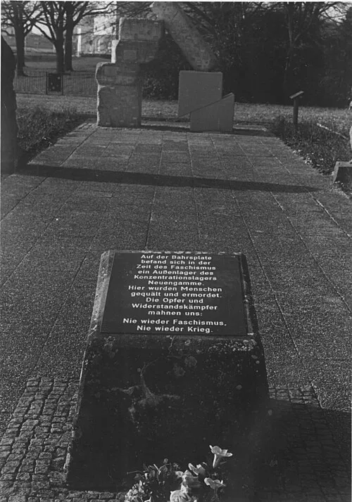
Bremen-Blumenthal Concentration Camp Klabusch · CC BY-SA 3.0 -
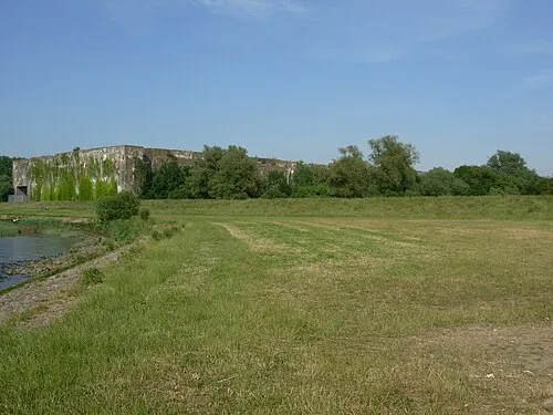
Bremen-Farge Concentration Camp (Valentin) No machine-readable author provided. Ricola~commonswiki assumed · Public domain


Climate of Brink
Best months for sightseeingBest months for sightseeing: June–August.
This month · November
A cold month
Day 8° · Night 3° · Rain 66 mm
- Hottest month
- August (day 21°)
- Coldest month
- January (night -1°)
- Wettest month
- June (73 mm)
- Driest month
- February (37 mm)
Bars: average monthly low and high temperature. Below: precipitation. Monthly averages for 1970–2000 at about 18 km resolution, adjusted for elevation. Highlighted months are mild and relatively dry. Source: WorldClim 2.1 (CC BY 4.0).
Show values as a table
| Month | Jan | Feb | Mar | Apr | May | Jun | Jul | Aug | Sep | Oct | Nov | Dec |
|---|---|---|---|---|---|---|---|---|---|---|---|---|
| Average high (°C) | 4° | 4° | 8° | 12° | 17° | 19° | 21° | 21° | 18° | 13° | 8° | 5° |
| Average low (°C) | -1° | -1° | 1° | 4° | 8° | 11° | 13° | 12° | 10° | 6° | 3° | 1° |
| Precipitation (mm) | 56 | 37 | 52 | 45 | 56 | 73 | 73 | 67 | 63 | 60 | 66 | 63 |
How to get to Brink
The nearest airport is Bremen Airport (BRE), 26 km to the southeast as the crow flies. The nearest large city is Bremen, 24 km to the southeast.
Airports
- Bremen Airport (BRE) Bremen 26 kmsoutheast
- Sea-Airport Cuxhaven/Nordholz / Nordholz Naval Airbase (FCN) Wurster Nordseeküste 59 kmnorth
- Hamburg Helmut Schmidt Airport (HAM) Hamburg 103 kmnortheast
Nearby large cities
- Bremen Population: 546.5K 24 kmsoutheast
- Oldenburg Population: 159.2K 27 kmsouthwest
- Bremerhaven Population: 118.6K 34 kmnorth
- Osnabrück Population: 166.5K 114 kmsouth
- Hanover Population: 515.1K 124 kmsoutheast
Straight-line distances; road distances are longer. Airport data: OurAirports.
Day trips from Brink
Within 100 km: 281 historic and cultural sites, 1,501 natural sites, 848 lakes, rivers and coasts.
0–25 km192 places
- Harrier Sand Island 9 kmNW
- Elsflether Sand Island 7 kmW
- Große Brake Lake 12 kmS
- Breites Wasser Lake 20 kmE
25–60 km766 places
- Friesenstrand Beach 44 kmNW
- Langlütjen II Island 37 kmN
- Zwischenahner Meer Lake 38 kmW
- Thülsfelder Talsperre Lake 56 kmSW
60–100 km1,672 places
- East Frisian Islands Island 94 kmNW
- Insel Spiekeroog Island 83 kmNW
- Baltrum Island 95 kmNW
- Sundern Natural site 90 kmSE
Straight-line distances.
Nearby attractions & nature
Everything nearby-
Lehmhorst Natural site, Schwanewede2.4 km SE
-
Galgenberg Mountain, Schwanewede2.9 km NE
-
Quetschenberg Mountain, Schwanewede3.3 km W
-
Hahnenberg Mountain, Schwanewede3.4 km E
-
Klingenberg Mountain, Schwanewede3.5 km NE
-
Bremen-Blumenthal Concentration Camp Historic site, Bremen5.5 km S
Sources & licences
Data last updated: