
- Population
- 10,280
- 10.3K
- Elevation
- 4 m
- above sea level
- Local time
- UTC+01:00
- Europe/Berlin · UTC+01:00
- Places inside
- 37
- listed under Friedeburg
- Airports
- FCN Sea-Airport Cuxhaven/Nordholz / Nordholz Naval Airbase65 km
- BRE Bremen Airport78 km
About Friedeburg
Friedeburg is a village. Location: Landkreis Wittmund, Lower Saxony. Population: 10,280. Elevation: 4 m.
Friedeburg is a municipality in the district of Wittmund, in Lower Saxony, Germany. It is situated approximately 14 km southeast of Wittmund, and 20 km west of Wilhelmshaven. About 4 kilometers east of the main village of Friedeburg, near the small village named Etzel, one of Europe's largest salt domes is located. This geological feature is part of the 240 million years old Zechstein Group formations.
Source: Wikipedia · CC BY-SA 4.0
Places bordering Friedeburg
- Wittmund
- Zetel
Population of Friedeburg over time
| 2016 | 10,225 | |
|---|---|---|
| 2017 | 10,177 | |
| 2019 | 10,165 | |
| 2021 | 10,269 | |
| 2022 | 10,458 | |
| 2023 | 10,366 | |
| 2024 | 10,280 | |
| 2025 | 10,203 |
Censuses and official estimates; source: Wikidata.
Climate of Friedeburg
Best months for sightseeingBest months for sightseeing: June–August.
This month · November
A cold month
Day 8° · Night 3° · Rain 81 mm
- Hottest month
- August (day 21°)
- Coldest month
- February (night -1°)
- Wettest month
- November (81 mm)
- Driest month
- February (44 mm)
Bars: average monthly low and high temperature. Below: precipitation. Monthly averages for 1970–2000 at about 18 km resolution, adjusted for elevation. Highlighted months are mild and relatively dry. Source: WorldClim 2.1 (CC BY 4.0).
Show values as a table
| Month | Jan | Feb | Mar | Apr | May | Jun | Jul | Aug | Sep | Oct | Nov | Dec |
|---|---|---|---|---|---|---|---|---|---|---|---|---|
| Average high (°C) | 4° | 5° | 8° | 12° | 17° | 19° | 21° | 21° | 18° | 13° | 8° | 5° |
| Average low (°C) | -1° | -1° | 1° | 3° | 7° | 10° | 12° | 12° | 9° | 6° | 3° | 0° |
| Precipitation (mm) | 69 | 44 | 63 | 49 | 59 | 76 | 79 | 66 | 77 | 71 | 81 | 74 |
How to get to Friedeburg
The nearest airport is Sea-Airport Cuxhaven/Nordholz / Nordholz Naval Airbase (FCN), 65 km to the northeast as the crow flies. For international flights: Bremen Airport (BRE) (78 km). The nearest large city is Oldenburg, 43 km to the southeast.
Airports
- Sea-Airport Cuxhaven/Nordholz / Nordholz Naval Airbase (FCN) Wurster Nordseeküste 65 kmnortheast
- Bremen Airport (BRE) Bremen 78 kmsoutheast
- Groningen Airport Eelde (GRQ) Groningen 92 kmsouthwest
Nearby large cities
- Oldenburg Population: 159.2K 43 kmsoutheast
- Bremerhaven Population: 118.6K 50 kmeast
- Bremen Population: 546.5K 77 kmsoutheast
- Groningen Population: 244.8K 89 kmwest
- Osnabrück Population: 166.5K 132 kmsouth
Straight-line distances; road distances are longer. Airport data: OurAirports.
Day trips from Friedeburg
Within 100 km: 168 historic and cultural sites, 749 natural sites, 587 lakes, rivers and coasts.
0–25 km121 places
- Riesmeer Lake 11 kmSW
- Lengener Meer Lake 10 kmS
- Im Diek Lake 17 kmSE
- Boekzeteler Meer Lake 24 kmSW
25–60 km463 places
- East Frisian Islands Island 42 kmNW
- Norderney Island 49 kmNW
- Insel Spiekeroog Island 37 kmN
- Baltrum Island 42 kmNW
60–100 km920 places
- Borkum Island 78 kmW
- Juist Island 61 kmNW
- Nordstrand Beach 74 kmW
- Südstrand Beach 81 kmN
Straight-line distances.
Places in Friedeburg
37 placesBar: population relative to the most populous place in this list.
Cities & villages32
- Abickhafe · Village
- Abickhafer Feld · Village
- Barge · Village
- Brentstreek · Village
- Brinkenshöhe · Village
- Bült · Neighbourhood
- Dose · Village
- Etzel · Village
- Heidendom · Village
- Hellmte · Village
- Hermannslust · Village
- Hesel · Village
- Hoheesche · Village
- Hohejohls · Village
- Hohemoor · Village
- Hopels · Village
- Horsten · Village
- Kleinhorsten · Village
- Klein Wiesedermeer · Village
- Marx · Village
- Moorstrich · Village
- Neuer Weg · Village
- Neu Wiesedermeer · Village
- Priemelsfehn · Village
- Reepsholt · Village
- Rußland · Village
- Stapelstein · Village
- Streek · Village
- Strudden · Village
- Upschört · Village
- Wiesede · Village
- Wiesedermeer · Village
Mountains & nature3
- Dobbenfeld · Natural site
- Meerfeld · Natural site
- Naturschutzgebiet Kollrunger Moor · Natural site
Heritage & sights1
- Alte Burgstätte · Historic site
Nearby attractions & nature
Everything nearby-
Reepsholter Tief River, Lower Saxony3 km NE
-
Wiesedertief River, Lower Saxony3 km N
-
Karl-Georgs-Forst Natural site, Lower Saxony3.6 km SW
-
Bitze River, Lower Saxony4.9 km E
-
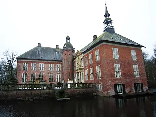 Gödens Historic site, Sande9 km NE
-
Knyphauser Wald Natural site, Lower Saxony6 km NW
Sources & licences
Data last updated: · 2 independent sources