Schäferberg
Located in Cremlingen, Landkreis Wolfenbüttel Coordinates: 52°17′00″ N 10°40′00″ E
- Elevation
- 85 m
- above sea level
- Local time
- UTC+01:00
- Europe/Berlin · UTC+01:00
- Airports
- HAJ Hannover Airport70 km
- KSF Kassel Airport130 km
About Schäferberg
Schäferberg is a mountain. Location: Cremlingen, Landkreis Wolfenbüttel. Elevation: 85 m. The best months to visit are June–August. The nearest airport is Hannover Airport (70 km). Nearby sights include Schandelah Concentration Camp and Hülsenberg.
Photos of Schäferberg
-
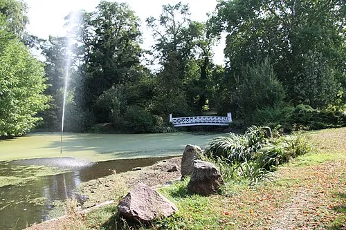
Gutspark Destedt Roll-Stone · CC BY-SA 4.0 -
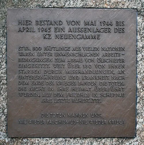
Schandelah Concentration Camp Roll-Stone · Public domain


Climate of Schäferberg
Best months for sightseeingBest months for sightseeing: June–August.
This month · November
A cold month
Day 8° · Night 2° · Rain 54 mm
- Hottest month
- August (day 23°)
- Coldest month
- January (night -2°)
- Wettest month
- June (71 mm)
- Driest month
- February (40 mm)
Bars: average monthly low and high temperature. Below: precipitation. Monthly averages for 1970–2000 at about 18 km resolution, adjusted for elevation. Highlighted months are mild and relatively dry. Source: WorldClim 2.1 (CC BY 4.0).
Show values as a table
| Month | Jan | Feb | Mar | Apr | May | Jun | Jul | Aug | Sep | Oct | Nov | Dec |
|---|---|---|---|---|---|---|---|---|---|---|---|---|
| Average high (°C) | 3° | 4° | 8° | 12° | 18° | 20° | 22° | 23° | 18° | 13° | 8° | 5° |
| Average low (°C) | -2° | -2° | 1° | 3° | 8° | 11° | 13° | 12° | 9° | 6° | 2° | 0° |
| Precipitation (mm) | 51 | 40 | 52 | 46 | 55 | 71 | 62 | 64 | 52 | 50 | 54 | 61 |
How to get to Schäferberg
The nearest airport is Hannover Airport (HAJ), 70 km to the west as the crow flies. The nearest large city is Braunschweig, 10 km to the west.
Airports
- Hannover Airport (HAJ) Hannover 70 kmwest
- Kassel Airport (KSF) Calden 130 kmsouthwest
- Leipzig/Halle Airport (LEJ) Schkeuditz 144 kmsoutheast
Nearby large cities
- Braunschweig Population: 244.7K 10 kmwest
- Wolfsburg Population: 123.1K 17 kmnortheast
- Salzgitter Population: 105K 22 kmsouthwest
- Hanover Population: 515.1K 64 kmwest
- Magdeburg Population: 244.3K 68 kmeast
Straight-line distances; road distances are longer. Airport data: OurAirports.
Day trips from Schäferberg
Within 100 km: 426 historic and cultural sites, 3,503 natural sites, 773 lakes, rivers and coasts.
0–25 km232 places
- Schapenbruch Teich Lake 6 kmW
- Kreuzteich Lake 6 kmW
- Allersee Lake 20 kmNE
- Waldsee Lake 22 kmNW
25–60 km1,356 places
- Wiehe River 40 kmNW
- Schalk River 53 kmS
- Sarre River 58 kmSE
- Aue River 28 kmS
60–100 km3,114 places
- Sundern Natural site 87 kmNW
- Warnau River 97 kmNW
- Ohe River 66 kmW
- Leine River 88 kmNW
Straight-line distances.
Nearest towns and villages
-
Hordorf Village, Cremlingen1.2 km NW
-
 Schandelah Village, Cremlingen2.1 km SE
-
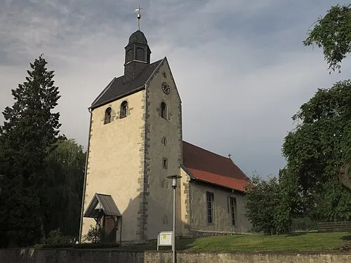 Cremlingen Town, Cremlingen4 km S
-
Schapen Village, Braunschweig4.2 km W
-
Volkmarode Village, Braunschweig4.7 km W
-
 Destedt Village, Cremlingen5.9 km SE
Nearby attractions & nature
Everything nearby-
Schandelah Concentration Camp Historic site, Cremlingen2 km SE
-
Hülsenberg Mountain, Lehre4.4 km NE
-
Gutspark Destedt Natural site, Cremlingen5.6 km SE
-
Buchhorst Natural site, Lower Saxony4.9 km W
-
Westerberg Mountain, Sickte7.8 km S
-
Galgenberg Mountain, Erkerode7.8 km S
-
Staatsforst Lehre Natural site, Lower Saxony6.5 km NE
-
Beienroder Holz Natural site, Lower Saxony6.5 km NE
Sources & licences
Data last updated: