- Population
- 24,074
- 24.1K
- Elevation
- 60 m
- above sea level
- Local time
- UTC+01:00
- Europe/Berlin · UTC+01:00
- Places inside
- 17
- listed under Isernhagen
- Airports
- HAJ Hannover Airport12 km
- BRE Bremen Airport98 km
About Isernhagen
Isernhagen is a village. Location: Region Hannover, Lower Saxony. Population: 24,074. Elevation: 60 m.
Isernhagen (German pronunciation: [ˈiːzɐnˌhaːɡn̩]; Eastphalian: Isernhogen) is a municipality in the district of Hanover, in Lower Saxony, Germany. It is situated in the north-east of Hanover. According to the average income per capita it is the most affluent municipality in Lower Saxony. Bundesautobahn 7 passes through the municipality. It is adjacent to Burgwedel, Burgdorf, Lehrte, Hannover, Langenhagen and Wedemark.
Source: Wikipedia · CC BY-SA 4.0
Places bordering Isernhagen
- Wedemark
- Langenhagen
- Burgwedel
Population of Isernhagen over time
| 2016 | 24,001 | |
|---|---|---|
| 2017 | 24,219 | |
| 2019 | 24,409 | |
| 2021 | 24,280 | |
| 2022 | 24,563 | |
| 2023 | 24,459 | |
| 2024 | 24,074 | |
| 2025 | 23,979 |
Censuses and official estimates; source: Wikidata.
Climate of Isernhagen
Best months for sightseeingBest months for sightseeing: June–August.
This month · November
A cold month
Day 8° · Night 2° · Rain 51 mm
- Hottest month
- August (day 23°)
- Coldest month
- February (night -2°)
- Wettest month
- June (72 mm)
- Driest month
- February (41 mm)
Bars: average monthly low and high temperature. Below: precipitation. Monthly averages for 1970–2000 at about 18 km resolution, adjusted for elevation. Highlighted months are mild and relatively dry. Source: WorldClim 2.1 (CC BY 4.0).
Show values as a table
| Month | Jan | Feb | Mar | Apr | May | Jun | Jul | Aug | Sep | Oct | Nov | Dec |
|---|---|---|---|---|---|---|---|---|---|---|---|---|
| Average high (°C) | 4° | 5° | 9° | 13° | 19° | 21° | 23° | 23° | 19° | 13° | 8° | 5° |
| Average low (°C) | -1° | -2° | 1° | 4° | 8° | 11° | 13° | 12° | 9° | 6° | 2° | 0° |
| Precipitation (mm) | 53 | 41 | 54 | 48 | 53 | 72 | 64 | 60 | 54 | 51 | 51 | 64 |
How to get to Isernhagen
The nearest airport is Hannover Airport (HAJ), 12 km to the west as the crow flies. The nearest large city is Hanover, 12 km to the southwest.
Airports
- Hannover Airport (HAJ) Hannover 12 kmwest
- Bremen Airport (BRE) Bremen 98 kmnorthwest
- Kassel Airport (KSF) Calden 119 kmsouth
Nearby large cities
- Hanover Population: 515.1K 12 kmsouthwest
- Braunschweig Population: 244.7K 50 kmsoutheast
- Salzgitter Population: 105K 50 kmsoutheast
- Wolfsburg Population: 123.1K 63 kmeast
- Bremen Population: 546.5K 99 kmnorthwest
Straight-line distances; road distances are longer. Airport data: OurAirports.
Day trips from Isernhagen
Within 100 km: 341 historic and cultural sites, 3,418 natural sites, 753 lakes, rivers and coasts.
0–25 km236 places
- Maschsee Lake 13 kmSW
- Irenensee Lake 21 kmE
- Spreewaldseen Lake 21 kmE
- Blauer See Lake 21 kmW
25–60 km1,287 places
- Sundern Natural site 41 kmN
- Warnau River 50 kmN
- Wiehe River 35 kmNE
- Ohe River 32 kmS
60–100 km2,989 places
- Schalk River 79 kmSE
- Aue River 79 kmSE
- Aue River 82 kmSE
- Zillerbachtalsperre Lake 97 kmSE
Straight-line distances.
Places in Isernhagen
17 placesBar: population relative to the most populous place in this list.
Cities & villages13
- Altwarmbüchen · Village
- An der Wietze · Village
- Entenpfühl · Village
- Farrelheide · Village
- Farster Bauerschaft · Village
- Gartenstadt Lohne · Village
- Groß Horst · Neighbourhood
- Isernhagen Hohenhorster Bauerschaft · Village
- Kircher Bauerschaft · Village
- Kirchhorst · Village
- Neuwarmbüchen · Village
- Niederhägener Bauerschaft · Neighbourhood
- Stelle · Neighbourhood
Mountains & nature2
Heritage & sights1
- NDB-Funkfeuer HA · Landmark
Nearby attractions & nature
Everything nearby-
Altwarmbüchener See Lake, Hanover3.1 km S
-
Laher Graben River, Hanover3.5 km SW
-
Große Heide Natural site, Hanover4.8 km SW
-
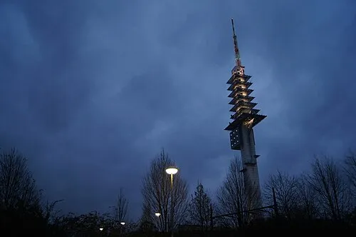 Telemax Landmark, Hanover7.5 km SW
-
Misburger Wald Natural site, Hanover5.2 km S
-
Wietzegraben River, Hanover5 km S
Sources & licences
Data last updated: · 2 independent sources