Naturschutzgebiet Schneckenstiege
Located in Stemmen, Rotenburg (Wümme) Coordinates: 53°13′47″ N 9°36′41″ E
- Elevation
- 36 m
- above sea level
- Airports
- HAM Hamburg Helmut Schmidt Airport51 km
- BRE Bremen Airport59 km
About Naturschutzgebiet Schneckenstiege
Naturschutzgebiet Schneckenstiege is a natural site. Location: Stemmen, Rotenburg (Wümme). The best months to visit are June–August. The nearest airport is Hamburg Helmut Schmidt Airport (51 km). Nearby sights include Naturschutzgebiet Ekelmoor and Lauenbrücker Forst.
Photos of Naturschutzgebiet Schneckenstiege
-
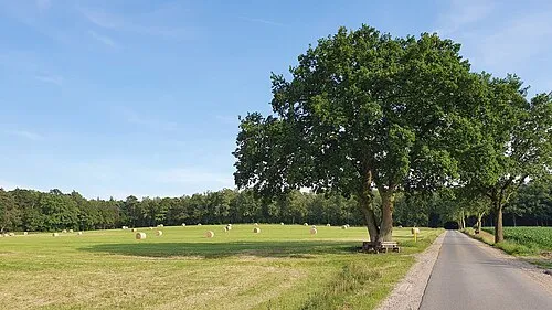
Otterberg smarties · CC BY-SA 4.0 -
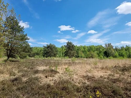
Finteler Wacholderlandschaft Smarties · CC BY-SA 4.0


Climate of Naturschutzgebiet Schneckenstiege
Best months for sightseeingBest months for sightseeing: June–August.
This month · November
A cold month
Day 8° · Night 2° · Rain 68 mm
- Hottest month
- July (day 22°)
- Coldest month
- January (night -2°)
- Wettest month
- December (74 mm)
- Driest month
- February (45 mm)
Bars: average monthly low and high temperature. Below: precipitation. Monthly averages for 1970–2000 at about 18 km resolution, adjusted for elevation. Highlighted months are mild and relatively dry. Source: WorldClim 2.1 (CC BY 4.0).
Show values as a table
| Month | Jan | Feb | Mar | Apr | May | Jun | Jul | Aug | Sep | Oct | Nov | Dec |
|---|---|---|---|---|---|---|---|---|---|---|---|---|
| Average high (°C) | 3° | 4° | 8° | 12° | 18° | 20° | 22° | 22° | 18° | 13° | 8° | 5° |
| Average low (°C) | -2° | -2° | 1° | 3° | 7° | 10° | 12° | 12° | 9° | 5° | 2° | 0° |
| Precipitation (mm) | 66 | 45 | 59 | 47 | 55 | 73 | 72 | 66 | 65 | 62 | 68 | 74 |
How to get to Naturschutzgebiet Schneckenstiege
The nearest airport is Hamburg Helmut Schmidt Airport (HAM), 51 km to the northeast as the crow flies. The nearest large city is Bremen, 56 km to the west.
Airports
- Hamburg Helmut Schmidt Airport (HAM) Hamburg 51 kmnortheast
- Bremen Airport (BRE) Bremen 59 kmwest
- Hannover Airport (HAJ) Hannover 86 kmsouth
Nearby large cities
- Bremen Population: 546.5K 56 kmwest
- Bremerhaven Population: 118.6K 78 kmnorthwest
- Oldenburg Population: 159.2K 94 kmwest
- Hanover Population: 515.1K 96 kmsouth
- Lübeck Population: 212.2K 101 kmnortheast
Straight-line distances; road distances are longer. Airport data: OurAirports.
Day trips from Naturschutzgebiet Schneckenstiege
Within 100 km: 400 historic and cultural sites, 2,667 natural sites, 1,098 lakes, rivers and coasts.
0–25 km225 places
- Treutsee Lake 17 kmN
- Birkensee Lake 21 kmSE
- Weichelsee Lake 19 kmSW
- Kleiner Bullensee Lake 23 kmSW
25–60 km1,350 places
- Viertbusch Natural site 57 kmNE
- Sundern Natural site 47 kmS
- Warnau River 39 kmS
- Leine River 56 kmS
60–100 km2,590 places
- Wiehe River 88 kmSE
- Aubek River 91 kmN
- Friesenstrand Beach 99 kmNW
- Rhinplate Island 63 kmN
Straight-line distances.
Nearest towns and villages
-
Königsmoor Village, Landkreis Harburg2.6 km E
-
Dreihausen Village, Stemmen1.3 km S
-
Stemmen Village, Stemmen3.9 km W
-
Lauenbrück Village, Rotenburg (Wümme)4.5 km SW
-
Lauenbrück Village, Lauenbrück4.6 km SW
-
Stemmerfeld Village, Stemmen2.6 km W
Nearby attractions & nature
Everything nearby-
Naturschutzgebiet Ekelmoor Natural site, Stemmen2.7 km NW
-
Lauenbrücker Forst Natural site, Lower Saxony3.4 km S
-
Rieper Reithbach River, Lauenbrück3.9 km SW
-
Naturschutzgebiet Tister Bauernmoor Natural site, Tiste4.7 km NW
-
Feienberg Mountain, Fintel5.1 km SE
-
Finteler Wacholderlandschaft Natural site, Fintel7.8 km SE
-
Blockenberg Mountain, Vahlde5.4 km S
-
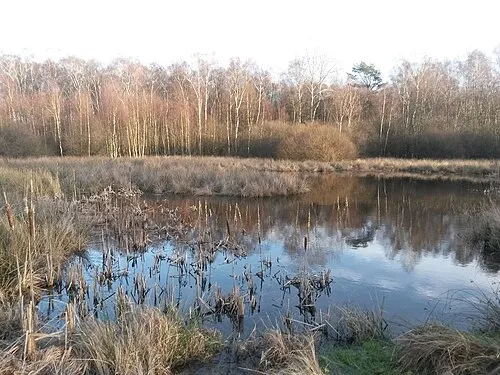 Obere Wümmeniederung Natural site, Otter8 km E
Sources & licences
Data last updated: