Greifswalder Oie
Located in Mecklenburg-Vorpommern, Germany Coordinates: 54°14′48″ N 13°54′59″ E
- Elevation
- 16 m
- above sea level
- Local time
- UTC+01:00
- Europe/Berlin · UTC+01:00
- Population
- 1
- 1
- Airports
- HDF Heringsdorf Airport44 km
- SZZ Solidarity Szczecin–Goleniów Airport98 km
About Greifswalder Oie
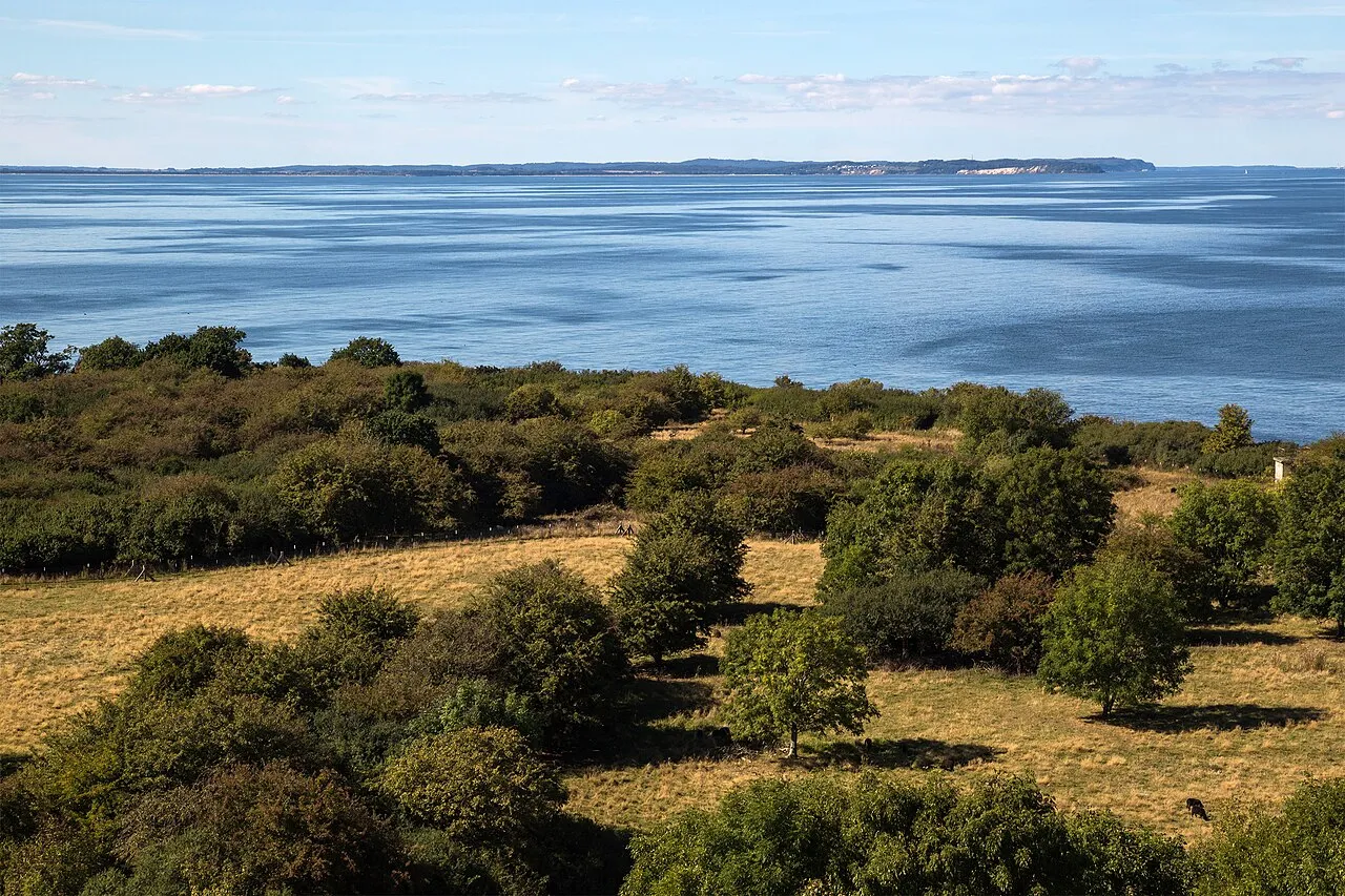
Greifswalder Oie is an island. Location: Mecklenburg-Vorpommern, Germany. Population: 1.
Greifswalder Oie (literally "Greifswald's isle") is a small island in the Baltic Sea, located east of Rügen and north of Usedom on the German coast. The island covers an area of about 54 hectares. The isle forms part of the municipality of Kröslin.
Source: Wikipedia · CC BY-SA 4.0
At a glance
- Length
- 1.6 km
- Area
- 54 ha
Source: Wikidata
Photos of Greifswalder Oie
-

Willem Blaeu · Public domain -

Unukorno · CC BY 4.0 -

Chron-Paul · CC BY-SA 3.0 de -

Unukorno · CC BY 4.0 -

Helmut Seger · CC BY-SA 4.0


Climate of Greifswalder Oie
Best months for sightseeingBest months for sightseeing: June–August.
This month · November
A cold month
Day 7° · Night 2° · Rain 48 mm
- Hottest month
- July (day 21°)
- Coldest month
- January (night -2°)
- Wettest month
- July (68 mm)
- Driest month
- February (34 mm)
Bars: average monthly low and high temperature. Below: precipitation. Monthly averages for 1970–2000 at about 18 km resolution, adjusted for elevation. Highlighted months are mild and relatively dry. Source: WorldClim 2.1 (CC BY 4.0).
Show values as a table
| Month | Jan | Feb | Mar | Apr | May | Jun | Jul | Aug | Sep | Oct | Nov | Dec |
|---|---|---|---|---|---|---|---|---|---|---|---|---|
| Average high (°C) | 2° | 3° | 6° | 10° | 15° | 19° | 21° | 21° | 17° | 12° | 7° | 4° |
| Average low (°C) | -2° | -2° | 0° | 3° | 7° | 11° | 13° | 13° | 10° | 6° | 2° | 0° |
| Precipitation (mm) | 41 | 34 | 38 | 35 | 48 | 57 | 68 | 64 | 57 | 48 | 48 | 48 |
How to get to Greifswalder Oie
The nearest airport is Heringsdorf Airport (HDF), 44 km to the south as the crow flies. For international flights: Solidarity Szczecin–Goleniów Airport (SZZ) (98 km). The nearest large city is Rostock, 117 km to the west.
Airports
- Heringsdorf Airport (HDF) Zirchow 44 kmsouth
- Solidarity Szczecin–Goleniów Airport (SZZ) Szczecin(Glewice) 98 kmsoutheast
- Bornholm Airport (RNN) Rønne 106 kmnortheast
Nearby large cities
- Rostock Population: 198.3K 117 kmwest
- Malmö Population: 362.1K 162 kmnorth
- Copenhagen Population: 1.2M 181 kmnorthwest
- Berlin Population: 3.4M 195 kmsouth
- Potsdam Population: 184.8K 213 kmsouth
Straight-line distances; road distances are longer. Airport data: OurAirports.
Day trips from Greifswalder Oie
Within 100 km: 118 historic and cultural sites, 885 natural sites, 366 lakes, rivers and coasts.
0–25 km91 places
- Ruden Island 11 kmSW
- Insel Görmitz Island 25 kmS
- Hauptstrand Sellin Beach 21 kmNW
- Lubminer Strand Beach 23 kmSW
25–60 km500 places
- Usedom Island Island 37 kmS
- Wolin Island 53 kmSE
- Ummanz Island 55 kmNW
- Vilm Island 26 kmW
60–100 km778 places
- Hiddensee Island 62 kmNW
- Beeke River 65 kmS
- Grabow Lake 72 kmW
- Glippe Beach 100 kmW
Straight-line distances.
Nearest towns and villages
-
Insel Oie Village, Kröslin0.6 km SW
-
 Karlshagen Village, Vorpommern-Greifswald15 km S
-
 Trassenheide Village, Vorpommern-Greifswald17 km S
-
 Thiessow Village, Mönchgut14 km W
-
Mönchgut Village, Landkreis Vorpommern-Rügen15 km NW
-
 Karlshagen Village, Karlshagen16 km S
Nearby attractions & nature
Everything nearby-
Naturschutzgebiet Greifswalder Oie Natural site, Vorpommern-Greifswald1.7 km SW
-
Leuchtturm Greifswalder Oie Landmark, Kröslin0.6 km NE
-
Ruden Island, Mecklenburg-Vorpommern11 km SW
-
Großer Wotig Island, Mecklenburg-Vorpommern17 km SW
-
Dänholm Island, Mecklenburg-Vorpommern16 km SW
-
Kleiner Wotig Island, Mecklenburg-Vorpommern17 km SW
-
Großer Strand Beach, Mönchgut14 km NW
-
Wolgaster Stadtforst Peenemünde Natural site, Mecklenburg-Vorpommern13 km SW
Sources & licences
Data last updated: · 2 independent sources