- Elevation
- 28 m
- above sea level
- Local time
- UTC+01:00
- Europe/Berlin · UTC+01:00
- Airports
- HDF Heringsdorf Airport81 km
- RNN Bornholm Airport90 km
About Kieler Bach
Kieler Bach is a river. Location: Mecklenburg-Vorpommern, Germany. The best months to visit are June–August. The nearest airport is Heringsdorf Airport (81 km). Nearby sights include Brisnitzer Bach and Trenzer Berg.
Climate of Kieler Bach
Best months for sightseeingBest months for sightseeing: June–August.
This month · November
A cold month
Day 7° · Night 3° · Rain 56 mm
- Hottest month
- July (day 20°)
- Coldest month
- January (night -1°)
- Wettest month
- July (65 mm)
- Driest month
- February (33 mm)
Bars: average monthly low and high temperature. Below: precipitation. Monthly averages for 1970–2000 at about 18 km resolution, adjusted for elevation. Highlighted months are mild and relatively dry. Source: WorldClim 2.1 (CC BY 4.0).
Show values as a table
| Month | Jan | Feb | Mar | Apr | May | Jun | Jul | Aug | Sep | Oct | Nov | Dec |
|---|---|---|---|---|---|---|---|---|---|---|---|---|
| Average high (°C) | 3° | 3° | 5° | 9° | 14° | 18° | 20° | 20° | 16° | 12° | 7° | 5° |
| Average low (°C) | -1° | -1° | 0° | 3° | 7° | 11° | 13° | 13° | 10° | 7° | 3° | 0° |
| Precipitation (mm) | 41 | 33 | 37 | 36 | 44 | 55 | 65 | 64 | 58 | 53 | 56 | 50 |
How to get to Kieler Bach
The nearest airport is Heringsdorf Airport (HDF), 81 km to the southeast as the crow flies. For international flights: Malmö Sturup Airport (MMX) (111 km). The nearest large city is Rostock, 113 km to the southwest.
Airports
- Heringsdorf Airport (HDF) Zirchow 81 kmsoutheast
- Bornholm Airport (RNN) Rønne 90 kmnortheast
- Malmö Sturup Airport (MMX) Malmö 111 kmnorth
Nearby large cities
- Rostock Population: 198.3K 113 kmsouthwest
- Malmö Population: 362.1K 125 kmnorth
- Copenhagen Population: 1.2M 144 kmnorthwest
- Helsingborg Population: 104.2K 178 kmnorth
- Lübeck Population: 212.2K 209 kmwest
Straight-line distances; road distances are longer. Airport data: OurAirports.
Day trips from Kieler Bach
Within 100 km: 92 historic and cultural sites, 610 natural sites, 263 lakes, rivers and coasts.
0–25 km140 places
- Hundestrand Beach 15 kmW
- Strand Glowe Beach 17 kmW
- Hauptstrand Sellin Beach 19 kmS
- Rügen Island Island 23 kmSW
25–60 km286 places
- Ruden Island 39 kmS
- Hiddensee Island 37 kmW
- Ummanz Island 34 kmW
- Greifswalder Oie Island 37 kmSE
60–100 km539 places
- Usedom Island Island 74 kmS
- Wolin Island 89 kmSE
- Insel Görmitz Island 61 kmS
- Hundestrand Dierhagen Ost Beach 90 kmW
Straight-line distances.
Nearest towns and villages
Nearby attractions & nature
Everything nearby-
Brisnitzer Bach River, Sassnitz0.2 km W
-
Trenzer Berg Mountain, Sassnitz2.7 km SW
-
Tipper Ort Natural site, Sassnitz1.1 km S
-
Kollicker Bach River, Mecklenburg-Vorpommern1.7 km NW
-
Stubnitz Natural site, Sassnitz1.7 km W
-
Nationalpark Jasmund Natural site, Sassnitz1.9 km W
-
Lenzer Bach River, Mecklenburg-Vorpommern2.8 km S
-
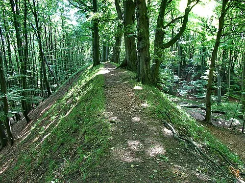 Herthaburg Mountain, Sassnitz2.3 km NW
Sources & licences
Data last updated: