Landkreis Rostock
Located in Mecklenburg-Vorpommern, Germany Coordinates: 53°55′14″ N 12°13′49″ E
- Population
- 218,721
- 218.7K
- Elevation
- 39 m
- above sea level
- Local time
- UTC+01:00
- Europe/Berlin · UTC+01:00
- Places inside
- 112
- listed under Landkreis Rostock
- Airports
- RLG Rostock-Laage Airport3 km
- LBC Lübeck Blankensee Airport100 km
About Landkreis Rostock
Landkreis Rostock is a municipality. Location: Mecklenburg-Vorpommern, Germany. Population: 218,721. Elevation: 39 m. The best months to visit are June–August. The nearest airport is Rostock-Laage Airport (3 km). Nearby sights include Striesdorfer Gehege and Hohensprenzer See.
Photos of Landkreis Rostock
-
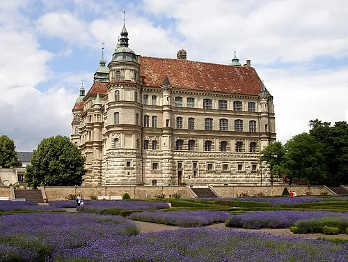
Güstrower Schloss Harke · Public domain

Climate of Landkreis Rostock
Best months for sightseeingBest months for sightseeing: June–August.
This month · November
A cold month
Day 7° · Night 2° · Rain 47 mm
- Hottest month
- July (day 22°)
- Coldest month
- January (night -2°)
- Wettest month
- July (68 mm)
- Driest month
- February (32 mm)
Bars: average monthly low and high temperature. Below: precipitation. Monthly averages for 1970–2000 at about 18 km resolution, adjusted for elevation. Highlighted months are mild and relatively dry. Source: WorldClim 2.1 (CC BY 4.0).
Show values as a table
| Month | Jan | Feb | Mar | Apr | May | Jun | Jul | Aug | Sep | Oct | Nov | Dec |
|---|---|---|---|---|---|---|---|---|---|---|---|---|
| Average high (°C) | 2° | 3° | 7° | 11° | 17° | 20° | 22° | 22° | 18° | 13° | 7° | 4° |
| Average low (°C) | -2° | -2° | 0° | 3° | 7° | 11° | 13° | 13° | 10° | 6° | 2° | -1° |
| Precipitation (mm) | 43 | 32 | 40 | 38 | 51 | 65 | 68 | 59 | 53 | 43 | 47 | 48 |
How to get to Landkreis Rostock
The nearest airport is Rostock-Laage Airport (RLG), 3 km to the east as the crow flies. The nearest large city is Rostock, 20 km to the north.
Airports
- Rostock-Laage Airport (RLG) Laage 3 kmeast
- Lübeck Blankensee Airport (LBC) Lübeck 100 kmwest
- Heringsdorf Airport (HDF) Zirchow 126 kmeast
Nearby large cities
- Rostock Population: 198.3K 20 kmnorth
- Lübeck Population: 212.2K 102 kmwest
- Kiel Population: 252.7K 144 kmwest
- Berlin Population: 3.4M 174 kmsoutheast
- Potsdam Population: 184.8K 178 kmsouth
Straight-line distances; road distances are longer. Airport data: OurAirports.
Day trips from Landkreis Rostock
Within 100 km: 205 historic and cultural sites, 2,431 natural sites, 1,122 lakes, rivers and coasts.
0–25 km356 places
- Beke River 18 kmW
- Schöninsel Island 18 kmS
- Zehnaer See Lake 24 kmS
- Wülwenowsee Lake 17 kmSE
25–60 km1,324 places
- Poel Island Island 53 kmW
- Ziegelwerder Island 60 kmSW
- Köppernitz River 51 kmW
- Strand Wangernp Beach 56 kmW
60–100 km2,078 places
- Falster Island 99 kmN
- Fehmarn Island 94 kmNW
- Hiddensee Island 89 kmNE
- Ummanz Island 87 kmNE
Straight-line distances.
Landkreis Rostock and similar cities
Side by side with cities of similar size in the same country: population, elevation and climate.
| Measure | Landkreis Rostock | Erfurt | Oberhausen | Mainz |
|---|---|---|---|---|
| Population | 218.7K | 218.8K | 219.2K | 222.9K |
| Elevation | 39 m | 194 m | 44 m | 125 m |
| Summer day (hottest month) | 22° | 24° | 23° | 25° |
| Winter night (coldest month) | -2° | -2° | 1° | -1° |
| Annual rainfall | 587 mm | 584 mm | 883 mm | 587 mm |
| Best months | Jun–Aug | Jun–Sep | Jun–Aug | May–Sep |
| Distance | — | 337 km | 453 km | 515 km |
Climate values are 1970–2000 monthly averages; straight-line distance.
Places in Landkreis Rostock
112 places- 61 Altkalen 790
- 62 Groß Wüstenfelde 787
- 63 Poppendorf 754
- 64 Hohenfelde 746
- 65 Plaaz 742
- 66 Prebberede 737
- 67 Bröbberow 671
- 68 Steinhagen 671
- 69 Kuchelmiß 668
- 70 Thulendorf 658
- 71 Zehna 639
- 72 Dolgen am See 619
- 73 Mistorf 619
- 74 Rühn 612
- 75 Groß Roge 578
- 76 Hoppenrade 576
- 77 Steffenshagen 554
- 78 Selpin 520
- 79 Alt Bukow 512
- 80 Am Salzhaff 512
- 81 Dobbin-Linstow 510
- 82 Hohen Sprenz 506
- 83 Sukow-Levitzow 505
- 84 Sarmstorf 500
- 85 Thelkow 489
- 86 Zarnewanz 470
- 87 Zepelin 466
- 88 Schwasdorf 432
- 89 Dahmen 429
- 90 Lelkendorf 417
- 91 Glasewitz 412
- 92 Schorssow 412
- 93 Benitz 405
- 94 Vorbeck 397
- 95 Alt Sührkow 389
- 96 Thürkow 374
- 97 Reimershagen 369
- 98 Rukieten 363
- 99 Hohen Demzin 361
- 100 Kassow 357
- 101 Finkenthal 332
- 102 Warnkenhagen 315
- 103 Kuhs 313
- 104 Groß Schwiesow 281
- 105 Gnewitz 268
- 106 Dalkendorf 266
- 107 Klein Upahl 229
- 108 Dreetz 191
- 109 Nustrow 174
- 110 Stubbendorf 172
- 111 Grammow 164
- 112 Penzin 140
Bar: population relative to the most populous place in this list.
Nearby attractions & nature
Everything nearby-
Striesdorfer Gehege Natural site, Mecklenburg-Vorpommern1.4 km E
-
Hohensprenzer See Lake, Mecklenburg-Vorpommern1.2 km W
-
Kritzkower Gehege Natural site, Mecklenburg-Vorpommern2.3 km S
-
Sprenzer Holz Natural site, Mecklenburg-Vorpommern2.5 km S
-
Dolgener See Lake, Mecklenburg-Vorpommern3.4 km N
-
Weitendorfer Tannen Natural site, Mecklenburg-Vorpommern5.4 km SE
-
Niendorfer Tannen Natural site, Mecklenburg-Vorpommern6.5 km W
-
Goldenitzer Tannen Natural site, Mecklenburg-Vorpommern6.7 km W
Other cities and towns in Mecklenburg-Vorpommern
-
Laage Town, Laage7.9 km E
-
Schwaan Town, Schwaan8.1 km W
-
Güstrow Town, Güstrow14 km S
-
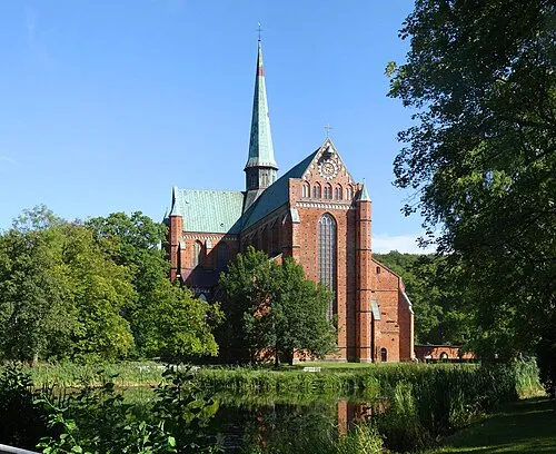 Bad Doberan Town, Bad Doberan30 km NW
-
Bützow Town, Bützow19 km SW
-
Nordwestmecklenburg Municipality, Mecklenburg-Vorpommern66 km W
Sources & licences
Data last updated: