Nordwestmecklenburg
Located in Mecklenburg-Vorpommern, Germany Coordinates: 53°48′28″ N 11°14′53″ E
- Population
- 156,692
- 156.7K
- Elevation
- 37 m
- above sea level
- Local time
- UTC+01:00
- Europe/Berlin · UTC+01:00
- Places inside
- 83
- listed under Nordwestmecklenburg
- Airports
- LBC Lübeck Blankensee Airport35 km
- RLG Rostock-Laage Airport69 km
About Nordwestmecklenburg
Nordwestmecklenburg is a municipality. Location: Mecklenburg-Vorpommern, Germany. Population: 156,692. Elevation: 37 m. The best months to visit are June–August. The nearest airport is Lübeck Blankensee Airport (35 km). Nearby sights include Everstorfer Forst and Wotenitzer Tannen.
Photos of Nordwestmecklenburg
-
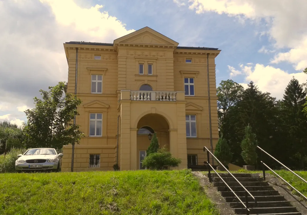
Schloß Tressow Dr. Thorsten Krieger · CC BY-SA 3.0 de -
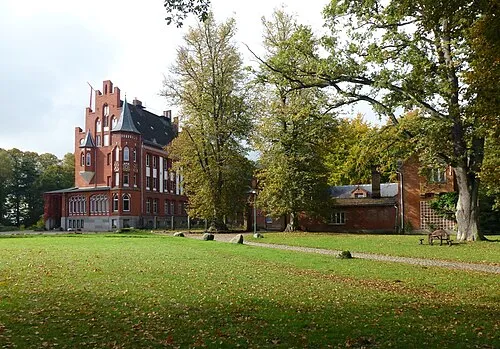
Schloß Kalkhorst Holger.Ellgaard · CC BY-SA 3.0 -
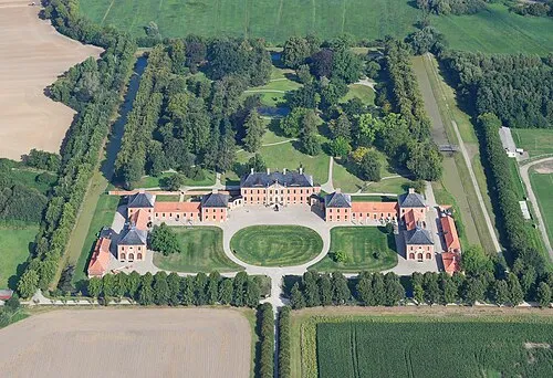
Schloß Bothmer Carsten Steger · CC BY-SA 4.0


Climate of Nordwestmecklenburg
Best months for sightseeingBest months for sightseeing: June–August.
This month · November
A cold month
Day 7° · Night 2° · Rain 58 mm
- Hottest month
- August (day 22°)
- Coldest month
- January (night -2°)
- Wettest month
- July (71 mm)
- Driest month
- February (38 mm)
Bars: average monthly low and high temperature. Below: precipitation. Monthly averages for 1970–2000 at about 18 km resolution, adjusted for elevation. Highlighted months are mild and relatively dry. Source: WorldClim 2.1 (CC BY 4.0).
Show values as a table
| Month | Jan | Feb | Mar | Apr | May | Jun | Jul | Aug | Sep | Oct | Nov | Dec |
|---|---|---|---|---|---|---|---|---|---|---|---|---|
| Average high (°C) | 3° | 4° | 7° | 12° | 17° | 20° | 22° | 22° | 18° | 13° | 7° | 4° |
| Average low (°C) | -2° | -2° | 1° | 3° | 7° | 10° | 12° | 12° | 9° | 6° | 2° | -1° |
| Precipitation (mm) | 52 | 38 | 47 | 43 | 50 | 62 | 71 | 65 | 55 | 49 | 58 | 59 |
How to get to Nordwestmecklenburg
The nearest airport is Lübeck Blankensee Airport (LBC), 35 km to the west as the crow flies. For international flights: Hamburg Helmut Schmidt Airport (HAM) (85 km). The nearest large city is Lübeck, 38 km to the west.
Airports
- Lübeck Blankensee Airport (LBC) Lübeck 35 kmwest
- Rostock-Laage Airport (RLG) Laage 69 kmeast
- Hamburg Helmut Schmidt Airport (HAM) Hamburg 85 kmwest
Nearby large cities
- Lübeck Population: 212.2K 38 kmwest
- Rostock Population: 198.3K 66 kmnortheast
- Kiel Population: 252.7K 93 kmnorthwest
- Wolfsburg Population: 123.1K 157 kmsouth
- Braunschweig Population: 244.7K 178 kmsouth
Straight-line distances; road distances are longer. Airport data: OurAirports.
Day trips from Nordwestmecklenburg
Within 100 km: 337 historic and cultural sites, 3,111 natural sites, 1,217 lakes, rivers and coasts.
0–25 km272 places
- Poel Island Island 24 kmNE
- Köppernitz River 17 kmNE
- Strand Wangernp Beach 20 kmNE
- Lieps Island 16 kmSE
25–60 km1,564 places
- Ziegelwerder Island 27 kmSE
- Beke River 49 kmE
- Hundestrand Beach 42 kmNW
- Strand Rosenhagen Beach 27 kmNW
60–100 km2,829 places
- Fehmarn Island 74 kmN
- Viertbusch Natural site 69 kmSW
- Spock River 88 kmNW
- Hafen Strände Beach 99 kmNW
Straight-line distances.
Nordwestmecklenburg and similar cities
Side by side with cities of similar size in the same country: population, elevation and climate.
| Measure | Nordwestmecklenburg | Oldenburg | Neuss | Regensburg |
|---|---|---|---|---|
| Population | 156.7K | 159.2K | 152.5K | 151.4K |
| Elevation | 37 m | 10 m | 44 m | 341 m |
| Summer day (hottest month) | 22° | 22° | 24° | 24° |
| Winter night (coldest month) | -2° | -1° | 1° | -4° |
| Annual rainfall | 649 mm | 742 mm | 788 mm | 656 mm |
| Best months | Jun–Aug | Jun–Aug | Jun–Sep | May–Sep |
| Distance | — | 215 km | 425 km | 536 km |
Climate values are 1970–2000 monthly averages; straight-line distance.
Places in Nordwestmecklenburg
83 places- 1 Wismar, Hansestadt 43.3K
- 2 Grevesmühlen 10.2K
- 3 Lüdersdorf 5.2K
- 4 Gadebusch 5.1K
- 5 Schönberg 4.3K
- 6 Neukloster 3.9K
- 7 Dassow 3.9K
- 8 Bad Kleinen 3.7K
- 9 Rehna 3.5K
- 10 Warin 3.3K
- 11 Dorf Mecklenburg 3.2K
- 12 Selmsdorf 3.1K
- 13 Klütz 3K
- 14 Gägelow 2.5K
- 15 Bobitz 2.5K
- 16 Insel Poel 2.5K
- 17 Boltenhagen 2.4K
- 18 Neuburg 2.2K
- 19 Brüsewitz 1.8K
- 20 Upahl 1.8K
- 21 Kalkhorst 1.7K
- 22 Stepenitztal 1.7K
- 23 Lübow 1.6K
- 24 Lützow 1.5K
- 25 Lübstorf 1.5K
- 26 Hornstorf 1.4K
- 27 Schlagsdorf 1.3K
- 28 Zurow 1.3K
- 29 Damshagen 1.3K
- 30 Carlow 1.2K
- 31 Alt Meteln 1.2K
- 32 Blowatz 1.1K
- 33 Klein Trebbow 1.1K
- 34 Hohenkirchen 1K
- 35 Roggendorf 996
- 36 Mühlen Eichsen 946
- 37 Seehof 943
- 38 Königsfeld 929
- 39 Krembz 864
- 40 Glasin 799
- 41 Zierow 751
- 42 Gottesgabe 750
- 43 Ventschow 735
- 44 Schildetal 719
- 45 Dragun 716
- 46 Hohen Viecheln 709
- 47 Wedendorfersee 684
- 48 Pokrent 660
- 49 Veelböken 657
- 50 Grambow 647
- 51 Benz 642
- 52 Testorf-Steinfort 636
- 53 Warnow 630
- 54 Krusenhagen 600
- 55 Siemz-Niendorf 581
- 56 Barnekow 577
- 57 Groß Stieten 566
- 58 Dalberg-Wendelstorf 560
- 59 Pingelshagen 558
- 60 Rüting 542
Bar: population relative to the most populous place in this list.
Nearby attractions & nature
Everything nearby-
Everstorfer Forst Natural site, Mecklenburg-Vorpommern6.6 km N
-
Wotenitzer Tannen Natural site, Mecklenburg-Vorpommern7.1 km NW
-
Jameler Forst Natural site, Mecklenburg-Vorpommern7.4 km NE
-
Tressower See Lake, Mecklenburg-Vorpommern6.9 km NE
-
Forst Gostorf Natural site, Mecklenburg-Vorpommern8.9 km NW
-
Vielbecker See Lake, Mecklenburg-Vorpommern8.7 km NW
-
Santower See Lake, Mecklenburg-Vorpommern8.9 km N
-
Forst Neu Dragun Natural site, Mecklenburg-Vorpommern9.9 km SW
Sources & licences
Data last updated: