Kreisfreie Stadt Rostock
Local name: Rostock
Located in Mecklenburg-Vorpommern, Germany Coordinates: 54°07′32″ N 12°07′15″ E
- Population
- 205,307
- 205.3K
- Elevation
- 5 m
- above sea level
- Local time
- UTC+01:00
- Europe/Berlin · UTC+01:00
- Places inside
- 1
- listed under Kreisfreie Stadt Rostock
- Airports
- RLG Rostock-Laage Airport25 km
- LBC Lübeck Blankensee Airport99 km
About Kreisfreie Stadt Rostock
Kreisfreie Stadt Rostock is a municipality. Location: Mecklenburg-Vorpommern, Germany. Population: 205,307. Elevation: 5 m.
Rostock (; German: [ˈʁɔstɔk] ), officially the Hanseatic and University City of Rostock (German: Hanse- und Universitätsstadt Rostock), is the largest city in the German state of Mecklenburg-Western Pomerania and lies in the Mecklenburgian part of the state, close to the border with Pomerania. With around 210,000 inhabitants, it is the third-largest city on the German Baltic coast after Kiel and Lübeck, the eighth-largest city in the area of former East Germany, as well as the 39th-largest city of Germany.
Source: Wikipedia · CC BY-SA 4.0
Twin towns and sister cities of Kreisfreie Stadt Rostock
- Varna· Bulgaria
- Turku· Finland
- Riga· Latvia
- Rijeka· Croatia
- Bremen· Germany
Source: Wikidata. Only places with a page on this site are shown.
Population of Kreisfreie Stadt Rostock over time
| 2012 | 202,887 | |
|---|---|---|
| 2013 | 203,431 | |
| 2015 | 206,011 | |
| 2016 | 207,513 | |
| 2017 | 208,409 | |
| 2018 | 208,886 | |
| 2019 | 208,886 | |
| 2021 | 209,061 | |
| 2022 | 209,920 | |
| 2023 | 210,795 | |
| 2024 | 205,307 | |
| 2025 | 204,929 |
Censuses and official estimates; source: Wikidata.
Climate of Kreisfreie Stadt Rostock
Best months for sightseeingBest months for sightseeing: June–August.
This month · November
A cold month
Day 7° · Night 3° · Rain 48 mm
- Hottest month
- August (day 22°)
- Coldest month
- January (night -2°)
- Wettest month
- July (67 mm)
- Driest month
- February (31 mm)
Bars: average monthly low and high temperature. Below: precipitation. Monthly averages for 1970–2000 at about 18 km resolution, adjusted for elevation. Highlighted months are mild and relatively dry. Source: WorldClim 2.1 (CC BY 4.0).
Show values as a table
| Month | Jan | Feb | Mar | Apr | May | Jun | Jul | Aug | Sep | Oct | Nov | Dec |
|---|---|---|---|---|---|---|---|---|---|---|---|---|
| Average high (°C) | 3° | 3° | 7° | 11° | 17° | 19° | 22° | 22° | 18° | 13° | 7° | 4° |
| Average low (°C) | -2° | -1° | 1° | 4° | 8° | 12° | 14° | 13° | 10° | 7° | 3° | 0° |
| Precipitation (mm) | 45 | 31 | 44 | 39 | 48 | 66 | 67 | 57 | 56 | 45 | 48 | 50 |
How to get to Kreisfreie Stadt Rostock
The nearest airport is Rostock-Laage Airport (RLG), 25 km to the southeast as the crow flies. The nearest large city is Rostock, 4 km to the south.
Airports
- Rostock-Laage Airport (RLG) Laage 25 kmsoutheast
- Lübeck Blankensee Airport (LBC) Lübeck 99 kmwest
- Heringsdorf Airport (HDF) Zirchow 136 kmeast
Nearby large cities
- Rostock Population: 198.3K 4 kmsouth
- Lübeck Population: 212.2K 98 kmwest
- Kiel Population: 252.7K 131 kmwest
- Malmö Population: 362.1K 174 kmnorth
- Copenhagen Population: 1.2M 175 kmnorth
Straight-line distances; road distances are longer. Airport data: OurAirports.
Day trips from Kreisfreie Stadt Rostock
Within 100 km: 187 historic and cultural sites, 2,149 natural sites, 903 lakes, rivers and coasts.
0–25 km194 places
- Beke River 24 kmSW
- Pagenwerder Island 5 kmN
- Teschower See Lake 21 kmSE
- Schwarze See Lake 20 kmSE
25–60 km1,049 places
- Poel Island Island 47 kmW
- Köppernitz River 51 kmSW
- Grabow Lake 55 kmNE
- Strand Wangernp Beach 51 kmW
60–100 km1,996 places
- Falster Island 76 kmN
- Fehmarn Island 74 kmNW
- Hiddensee Island 79 kmNE
- Ummanz Island 79 kmNE
Straight-line distances.
Kreisfreie Stadt Rostock and similar cities
Side by side with cities of similar size in the same country: population, elevation and climate.
| Measure | Kreisfreie Stadt Rostock | Hagen | Lübeck | Rostock |
|---|---|---|---|---|
| Population | 205.3K | 199K | 212.2K | 198.3K |
| Elevation | 5 m | 111 m | 16 m | 18 m |
| Summer day (hottest month) | 22° | 23° | 22° | 22° |
| Winter night (coldest month) | -2° | -1° | -2° | -2° |
| Annual rainfall | 596 mm | 980 mm | 674 mm | 596 mm |
| Best months | Jun–Aug | Jun–Aug | Jun–Aug | Jun–Aug |
| Distance | — | 439 km | 98 km | 4 km |
Climate values are 1970–2000 monthly averages; straight-line distance.
Places in Kreisfreie Stadt Rostock
1 placeBar: population relative to the most populous place in this list.
Nearby attractions & nature
Everything nearby-
Warnow River, Mecklenburg-Vorpommern3.7 km S
-
Unterwarnow River, Mecklenburg-Vorpommern3.5 km NW
-
Peezer Bach River, Mecklenburg-Vorpommern4.4 km NE
-
Carbäk River, Mecklenburg-Vorpommern4.7 km SE
-
Breitling Lake, Mecklenburg-Vorpommern4.5 km N
-
Kleine Radel River, Mecklenburg-Vorpommern4.6 km N
-
Pagenwerder Island, Mecklenburg-Vorpommern4.8 km N
-
Oberwarnow River, Mecklenburg-Vorpommern5.1 km S
Other cities and towns in Mecklenburg-Vorpommern
-
Rostock City, Rostock4.3 km S
-
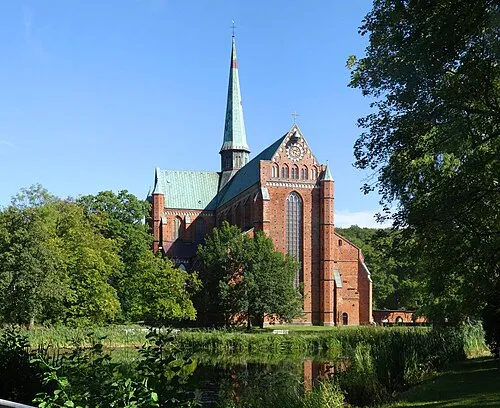 Bad Doberan Town, Bad Doberan15 km W
-
Landkreis Rostock Municipality, Mecklenburg-Vorpommern24 km S
-
Ostseebad Kühlungsborn Town, Kühlungsborn25 km W
-
Landkreis Vorpommern-Rügen Municipality, Mecklenburg-Vorpommern91 km NE
-
Schwaan Town, Schwaan21 km S
Sources & licences
Data last updated: · 2 independent sources