- Elevation
- 18 m
- above sea level
- Local time
- UTC+01:00
- Europe/Berlin · UTC+01:00
- Airports
- NRN Weeze (Niederrhein) Airport32 km
- DUS Düsseldorf Airport34 km
About Alter Rhein
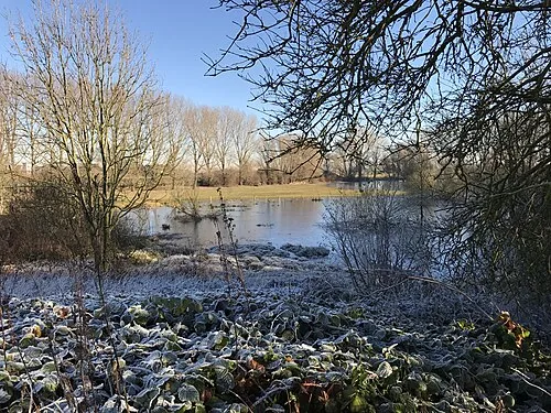
Alter Rhein is a river. Location: North Rhine-Westphalia, Germany. The best months to visit are June–August. The nearest airport is Weeze (Niederrhein) Airport (32 km). Nearby sights include Die Momm and Niepgraben.
Climate of Alter Rhein
Best months for sightseeingBest months for sightseeing: June–August.
This month · November
A cold month
Day 9° · Night 4° · Rain 67 mm
- Hottest month
- July (day 23°)
- Coldest month
- February (night 0°)
- Wettest month
- June (76 mm)
- Driest month
- April (45 mm)
Bars: average monthly low and high temperature. Below: precipitation. Monthly averages for 1970–2000 at about 18 km resolution, adjusted for elevation. Highlighted months are mild and relatively dry. Source: WorldClim 2.1 (CC BY 4.0).
Show values as a table
| Month | Jan | Feb | Mar | Apr | May | Jun | Jul | Aug | Sep | Oct | Nov | Dec |
|---|---|---|---|---|---|---|---|---|---|---|---|---|
| Average high (°C) | 5° | 6° | 10° | 14° | 19° | 21° | 23° | 23° | 19° | 14° | 9° | 6° |
| Average low (°C) | 1° | 0° | 3° | 5° | 9° | 12° | 14° | 13° | 11° | 7° | 4° | 2° |
| Precipitation (mm) | 63 | 48 | 63 | 45 | 64 | 76 | 69 | 62 | 67 | 61 | 67 | 72 |
How to get to Alter Rhein
The nearest airport is Weeze (Niederrhein) Airport (NRN), 32 km to the west as the crow flies. The nearest large city is Moers, 14 km to the south.
Airports
- Weeze (Niederrhein) Airport (NRN) Weeze 32 kmwest
- Düsseldorf Airport (DUS) Düsseldorf 34 kmsouth
- Dortmund Airport (DTM) Dortmund 71 kmeast
Nearby large cities
- Moers Population: 103.5K 14 kmsouth
- Duisburg Population: 504.4K 20 kmsoutheast
- Oberhausen Population: 219.2K 22 kmsoutheast
- Bottrop Population: 119.9K 24 kmeast
- Mülheim Population: 173K 26 kmsoutheast
Straight-line distances; road distances are longer. Airport data: OurAirports.
Nearest towns and villages
Nearby attractions & nature
Everything nearby-
Die Momm River, North Rhine-Westphalia1.5 km N
-
Niepgraben River, North Rhine-Westphalia3.1 km S
-
Jenneckes Gatt Lake, North Rhine-Westphalia3.1 km S
-
Grindbach River, North Rhine-Westphalia3.4 km SE
-
Moersbach River, North Rhine-Westphalia3.5 km S
-
Büdericher Insel Island, North Rhine-Westphalia7.2 km N
-
Saalhoffer Ley River, North Rhine-Westphalia4.9 km SW
-
 Bislicher Insel Island, North Rhine-Westphalia10 km NW
Sources & licences
Data last updated: