
- Population
- 723
- 723
- Elevation
- 147 m
- above sea level
- Local time
- UTC+01:00
- Europe/Berlin · UTC+01:00
- Airports
- CGN Cologne Bonn Airport26 km
- DUS Düsseldorf Airport68 km
About Ollheim
Ollheim is a village. Location: Swisttal, Rhein-Sieg-Kreis. Population: 723. Elevation: 147 m.
Ollheim is a farming village in the municipality Swisttal in the North Rhine-Westphalian Rhein-Sieg district. It is situated approximately 19 km west of Bonn. In 2007 it had 723 inhabitants.
Source: Wikipedia · CC BY-SA 4.0
At a glance
- Area
- 9.7 km²
Source: Wikidata
Photos of Ollheim
-

Signal Corps Archive from United States · Public domain

Climate of Ollheim
Best months for sightseeingBest months for sightseeing: June–August.
This month · November
A cold month
Day 9° · Night 3° · Rain 55 mm
- Hottest month
- August (day 23°)
- Coldest month
- February (night -1°)
- Wettest month
- July (73 mm)
- Driest month
- February (42 mm)
Bars: average monthly low and high temperature. Below: precipitation. Monthly averages for 1970–2000 at about 18 km resolution, adjusted for elevation. Highlighted months are mild and relatively dry. Source: WorldClim 2.1 (CC BY 4.0).
Show values as a table
| Month | Jan | Feb | Mar | Apr | May | Jun | Jul | Aug | Sep | Oct | Nov | Dec |
|---|---|---|---|---|---|---|---|---|---|---|---|---|
| Average high (°C) | 5° | 6° | 10° | 13° | 18° | 21° | 23° | 23° | 19° | 14° | 9° | 6° |
| Average low (°C) | 0° | -1° | 2° | 4° | 8° | 11° | 13° | 13° | 10° | 6° | 3° | 1° |
| Precipitation (mm) | 47 | 42 | 52 | 50 | 64 | 71 | 73 | 63 | 57 | 50 | 55 | 54 |
How to get to Ollheim
The nearest airport is Cologne Bonn Airport (CGN), 26 km to the northeast as the crow flies. The nearest large city is Bonn, 15 km to the east.
Airports
- Cologne Bonn Airport (CGN) Köln (Cologne) 26 kmnortheast
- Düsseldorf Airport (DUS) Düsseldorf 68 kmnorth
- Maastricht Aachen Airport (MST) Maastricht 83 kmwest
Nearby large cities
- Bonn Population: 330.6K 15 kmeast
- Cologne Population: 1M 28 kmnorth
- Bergisch Gladbach Population: 106.2K 37 kmnortheast
- Leverkusen Population: 162.7K 39 kmnorth
- Solingen Population: 164.4K 56 kmnorth
Straight-line distances; road distances are longer. Airport data: OurAirports.
Day trips from Ollheim
Within 100 km: 585 historic and cultural sites, 2,917 natural sites, 911 lakes, rivers and coasts.
0–25 km325 places
- Kemper Werth Island 16 kmNE
- Liblarer See Lake 15 kmN
- Talsperre Steinbach Lake 12 kmS
- Rotter See Lake 20 kmNE
25–60 km1,453 places
- Lac d'Eupen Lake 57 kmW
- Schartenknopf Mountain 54 kmSW
- Roderhöhe Mountain 53 kmSW
- Petersberg Mountain 54 kmSW
60–100 km2,635 places
- Île du Moulin Island 93 kmW
- Île Monsin Island 89 kmW
- Île de Franche Garenne Island 86 kmW
- Lac de la Gileppe Lake 65 kmW
Straight-line distances.
Nearby attractions & nature
Everything nearby-
Jungbach River, North Rhine-Westphalia2.1 km E
-
Schießbach River, North Rhine-Westphalia2.5 km NE
-
Ohrbach River, North Rhine-Westphalia2.5 km S
-
Tüttelbach River, North Rhine-Westphalia3.6 km SE
-
Rodderbach River, North Rhine-Westphalia4.6 km SW
-
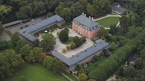 Burg Historic site, Bornheim9.1 km N
Other cities and towns in Swisttal
-
 Buschhoven Village, Swisttal5.9 km E
-
 Straßfeld Village, Swisttal2.3 km NW
-
 Essig Village, Swisttal3.3 km S
-
 Heimerzheim Village, Swisttal3.6 km NE
Sources & licences
Data last updated: · 2 independent sources