Eschbachthal
Located in Wermelskirchen, Rheinisch-Bergischer Kreis Coordinates: 51°09′00″ N 7°12′00″ E
- Elevation
- 207 m
- above sea level
- Local time
- UTC+01:00
- Europe/Berlin · UTC+01:00
- Airports
- CGN Cologne Bonn Airport32 km
- DUS Düsseldorf Airport34 km
About Eschbachthal
Eschbachthal is a village. Location: Wermelskirchen, Rheinisch-Bergischer Kreis. Elevation: 207 m. The best months to visit are June–August. The nearest airport is Cologne Bonn Airport (32 km). Nearby sights include Burg Castle and Schloss Burg.
Climate of Eschbachthal
Best months for sightseeingBest months for sightseeing: June–August.
This month · November
A wet month
Day 8° · Night 3° · Rain 104 mm
- Hottest month
- July (day 22°)
- Coldest month
- February (night -1°)
- Wettest month
- December (117 mm)
- Driest month
- April (73 mm)
Bars: average monthly low and high temperature. Below: precipitation. Monthly averages for 1970–2000 at about 18 km resolution, adjusted for elevation. Highlighted months are mild and relatively dry. Source: WorldClim 2.1 (CC BY 4.0).
Show values as a table
| Month | Jan | Feb | Mar | Apr | May | Jun | Jul | Aug | Sep | Oct | Nov | Dec |
|---|---|---|---|---|---|---|---|---|---|---|---|---|
| Average high (°C) | 4° | 5° | 9° | 12° | 17° | 20° | 22° | 22° | 18° | 13° | 8° | 5° |
| Average low (°C) | -1° | -1° | 1° | 4° | 8° | 11° | 13° | 12° | 9° | 6° | 3° | 1° |
| Precipitation (mm) | 108 | 78 | 99 | 73 | 80 | 99 | 102 | 82 | 92 | 92 | 104 | 117 |
How to get to Eschbachthal
The nearest airport is Cologne Bonn Airport (CGN), 32 km to the south as the crow flies. The nearest large city is Remscheid, 3 km to the north.
Airports
- Cologne Bonn Airport (CGN) Köln (Cologne) 32 kmsouth
- Düsseldorf Airport (DUS) Düsseldorf 34 kmnorthwest
- Dortmund Airport (DTM) Dortmund 50 kmnortheast
Nearby large cities
- Remscheid Population: 117.1K 3 kmnorth
- Solingen Population: 164.4K 8 kmwest
- Wuppertal Population: 360.8K 12 kmnorth
- Bergisch Gladbach Population: 106.2K 19 kmsouth
- Leverkusen Population: 162.7K 20 kmsouthwest
Straight-line distances; road distances are longer. Airport data: OurAirports.
Day trips from Eschbachthal
Within 100 km: 515 historic and cultural sites, 2,878 natural sites, 823 lakes, rivers and coasts.
0–25 km117 places
- Neyetalsperre Lake 14 kmE
- Lingesetalsperre Lake 24 kmE
- Kerspetalsperre Lake 21 kmE
- Glörtalsperre Lake 23 kmNE
25–60 km1,028 places
- Else River 41 kmNE
- Else River 48 kmE
- Weibe River 56 kmSE
- Kemper Werth Island 44 kmS
60–100 km3,071 places
- Lac d'Eupen Lake 97 kmSW
- Hohe Mark Mountain 99 kmSW
- Dickelt Mountain 100 kmSW
- Schimperbos Natural site 96 kmSW
Straight-line distances.
Nearby attractions & nature
Everything nearby-
Burg Castle Historic site, Solingen3.6 km SW
-
Schloss Burg Historic site, Solingen3.6 km SW
-
Rattenberg Mountain, Hückeswagen5.1 km E
-
Sengbachtalsperre Lake, North Rhine-Westphalia4.9 km SW
-
Fernmeldeturm Witzhelden Landmark, Leichlingen (Rheinland)6.9 km SW
-
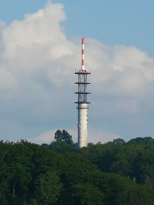 Fernmeldeturm Wuppertal-Küllenhahn Landmark, Wuppertal9.9 km NW
Other cities and towns in Wermelskirchen
-
Elbringhausen Village, Wermelskirchen2.7 km E
-
Unterwinkelhausen Village, Wermelskirchen3.1 km SW
-
 Tente Village, Wermelskirchen3.4 km S
-
Herrlinghausen Village, Wermelskirchen3.7 km S
-
Bollinghausen Village, Wermelskirchen1.4 km S
-
Haid Village, Wermelskirchen1.8 km SW
Sources & licences
Data last updated: