- Population
- 60,785
- 60.8K
- Elevation
- 29 m
- above sea level
- Local time
- UTC+01:00
- Europe/Berlin · UTC+01:00
- Places inside
- 36
- listed under Wesel
- Airports
- NRN Weeze (Niederrhein) Airport34 km
- DUS Düsseldorf Airport42 km
About Wesel
Wesel is a village. Location: Kreis Wesel, Düsseldorf District. Population: 60,785. Elevation: 29 m.
Wesel (German pronunciation: [ˈveːzl̩] ) is a city in North Rhine-Westphalia, in western Germany. It is the capital of the Wesel district.
Source: Wikipedia · CC BY-SA 4.0
Places bordering Wesel
- Rees
Twin towns and sister cities of Wesel
- Hagerstown· United States
- Salzwedel· Germany
- Kętrzyn· Poland
Source: Wikidata. Only places with a page on this site are shown.
Population of Wesel over time
| 1975 | 56,584 | |
|---|---|---|
| 2014 | 60,088 | |
| 2017 | 60,496 | |
| 2019 | 60,357 | |
| 2021 | 60,688 | |
| 2022 | 61,330 | |
| 2023 | 61,277 | |
| 2024 | 60,785 | |
| 2025 | 60,717 |
Censuses and official estimates; source: Wikidata.
Climate of Wesel
Best months for sightseeingBest months for sightseeing: June–August.
This month · November
A cold month
Day 9° · Night 4° · Rain 67 mm
- Hottest month
- July (day 23°)
- Coldest month
- February (night 0°)
- Wettest month
- June (76 mm)
- Driest month
- April (45 mm)
Bars: average monthly low and high temperature. Below: precipitation. Monthly averages for 1970–2000 at about 18 km resolution, adjusted for elevation. Highlighted months are mild and relatively dry. Source: WorldClim 2.1 (CC BY 4.0).
Show values as a table
| Month | Jan | Feb | Mar | Apr | May | Jun | Jul | Aug | Sep | Oct | Nov | Dec |
|---|---|---|---|---|---|---|---|---|---|---|---|---|
| Average high (°C) | 5° | 6° | 10° | 14° | 19° | 21° | 23° | 23° | 19° | 14° | 9° | 6° |
| Average low (°C) | 1° | 0° | 3° | 5° | 9° | 12° | 14° | 13° | 11° | 7° | 4° | 2° |
| Precipitation (mm) | 63 | 48 | 63 | 45 | 64 | 76 | 69 | 62 | 67 | 61 | 67 | 72 |
How to get to Wesel
The nearest airport is Weeze (Niederrhein) Airport (NRN), 34 km to the west as the crow flies. The nearest large city is Moers, 23 km to the south.
Airports
- Weeze (Niederrhein) Airport (NRN) Weeze 34 kmwest
- Düsseldorf Airport (DUS) Düsseldorf 42 kmsouth
- Dortmund Airport (DTM) Dortmund 70 kmeast
Nearby large cities
- Moers Population: 103.5K 23 kmsouth
- Bottrop Population: 119.9K 26 kmsoutheast
- Oberhausen Population: 219.2K 26 kmsoutheast
- Duisburg Population: 504.4K 27 kmsouth
- Mülheim Population: 173K 31 kmsoutheast
Straight-line distances; road distances are longer. Airport data: OurAirports.
Day trips from Wesel
Within 100 km: 341 historic and cultural sites, 743 natural sites, 492 lakes, rivers and coasts.
0–25 km166 places
- Schmales Meer Lake 18 kmNW
- Millinger Meer Lake 22 kmNW
- Lange Renne Lake 12 kmNW
- Kaplanskuhlen Lake 23 kmSW
25–60 km422 places
- Kasteel Arcen Historic site 37 kmSW
- Wijlermeer Lake 50 kmW
- Strang Lake 37 kmNW
- Halterner Talsperre Lake 43 kmE
60–100 km988 places
- Putjensberg Mountain 93 kmNW
- Veldhoven Bos Natural site 87 kmSW
- Varkensbos Natural site 90 kmSW
- Stokkemderbos Natural site 96 kmSW
Straight-line distances.
Places in Wesel
36 places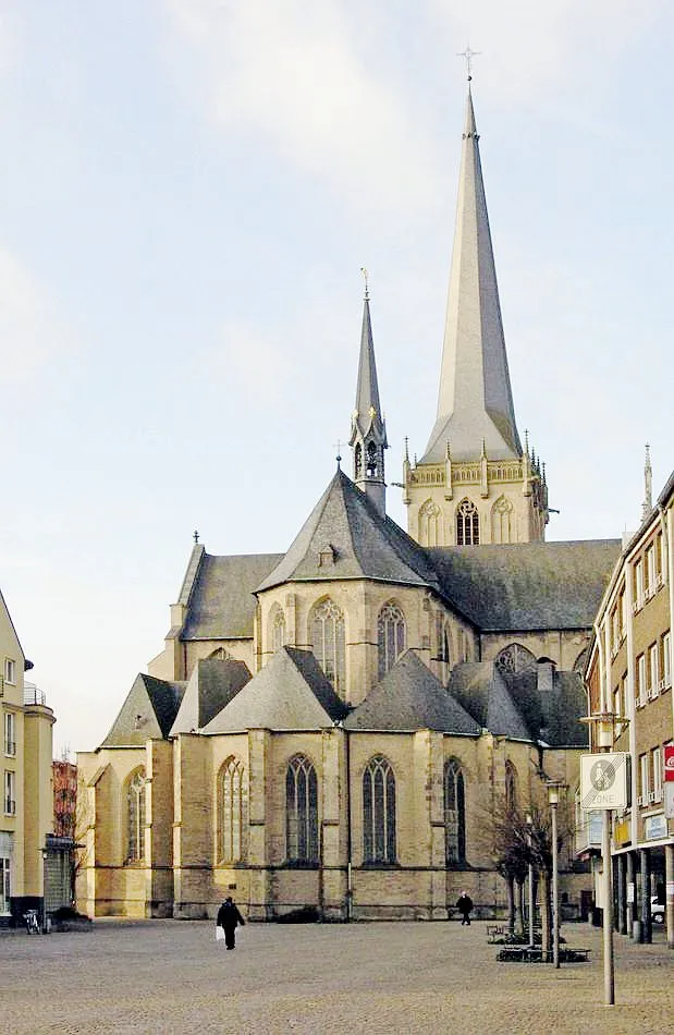
Wesel
Population: 61.7K


Cities & villages26
- Büderich · Village
- Diersfordt · Village
- Feldmark Wesel · Village
- Feldwick · Village
- Flüren · Village
- Flürener Feld · Village
- Fusternberg · Village
- Gest · Village
- Ginderich · Village
- Jöckern · Village
- Laak · Village
- Lackhausen · Village
- Lippedorf · Village
- Loh · Village
- Mars · Village
- Marwick · Village
- Mühlenfeld · Village
- Oberemmelsum · Village
- Obrighoven · Village
- Perrich · Village
- Schüttwick · Village
- Vahnum · Village
- Vissel · Village
- Werrich · Village
- Westerheide · Village
- Winkeling · Village
Mountains & nature1
- Schneppenberg · Mountain
Heritage & sights3
- Fernmeldeturm Wesel · Landmark
- Sendemast Wesel · Landmark
- St. Peter (Büderich) · Attraction
Nearby attractions & nature
Everything nearby-
Lippe River, North Rhine-Westphalia1.4 km SW
-
Büdericher Insel Island, North Rhine-Westphalia1.9 km S
-
Karthauser Gravinsel Island, North Rhine-Westphalia5.1 km W
-
Leygraben River, North Rhine-Westphalia4.4 km W
-
Mühlenberg Mountain, Hamminkeln7.3 km NE
-
Kugelberg Mountain, Hamminkeln7.7 km NE
Other cities and towns in Kreis Wesel

Sources & licences
Data last updated: · 2 independent sources