- Elevation
- 73 m
- above sea level
- Local time
- UTC+01:00
- Europe/Berlin · UTC+01:00
- Airports
- NRN Weeze (Niederrhein) Airport21 km
- DUS Düsseldorf Airport45 km
About Wolfsberg
Wolfsberg is a mountain. Location: Xanten, Kreis Wesel. Elevation: 73 m. The best months to visit are June–August. The nearest airport is Weeze (Niederrhein) Airport (21 km). Nearby sights include Bislicher Insel and Alter Rhein.
Photos of Wolfsberg
-
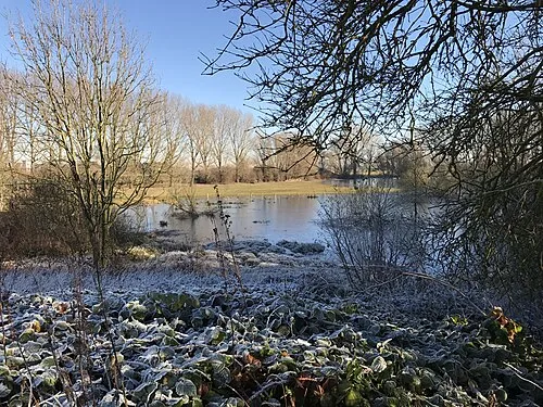
Bislicher Insel Karsten Reuß · CC BY 2.0

Climate of Wolfsberg
Best months for sightseeingBest months for sightseeing: June–August.
This month · November
A cold month
Day 9° · Night 3° · Rain 65 mm
- Hottest month
- August (day 23°)
- Coldest month
- February (night 0°)
- Wettest month
- June (74 mm)
- Driest month
- April (44 mm)
Bars: average monthly low and high temperature. Below: precipitation. Monthly averages for 1970–2000 at about 18 km resolution, adjusted for elevation. Highlighted months are mild and relatively dry. Source: WorldClim 2.1 (CC BY 4.0).
Show values as a table
| Month | Jan | Feb | Mar | Apr | May | Jun | Jul | Aug | Sep | Oct | Nov | Dec |
|---|---|---|---|---|---|---|---|---|---|---|---|---|
| Average high (°C) | 5° | 6° | 9° | 13° | 18° | 20° | 22° | 23° | 19° | 14° | 9° | 6° |
| Average low (°C) | 0° | 0° | 2° | 4° | 8° | 11° | 13° | 13° | 10° | 7° | 3° | 1° |
| Precipitation (mm) | 61 | 46 | 62 | 44 | 62 | 74 | 68 | 59 | 66 | 60 | 65 | 70 |
How to get to Wolfsberg
The nearest airport is Weeze (Niederrhein) Airport (NRN), 21 km to the west as the crow flies. The nearest large city is Moers, 24 km to the southeast.
Airports
- Weeze (Niederrhein) Airport (NRN) Weeze 21 kmwest
- Düsseldorf Airport (DUS) Düsseldorf 45 kmsoutheast
- Eindhoven Airport (EIN) Eindhoven 77 kmwest
Nearby large cities
- Moers Population: 103.5K 24 kmsoutheast
- Duisburg Population: 504.4K 32 kmsoutheast
- Oberhausen Population: 219.2K 34 kmsoutheast
- Krefeld Population: 238K 34 kmsouth
- Venlo Population: 102K 35 kmsouthwest
Straight-line distances; road distances are longer. Airport data: OurAirports.
Day trips from Wolfsberg
Within 100 km: 348 historic and cultural sites, 628 natural sites, 443 lakes, rivers and coasts.
0–25 km141 places
- Schmales Meer Lake 15 kmN
- Millinger Meer Lake 18 kmN
- Lange Renne Lake 11 kmN
- Kaplanskuhlen Lake 19 kmS
25–60 km392 places
- Kasteel Arcen Historic site 26 kmSW
- Wijlermeer Lake 40 kmNW
- Strang Lake 30 kmNW
- Halterner Talsperre Lake 55 kmE
60–100 km886 places
- Putjensberg Mountain 90 kmN
- Zeven-Heerlijkhedenheide Natural site 96 kmSW
- Warandeheide Natural site 94 kmSW
- Verkallenbos Natural site 98 kmSW
Straight-line distances.
Nearest towns and villages
Nearby attractions & nature
Everything nearby-
Bislicher Insel Island, North Rhine-Westphalia3.3 km E
-
Alter Rhein River, North Rhine-Westphalia4 km NE
-
Xanten Stiftskirche St. Viktor Attraction, Xanten3 km N
-
Alter Rhein River, North Rhine-Westphalia4.3 km NE
-
Eastern Tower Historic site, Xanten3.4 km N
-
Tacke Ley River, North Rhine-Westphalia4.7 km NW
-
Amphitheater Tower Historic site, Xanten3.5 km N
-
Northeastern Defensive Wall Historic site, Xanten3.6 km N
Sources & licences
Data last updated: · 2 independent sources