Kreisfreie Stadt Essen
Local name: Essen
Located in Düsseldorf District, North Rhine-Westphalia Coordinates: 51°27′30″ N 7°00′57″ E
- Population
- 574,682
- 574.7K
- Elevation
- 80 m
- above sea level
- Local time
- UTC+01:00
- Europe/Berlin · UTC+01:00
- Places inside
- 1
- listed under Kreisfreie Stadt Essen
- Airports
- DUS Düsseldorf Airport26 km
- DTM Dortmund Airport42 km
About Kreisfreie Stadt Essen
Kreisfreie Stadt Essen is a municipality. Location: Düsseldorf District, North Rhine-Westphalia. Population: 574,682. Elevation: 80 m.
Essen (German pronunciation: [ˈɛsn̩] ) is the central and, after Dortmund, second-largest city of the Ruhr, the largest urban area in Germany. Its population of 573,618 makes it the fourth-largest city of North Rhine-Westphalia after Cologne, Düsseldorf and Dortmund, as well as the tenth-largest city of Germany. Essen lies in the larger Rhine-Ruhr metropolitan region, second largest by GDP in the EU, and is part of the cultural area of Rhineland.
Source: Wikipedia · CC BY-SA 4.0
Photos of Kreisfreie Stadt Essen
-
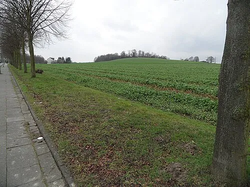
Mechtenberg Matthias Nonnenmacher · CC BY-SA 4.0 -
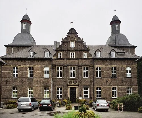
Schloß Hugenpoet Sir Gawain · CC BY-SA 3.0


Places bordering Kreisfreie Stadt Essen
- Bochum
Twin towns and sister cities of Kreisfreie Stadt Essen
- Sunderland· United Kingdom
- Tampere· Finland
Source: Wikidata. Only places with a page on this site are shown.
Population of Kreisfreie Stadt Essen over time
| 1975 | 677,568 | |
|---|---|---|
| 2011 | 565,900 | |
| 2012 | 566,862 | |
| 2013 | 569,884 | |
| 2014 | 576,691 | |
| 2017 | 590,194 | |
| 2019 | 583,109 | |
| 2021 | 582,415 | |
| 2022 | 584,580 | |
| 2023 | 586,608 | |
| 2024 | 574,682 | |
| 2025 | 573,618 |
Censuses and official estimates; source: Wikidata.
Climate of Kreisfreie Stadt Essen
Best months for sightseeingBest months for sightseeing: June–August.
This month · November
A cold month
Day 9° · Night 4° · Rain 86 mm
- Hottest month
- July (day 23°)
- Coldest month
- February (night 0°)
- Wettest month
- December (96 mm)
- Driest month
- February (64 mm)
Bars: average monthly low and high temperature. Below: precipitation. Monthly averages for 1970–2000 at about 18 km resolution, adjusted for elevation. Highlighted months are mild and relatively dry. Source: WorldClim 2.1 (CC BY 4.0).
Show values as a table
| Month | Jan | Feb | Mar | Apr | May | Jun | Jul | Aug | Sep | Oct | Nov | Dec |
|---|---|---|---|---|---|---|---|---|---|---|---|---|
| Average high (°C) | 5° | 6° | 9° | 13° | 19° | 21° | 23° | 23° | 19° | 14° | 9° | 6° |
| Average low (°C) | 0° | 0° | 3° | 5° | 9° | 12° | 14° | 13° | 10° | 7° | 4° | 2° |
| Precipitation (mm) | 87 | 64 | 81 | 65 | 71 | 92 | 86 | 80 | 81 | 78 | 86 | 96 |
How to get to Kreisfreie Stadt Essen
The nearest airport is Düsseldorf Airport (DUS), 26 km to the southwest as the crow flies. The nearest large city is Essen, 1 km to the southwest.
Airports
- Düsseldorf Airport (DUS) Düsseldorf 26 kmsouthwest
- Dortmund Airport (DTM) Dortmund 42 kmeast
- Weeze (Niederrhein) Airport (NRN) Weeze 63 kmwest
Nearby large cities
- Essen Population: 593.1K 1 kmsouthwest
- Gelsenkirchen Population: 270K 8 kmnortheast
- Bottrop Population: 119.9K 9 kmnorthwest
- Mülheim Population: 173K 10 kmwest
- Oberhausen Population: 219.2K 11 kmwest
Straight-line distances; road distances are longer. Airport data: OurAirports.
Day trips from Kreisfreie Stadt Essen
Within 100 km: 385 historic and cultural sites, 1,438 natural sites, 688 lakes, rivers and coasts.
0–25 km125 places
- Margaretensee Lake 17 kmW
- Bertasee Lake 17 kmW
- Barbarasee Lake 17 kmW
- Baldeneysee Lake 6 kmS
25–60 km730 places
- Kasteel Arcen Historic site 58 kmW
- Else River 38 kmE
- Versetalsperre Lake 56 kmSE
- Halterner Talsperre Lake 35 kmNE
60–100 km1,656 places
- Itterbeek River 88 kmW
- Zanderbeek River 99 kmSW
- Witbeek River 89 kmW
- Tapziep River 97 kmSW
Straight-line distances.
Kreisfreie Stadt Essen and similar cities
Side by side with cities of similar size in the same country: population, elevation and climate.
| Measure | Kreisfreie Stadt Essen | Dresden | Dortmund | Essen |
|---|---|---|---|---|
| Population | 574.7K | 564.9K | 588.5K | 593.1K |
| Elevation | 80 m | 116 m | 96 m | 83 m |
| Summer day (hottest month) | 23° | 25° | 24° | 23° |
| Winter night (coldest month) | 0° | -2° | -1° | 0° |
| Annual rainfall | 967 mm | 653 mm | 857 mm | 967 mm |
| Best months | Jun–Aug | May–Sep | Jun–Aug | Jun–Aug |
| Distance | — | 471 km | 32 km | 0 km |
Climate values are 1970–2000 monthly averages; straight-line distance.
Places in Kreisfreie Stadt Essen
1 placeBar: population relative to the most populous place in this list.
Nearby attractions & nature
Everything nearby-
Aspelflotte River, North Rhine-Westphalia5.8 km NW
-
Donnerberg Mountain, Oberhausen8.3 km NW
-
Baldeneysee Lake, North Rhine-Westphalia6.3 km S
-
Gelsenkirchen-Horst Concentration Camp Historic site, Gelsenkirchen8.2 km N
-
Grosser Gasometer der Kokerei Prosper Landmark, Bottrop7.4 km NW
-
Fernmeldeturm Gelsenkirchen Landmark, Gelsenkirchen7.6 km NE
-
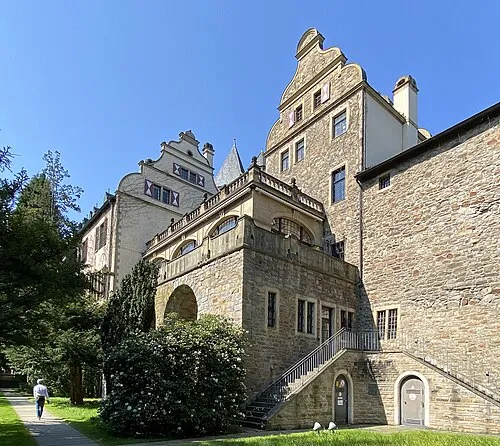 Schloß Landsberg Historic site, Ratingen13 km SW
-
Eisenbahnmuseum Bochum-Dahlhausen Museum, Bochum8.1 km E
Other cities and towns in Düsseldorf District
-
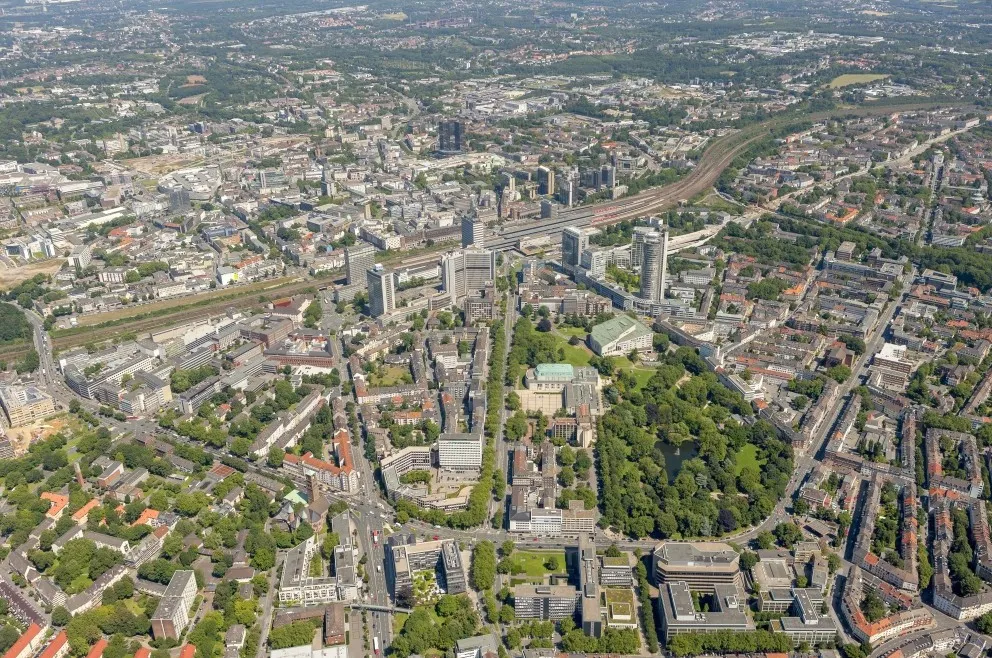 Essen City, Essen0.3 km SW
-
Kreisfreie Stadt Mülheim an der Ruhr Municipality, Düsseldorf District9.8 km SW
-
Kreisfreie Stadt Oberhausen Municipality, Düsseldorf District13 km NW
-
Mülheim City, Mülheim9.9 km W
-
Kreisfreie Stadt Duisburg Municipality, Düsseldorf District18 km W
-
Kreis Mettmann Municipality, Düsseldorf District24 km S
Sources & licences
Data last updated: · 2 independent sources