- Elevation
- 54 m
- above sea level
- Local time
- UTC+01:00
- Europe/Berlin · UTC+01:00
- Airports
- DUS Düsseldorf Airport21 km
- CGN Cologne Bonn Airport51 km
About Damm
Damm is a village. Location: Jüchen, Rhein-Kreis Neuss. Elevation: 54 m. The best months to visit are June–August. The nearest airport is Düsseldorf Airport (21 km). Nearby sights include Schloss Rheydt and Kloster Eppinghoven.
Photos of Damm
-
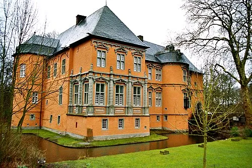
Schloss Rheydt Heribert Pohl --- Thanks for half a million clicks! from Germering bei München, Bayern · CC BY-SA 2.0

Climate of Damm
Best months for sightseeingBest months for sightseeing: June–August.
This month · November
A cold month
Day 9° · Night 3° · Rain 62 mm
- Hottest month
- July (day 23°)
- Coldest month
- February (night 0°)
- Wettest month
- June (74 mm)
- Driest month
- February (48 mm)
Bars: average monthly low and high temperature. Below: precipitation. Monthly averages for 1970–2000 at about 18 km resolution, adjusted for elevation. Highlighted months are mild and relatively dry. Source: WorldClim 2.1 (CC BY 4.0).
Show values as a table
| Month | Jan | Feb | Mar | Apr | May | Jun | Jul | Aug | Sep | Oct | Nov | Dec |
|---|---|---|---|---|---|---|---|---|---|---|---|---|
| Average high (°C) | 5° | 6° | 10° | 14° | 19° | 21° | 23° | 23° | 19° | 14° | 9° | 6° |
| Average low (°C) | 0° | 0° | 3° | 5° | 9° | 12° | 14° | 13° | 10° | 7° | 3° | 2° |
| Precipitation (mm) | 58 | 48 | 60 | 49 | 68 | 74 | 72 | 64 | 60 | 57 | 62 | 65 |
How to get to Damm
The nearest airport is Düsseldorf Airport (DUS), 21 km to the northeast as the crow flies. The nearest large city is Neuss, 10 km to the northeast.
Airports
- Düsseldorf Airport (DUS) Düsseldorf 21 kmnortheast
- Cologne Bonn Airport (CGN) Köln (Cologne) 51 kmsoutheast
- Weeze (Niederrhein) Airport (NRN) Weeze 59 kmnorthwest
Nearby large cities
- Neuss Population: 152.5K 10 kmnortheast
- Mönchengladbach Population: 261.7K 10 kmnorthwest
- Düsseldorf Population: 618.7K 17 kmnortheast
- Krefeld Population: 238K 21 kmnorth
- Leverkusen Population: 162.7K 31 kmsoutheast
Straight-line distances; road distances are longer. Airport data: OurAirports.
Day trips from Damm
Within 100 km: 465 historic and cultural sites, 1,775 natural sites, 806 lakes, rivers and coasts.
0–25 km112 places
- Schönwasser Lake 21 kmN
- Balgheimersee Lake 16 kmE
- Glessener Höhe Mountain 24 kmSE
- Weidenfelder Höhe Mountain 19 kmS
25–60 km692 places
- Schimperbos Natural site 60 kmSW
- Landwehring Natural site 58 kmSW
- Itterbeek River 51 kmW
- Gulp River 60 kmSW
60–100 km2,242 places
- Île du Moulin Island 94 kmSW
- Île Monsin Island 85 kmSW
- Île de Franche Garenne Island 80 kmSW
- Lac de la Gileppe Lake 75 kmSW
Straight-line distances.
Nearby attractions & nature
Everything nearby-
Schloss Rheydt Historic site, Mönchengladbach7.7 km NW
-
Kloster Eppinghoven Attraction, Neuss7.4 km E
-
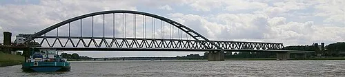 Hamm Railway Bridge Landmark, Neuss13 km NE
-
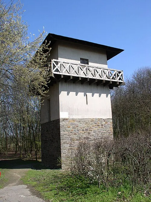 Reckenberg Roman Watchtower Historic site, Neuss14 km E
-
Vollrather Höhe Mountain, Grevenbroich9.1 km S
-
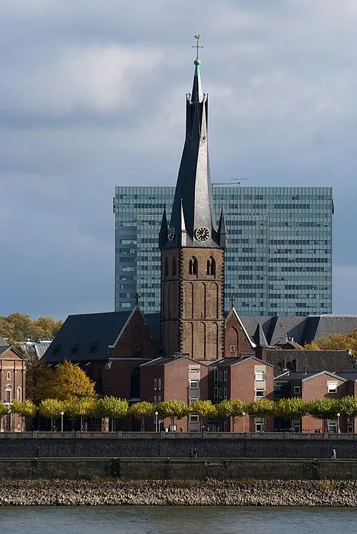 St. Lambertus Attraction, Düsseldorf17 km NE
Other cities and towns in Jüchen
-
 Neu-Otzenrath Village, Jüchen8.7 km SW
-
Rath Village, Jüchen3.1 km SW
-
Stessen Village, Jüchen3.1 km SW
-
Gierath Village, Jüchen4.2 km SW
-
 Kelzenberg Village, Jüchen6.1 km SW
-
Kamphausen Village, Jüchen7 km W
Sources & licences
Data last updated: · 2 independent sources