
- Elevation
- 36 m
- above sea level
- Local time
- UTC+01:00
- Europe/Berlin · UTC+01:00
- Airports
- DUS Düsseldorf Airport8 km
- NRN Weeze (Niederrhein) Airport50 km
About Strümp
Strümp is a village. Location: Meerbusch, Rhein-Kreis Neuss. Elevation: 36 m.
Strümp is one of the eight districts of the city of Meerbusch, Germany. Its name is believed to be based on the stream Strempe that runs through the town and has its spring nearby.
Source: Wikipedia · CC BY-SA 4.0
Photos of Strümp
-

A. Vossbeck-Krahwinkel und U. Vossbeck · CC BY-SA 4.0 -

Erwin Quedenfeldt · Public domain -

Alice Wiegand · CC BY-SA 3.0 -

Frank Schmitter, Alice Wiegand · CC BY-SA 3.0 -

Tetris L · CC BY-SA 3.0


Places bordering Strümp
- Schloß Pesch
Climate of Strümp
Best months for sightseeingBest months for sightseeing: June–August.
This month · November
A cold month
Day 9° · Night 4° · Rain 65 mm
- Hottest month
- July (day 23°)
- Coldest month
- February (night 0°)
- Wettest month
- June (76 mm)
- Driest month
- April (48 mm)
Bars: average monthly low and high temperature. Below: precipitation. Monthly averages for 1970–2000 at about 18 km resolution, adjusted for elevation. Highlighted months are mild and relatively dry. Source: WorldClim 2.1 (CC BY 4.0).
Show values as a table
| Month | Jan | Feb | Mar | Apr | May | Jun | Jul | Aug | Sep | Oct | Nov | Dec |
|---|---|---|---|---|---|---|---|---|---|---|---|---|
| Average high (°C) | 5° | 6° | 10° | 14° | 19° | 21° | 23° | 23° | 19° | 15° | 9° | 6° |
| Average low (°C) | 1° | 0° | 3° | 5° | 9° | 12° | 14° | 13° | 11° | 7° | 4° | 2° |
| Precipitation (mm) | 62 | 49 | 62 | 48 | 66 | 76 | 69 | 62 | 63 | 59 | 65 | 70 |
How to get to Strümp
The nearest airport is Düsseldorf Airport (DUS), 8 km to the east as the crow flies. The nearest large city is Krefeld, 9 km to the northwest.
Airports
- Düsseldorf Airport (DUS) Düsseldorf 8 kmeast
- Weeze (Niederrhein) Airport (NRN) Weeze 50 kmnorthwest
- Cologne Bonn Airport (CGN) Köln (Cologne) 58 kmsoutheast
Nearby large cities
- Krefeld Population: 238K 9 kmnorthwest
- Neuss Population: 152.5K 10 kmsouth
- Düsseldorf Population: 618.7K 11 kmsoutheast
- Duisburg Population: 504.4K 18 kmnortheast
- Mönchengladbach Population: 261.7K 19 kmsouthwest
Straight-line distances; road distances are longer. Airport data: OurAirports.
Day trips from Strümp
Within 100 km: 428 historic and cultural sites, 1,463 natural sites, 708 lakes, rivers and coasts.
0–25 km167 places
- Schönwasser Lake 8 kmNW
- Margaretensee Lake 17 kmNE
- Kaplanskuhlen Lake 24 kmNW
- Bertasee Lake 17 kmNE
25–60 km548 places
- Itterbeek River 58 kmW
- Witbeek River 59 kmW
- Kasteel Arcen Historic site 39 kmNW
- Schrolik Lake 29 kmW
60–100 km1,884 places
- Île Monsin Island 100 kmSW
- Île de Franche Garenne Island 94 kmSW
- Lac de la Gileppe Lake 91 kmSW
- Lac d'Eupen Lake 84 kmSW
Straight-line distances.
Nearby attractions & nature
Everything nearby-
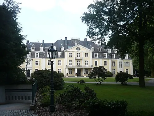 Schloß Pesch Historic site, Meerbusch1.6 km NW
-
Meerbusch Natural site, North Rhine-Westphalia2.7 km S
-
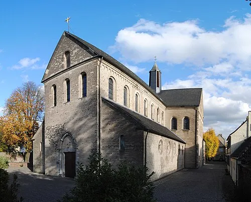 St. Suitbertus Attraction, Düsseldorf5.6 km E
-
Mühlenbach River, North Rhine-Westphalia3.4 km E
-
St. Suitbertus Attraction, Meerbusch4.7 km NE
-
Düsseldorf-Lohausen Concentration Camp Historic site, Düsseldorf5.6 km E
Other cities and towns in Meerbusch
-
Ilverich Village, Meerbusch2.9 km E
-
Lank-Latum Village, Meerbusch3 km NE
-
Osterath Village, Meerbusch3.2 km SW
-
Langst-Kierst Village, Meerbusch4.1 km NE
-
 Nierst Village, Meerbusch5.3 km NE
-
Ivangsheide Village, Meerbusch2.3 km SW
Sources & licences
Data last updated: · 2 independent sources