- Elevation
- 505 m
- above sea level
- Local time
- UTC+01:00
- Europe/Berlin · UTC+01:00
- Airports
- DTM Dortmund Airport23 km
- PAD Paderborn Lippstadt Airport61 km
About Osten-Berg
Osten-Berg is a mountain. Location: Hemer, Märkischer Kreis. Elevation: 505 m. The best months to visit are June–August. The nearest airport is Dortmund Airport (23 km). Nearby sights include Steinrade-Berg and Balver Wald.
Photos of Osten-Berg
-
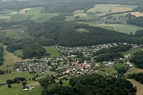
Ebberg Michael Kramer · CC BY-SA 3.0

Climate of Osten-Berg
Best months for sightseeingBest months for sightseeing: June–August.
This month · November
A cold month
Day 6° · Night 1° · Rain 91 mm
- Hottest month
- July (day 20°)
- Coldest month
- February (night -3°)
- Wettest month
- December (100 mm)
- Driest month
- April (64 mm)
Bars: average monthly low and high temperature. Below: precipitation. Monthly averages for 1970–2000 at about 18 km resolution, adjusted for elevation. Highlighted months are mild and relatively dry. Source: WorldClim 2.1 (CC BY 4.0).
Show values as a table
| Month | Jan | Feb | Mar | Apr | May | Jun | Jul | Aug | Sep | Oct | Nov | Dec |
|---|---|---|---|---|---|---|---|---|---|---|---|---|
| Average high (°C) | 2° | 3° | 7° | 10° | 16° | 18° | 20° | 20° | 16° | 11° | 6° | 3° |
| Average low (°C) | -3° | -3° | -1° | 1° | 6° | 8° | 10° | 10° | 7° | 4° | 1° | -2° |
| Precipitation (mm) | 95 | 69 | 78 | 64 | 74 | 86 | 97 | 85 | 79 | 74 | 91 | 100 |
How to get to Osten-Berg
The nearest airport is Dortmund Airport (DTM), 23 km to the northwest as the crow flies. The nearest large city is Hagen, 25 km to the west.
Airports
- Dortmund Airport (DTM) Dortmund 23 kmnorthwest
- Paderborn Lippstadt Airport (PAD) Büren 61 kmnortheast
- Cologne Bonn Airport (CGN) Köln (Cologne) 74 kmsouthwest
Nearby large cities
- Hagen Population: 199K 25 kmwest
- Dortmund Population: 588.5K 30 kmnorthwest
- Hamm Population: 179K 35 kmnorth
- Bochum Population: 385.7K 44 kmwest
- Herne Population: 172.1K 46 kmnorthwest
Straight-line distances; road distances are longer. Airport data: OurAirports.
Day trips from Osten-Berg
Within 100 km: 414 historic and cultural sites, 3,216 natural sites, 813 lakes, rivers and coasts.
0–25 km351 places
- Else River 20 kmW
- Else River 16 kmS
- Versetalsperre Lake 23 kmSW
- Sorpe Dam Lake 9 kmSE
25–60 km1,297 places
- Weibe River 54 kmS
- Valme River 40 kmE
- Elpe River 41 kmE
- Ahse River 35 kmN
60–100 km2,795 places
- Wande River 90 kmE
- Erpe River 90 kmE
- Werse River 75 kmN
- Ohe River 88 kmSE
Straight-line distances.
Nearest towns and villages
-
Hemer Town, Hemer4.6 km NW
-
Brockhausen Village, Hemer1.1 km N
-
Balve Town, Balve4.7 km SE
-
Balve Village, Märkischer Kreis5.1 km SE
-
 Riemke Village, Hemer2.6 km N
-
Deilinghofen Village, Hemer2.2 km NW
Nearby attractions & nature
Everything nearby-
Steinrade-Berg Mountain, Balve1.7 km SE
-
Balver Wald Mountain, Hemer1.3 km S
-
Osterloh Mountain, Hemer2 km W
-
Hochgiebel Mountain, Hemer2.4 km SW
-
Hoppenberg Mountain, Hemer2.7 km N
-
Das Beil Mountain, Balve3.8 km NE
-
Ebberg Mountain, Balve4.6 km NE
-
Gremberg Mountain, Balve3.4 km S
Sources & licences
Data last updated: