
- Elevation
- 217 m
- above sea level
- Local time
- UTC+01:00
- Europe/Berlin · UTC+01:00
- Airports
- DTM Dortmund Airport17 km
- DUS Düsseldorf Airport62 km
About Dröschede
Dröschede is a village. Location: Iserlohn, Märkischer Kreis. Elevation: 217 m. The best months to visit are June–August. The nearest airport is Dortmund Airport (17 km). Nearby sights include Sonderhorst and Burg-Berg.
Photos of Dröschede
-

Asio otus · CC BY-SA 3.0 -

Bubo · CC BY-SA 3.0 -

Asio otus · CC BY-SA 3.0 -

Bubo · CC BY-SA 3.0 -
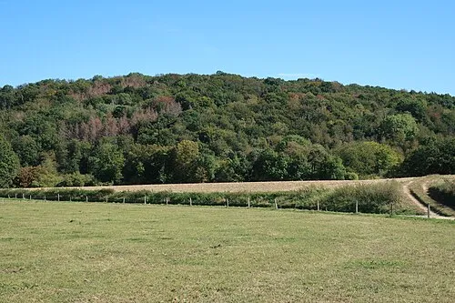
Rehberg Bärwinkel,Klaus · CC BY-SA 4.0


Climate of Dröschede
Best months for sightseeingBest months for sightseeing: June–August.
This month · November
A cold month
Day 8° · Night 2° · Rain 85 mm
- Hottest month
- July (day 22°)
- Coldest month
- February (night -2°)
- Wettest month
- July (96 mm)
- Driest month
- April (62 mm)
Bars: average monthly low and high temperature. Below: precipitation. Monthly averages for 1970–2000 at about 18 km resolution, adjusted for elevation. Highlighted months are mild and relatively dry. Source: WorldClim 2.1 (CC BY 4.0).
Show values as a table
| Month | Jan | Feb | Mar | Apr | May | Jun | Jul | Aug | Sep | Oct | Nov | Dec |
|---|---|---|---|---|---|---|---|---|---|---|---|---|
| Average high (°C) | 4° | 5° | 8° | 12° | 17° | 20° | 22° | 22° | 18° | 13° | 8° | 5° |
| Average low (°C) | -1° | -2° | 1° | 3° | 7° | 10° | 12° | 12° | 9° | 5° | 2° | 0° |
| Precipitation (mm) | 87 | 66 | 72 | 62 | 71 | 85 | 96 | 86 | 78 | 71 | 85 | 93 |
How to get to Dröschede
The nearest airport is Dortmund Airport (DTM), 17 km to the north as the crow flies. The nearest large city is Hagen, 12 km to the west.
Airports
- Dortmund Airport (DTM) Dortmund 17 kmnorth
- Düsseldorf Airport (DUS) Düsseldorf 62 kmwest
- Cologne Bonn Airport (CGN) Köln (Cologne) 67 kmsouthwest
Nearby large cities
- Hagen Population: 199K 12 kmwest
- Dortmund Population: 588.5K 20 kmnorthwest
- Bochum Population: 385.7K 33 kmwest
- Herne Population: 172.1K 35 kmnorthwest
- Hamm Population: 179K 36 kmnorth
Straight-line distances; road distances are longer. Airport data: OurAirports.
Day trips from Dröschede
Within 100 km: 409 historic and cultural sites, 2,883 natural sites, 801 lakes, rivers and coasts.
0–25 km285 places
- Else River 9 kmNW
- Else River 22 kmSE
- Versetalsperre Lake 21 kmS
- Sorpe Dam Lake 21 kmE
25–60 km1,104 places
- Weibe River 57 kmS
- Valme River 52 kmE
- Elpe River 53 kmE
- Ahse River 37 kmN
60–100 km2,704 places
- Werse River 74 kmN
- Ohe River 98 kmSE
- Ogge River 78 kmE
- Naure River 100 kmE
Straight-line distances.
Nearby attractions & nature
Everything nearby-
Sonderhorst Mountain, Iserlohn0.6 km S
-
Burg-Berg Mountain, Iserlohn1.3 km SW
-
Fröndenberg Mountain, Iserlohn3.1 km E
-
Die Humpfert Mountain, Iserlohn3.5 km W
-
Mühlenberg Mountain, Iserlohn4.3 km E
-
Bräkerkopf Mountain, Iserlohn4.3 km SE
Other cities and towns in Iserlohn
-
 Letmathe Village, Iserlohn3.2 km W
-
 Genna Village, Iserlohn2.8 km W
-
 Lasbeck Village, Iserlohn3.2 km S
-
 Leckingsen Village, Iserlohn4.9 km N
-
Helmke Village, Iserlohn2 km SW
-
Stenglingsen Village, Iserlohn2.1 km SW
Sources & licences
Data last updated: · 2 independent sources