Kreis Höxter
Located in Regierungsbezirk Detmold, North Rhine-Westphalia Coordinates: 51°40′50″ N 9°11′45″ E
- Population
- 139,252
- 139.3K
- Elevation
- 193 m
- above sea level
- Local time
- UTC+01:00
- Europe/Berlin · UTC+01:00
- Places inside
- 10
- listed under Kreis Höxter
- Airports
- KSF Kassel Airport32 km
- PAD Paderborn Lippstadt Airport41 km
About Kreis Höxter
Kreis Höxter is a municipality. Location: Regierungsbezirk Detmold, North Rhine-Westphalia. Population: 139,252. Elevation: 193 m. The best months to visit are June–August. The nearest airport is Kassel Airport (32 km). Nearby sights include Sulmer and Nettenburg.
Photos of Kreis Höxter
-
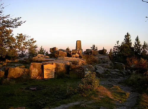
Velmerstot User:Mada · CC BY-SA 2.5 -
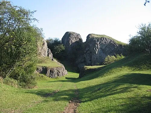
Hüssenberg Bladel · CC BY-SA 3.0 -
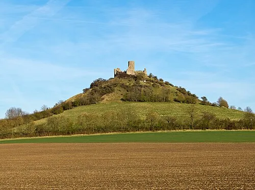
Desenberg Jörg Braukmann · CC BY-SA 4.0 -
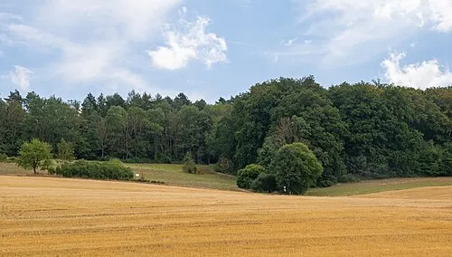
Bielenberg Tsungam · CC BY-SA 4.0


Climate of Kreis Höxter
Best months for sightseeingBest months for sightseeing: June–August.
This month · November
A cold month
Day 7° · Night 2° · Rain 75 mm
- Hottest month
- August (day 22°)
- Coldest month
- February (night -2°)
- Wettest month
- December (87 mm)
- Driest month
- April (55 mm)
Bars: average monthly low and high temperature. Below: precipitation. Monthly averages for 1970–2000 at about 18 km resolution, adjusted for elevation. Highlighted months are mild and relatively dry. Source: WorldClim 2.1 (CC BY 4.0).
Show values as a table
| Month | Jan | Feb | Mar | Apr | May | Jun | Jul | Aug | Sep | Oct | Nov | Dec |
|---|---|---|---|---|---|---|---|---|---|---|---|---|
| Average high (°C) | 3° | 4° | 8° | 12° | 17° | 20° | 22° | 22° | 18° | 13° | 7° | 4° |
| Average low (°C) | -2° | -2° | 1° | 3° | 8° | 10° | 12° | 12° | 9° | 6° | 2° | 0° |
| Precipitation (mm) | 81 | 60 | 71 | 55 | 68 | 78 | 81 | 74 | 72 | 68 | 75 | 87 |
How to get to Kreis Höxter
The nearest airport is Kassel Airport (KSF), 32 km to the southeast as the crow flies. The nearest large city is Paderborn, 31 km to the west.
Airports
- Kassel Airport (KSF) Calden 32 kmsoutheast
- Paderborn Lippstadt Airport (PAD) Büren 41 kmwest
- Hannover Airport (HAJ) Hannover 93 kmnorth
Nearby large cities
- Paderborn Population: 142.2K 31 kmwest
- Kassel Population: 197.2K 46 kmsoutheast
- Göttingen Population: 122.1K 54 kmeast
- Bielefeld Population: 331.9K 60 kmnorthwest
- Hanover Population: 515.1K 85 kmnortheast
Straight-line distances; road distances are longer. Airport data: OurAirports.
Day trips from Kreis Höxter
Within 100 km: 320 historic and cultural sites, 4,611 natural sites, 821 lakes, rivers and coasts.
0–25 km363 places
- Naure River 20 kmSW
- Zollberg Mountain 10 kmE
- Ziegenberg Mountain 15 kmNE
- Ziegenberg Mountain 24 kmW
25–60 km1,638 places
- Wande River 30 kmS
- Erpe River 29 kmS
- Ogge River 59 kmSW
- Grimke River 33 kmW
60–100 km3,751 places
- Valme River 66 kmSW
- Schalk River 87 kmE
- Ohe River 65 kmNE
- Liese River 74 kmSW
Straight-line distances.
Kreis Höxter and similar cities
Side by side with cities of similar size in the same country: population, elevation and climate.
| Measure | Kreis Höxter | Paderborn | Heidelberg | Würzburg |
|---|---|---|---|---|
| Population | 139.3K | 142.2K | 143.3K | 133.7K |
| Elevation | 193 m | 118 m | 115 m | 204 m |
| Summer day (hottest month) | 22° | 23° | 24° | 24° |
| Winter night (coldest month) | -2° | -1° | 0° | -2° |
| Annual rainfall | 870 mm | 934 mm | 953 mm | 659 mm |
| Best months | Jun–Aug | Jun–Aug | May–Sep | May–Sep |
| Distance | — | 31 km | 255 km | 217 km |
Climate values are 1970–2000 monthly averages; straight-line distance.
Places in Kreis Höxter
10 places- 1 Höxter 28.2K
- 2 Warburg 23.3K
- 3 Bad Driburg 19.1K
- 4 Brakel 16.2K
- 5 Beverungen 12.7K
- 6 Steinheim 12.1K
- 7 Borgentreich 8.6K
- 8 Willebadessen 8.3K
- 9 Nieheim 6.1K
- 10 Marienmünster 4.8K
Bar: population relative to the most populous place in this list.
Nearby attractions & nature
Everything nearby-
Sulmer Mountain, Hesse1.1 km N
-
Nettenburg Historic site, Hesse0.8 km W
-
Hakesbach River, North Rhine-Westphalia2.2 km N
-
Mähne Natural site, North Rhine-Westphalia3.2 km W
-
Aa River, North Rhine-Westphalia2.9 km NW
-
Oberholz Natural site, North Rhine-Westphalia4.1 km E
-
Tiftholz Natural site, North Rhine-Westphalia4.3 km W
-
Brucht River, North Rhine-Westphalia4.1 km N
Sources & licences
Data last updated: