Detmold
Located in Kreis Lippe, Regierungsbezirk Detmold Coordinates: 51°56′09″ N 8°52′42″ E
- Population
- 74,278
- 74.3K
- Elevation
- 142 m
- above sea level
- Local time
- UTC+01:00
- Europe/Berlin · UTC+01:00
- Places inside
- 75
- listed under Detmold
- Airports
- PAD Paderborn Lippstadt Airport40 km
- KSF Kassel Airport68 km
About Detmold
Detmold is a village. Location: Kreis Lippe, Regierungsbezirk Detmold. Population: 74,278. Elevation: 142 m.
Detmold (German pronunciation: [ˈdɛtmɔlt] ) is a city in North Rhine-Westphalia, Germany, with a population of 74,438. It was the capital of the small Principality of Lippe from 1468 until 1918 and then of the Free State of Lippe until 1947. Today it is the administrative center of the district of Lippe and of the Regierungsbezirk Detmold. The Church of Lippe has its central administration located in Detmold. The Reformed Redeemer Church is the preaching venue of the state superintendent of the Lippe church.
Source: Wikipedia · CC BY-SA 4.0
Photos of Detmold
-
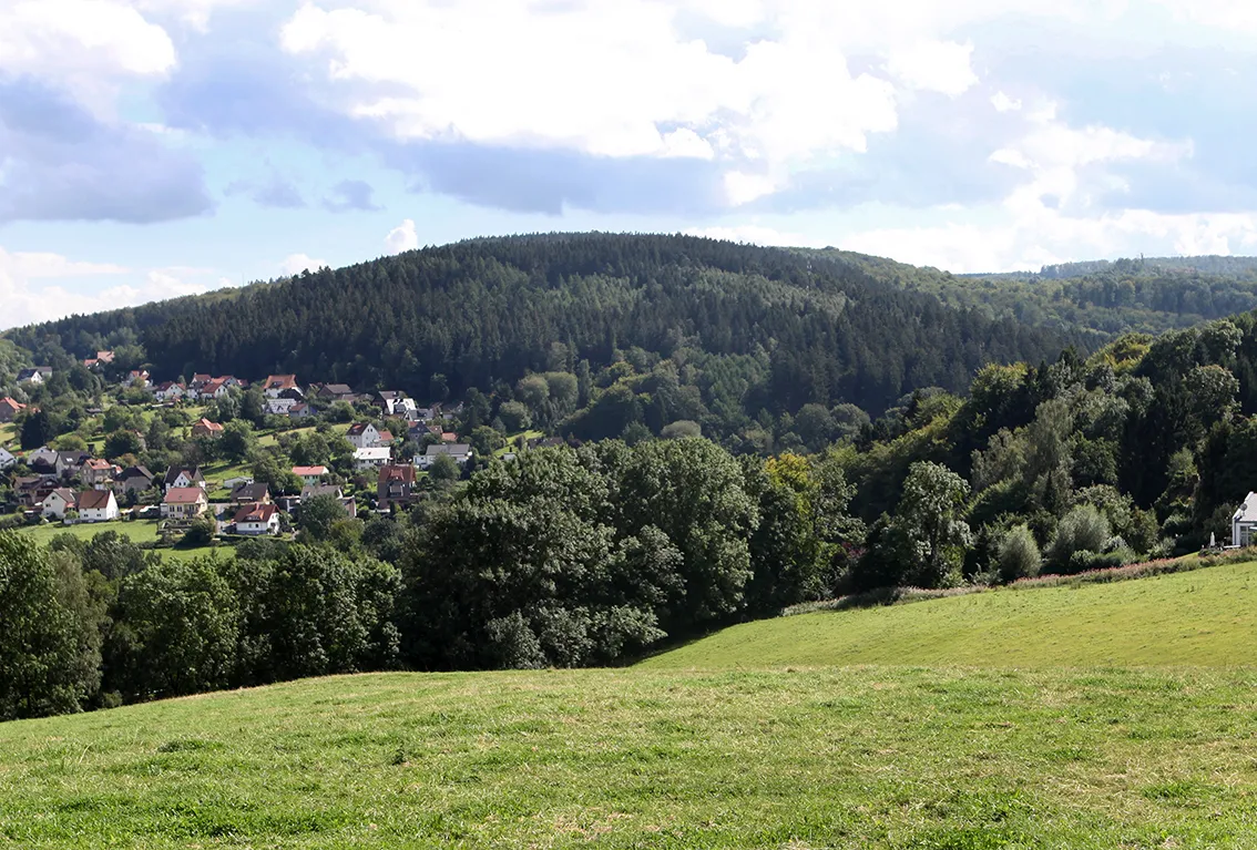
Stemberg Grugerio · CC0 -
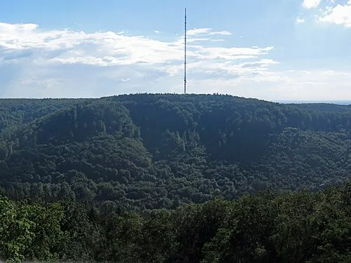
Bielstein Jörg Braukmann · CC BY-SA 3.0 -
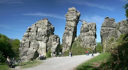
Externsteine Daniel Schwen · CC BY-SA 2.5 -
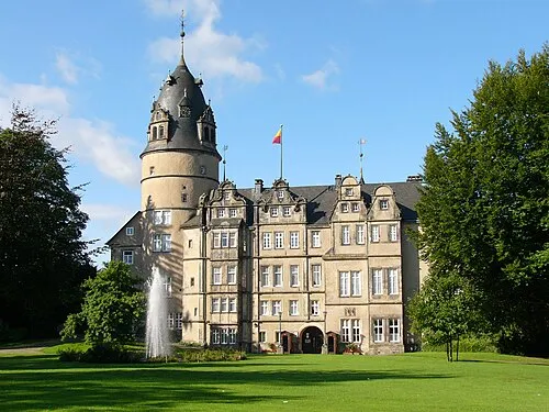
Schloss Detmold Nikater · CC BY-SA 4.0


Twin towns and sister cities of Detmold
- Zeitz· Germany
- Savonlinna· Finland
Source: Wikidata. Only places with a page on this site are shown.
Population of Detmold over time
| 1818 | 2,742 | |
|---|---|---|
| 1828 | 3,497 | |
| 1975 | 65,629 | |
| 2015 | 74,817 | |
| 2017 | 74,353 | |
| 2019 | 74,388 | |
| 2021 | 73,969 | |
| 2022 | 75,089 | |
| 2023 | 74,835 | |
| 2024 | 74,278 | |
| 2025 | 74,438 |
Censuses and official estimates; source: Wikidata.
Climate of Detmold
Best months for sightseeingBest months for sightseeing: June–August.
This month · November
A cold month
Day 8° · Night 3° · Rain 83 mm
- Hottest month
- August (day 22°)
- Coldest month
- February (night -1°)
- Wettest month
- December (99 mm)
- Driest month
- April (63 mm)
Bars: average monthly low and high temperature. Below: precipitation. Monthly averages for 1970–2000 at about 18 km resolution, adjusted for elevation. Highlighted months are mild and relatively dry. Source: WorldClim 2.1 (CC BY 4.0).
Show values as a table
| Month | Jan | Feb | Mar | Apr | May | Jun | Jul | Aug | Sep | Oct | Nov | Dec |
|---|---|---|---|---|---|---|---|---|---|---|---|---|
| Average high (°C) | 4° | 5° | 8° | 12° | 17° | 20° | 22° | 22° | 18° | 13° | 8° | 5° |
| Average low (°C) | -1° | -1° | 2° | 4° | 8° | 11° | 13° | 13° | 10° | 7° | 3° | 1° |
| Precipitation (mm) | 92 | 67 | 82 | 63 | 72 | 83 | 88 | 80 | 83 | 77 | 83 | 99 |
How to get to Detmold
The nearest airport is Paderborn Lippstadt Airport (PAD), 40 km to the southwest as the crow flies. The nearest large city is Paderborn, 26 km to the south.
Airports
- Paderborn Lippstadt Airport (PAD) Büren 40 kmsouthwest
- Kassel Airport (KSF) Calden 68 kmsoutheast
- Hannover Airport (HAJ) Hannover 80 kmnortheast
Nearby large cities
- Paderborn Population: 142.2K 26 kmsouth
- Bielefeld Population: 331.9K 26 kmnorthwest
- Osnabrück Population: 166.5K 68 kmnorthwest
- Hanover Population: 515.1K 76 kmnortheast
- Hamm Population: 179K 78 kmwest
Straight-line distances; road distances are longer. Airport data: OurAirports.
Day trips from Detmold
Within 100 km: 292 historic and cultural sites, 3,501 natural sites, 809 lakes, rivers and coasts.
0–25 km255 places
- Grimke River 21 kmSW
- Norder Teich Lake 12 kmSE
- Hartigsee Lake 15 kmNW
- Ziegenberg Mountain 21 kmS
25–60 km1,098 places
- Erpe River 60 kmS
- Naure River 48 kmS
- Aabachtalsperre Lake 50 kmS
- Bergsee Oberlübbe Lake 40 kmN
60–100 km3,249 places
- Wande River 60 kmS
- Werse River 83 kmW
- Valme River 72 kmSW
- Ohe River 63 kmNE
Straight-line distances.
Places in Detmold
75 placesBar: population relative to the most populous place in this list.
Cities & villages40
- Altenkamp · Village
- Auf der Becke · Village
- Barkhausen · Village
- Berlebeck · Village
- Braunenbruch · Village
- Bremke · Village
- Brokhausen · Village
- Dehlentrup · Village
- Diestelbruch · Village
- Eichholz · Village
- Falkenkrug · Village
- Friedrichshöhe · Village
- Fromhausen · Village
- Hahnberg · Village
- Hakedahl · Village
- Heidenoldendorf · Neighbourhood
- Heiligenkirchen · Village
- Hiddesen · Village
- Hohenwart · Village
- Hülsen · Village
- Jerxen · Village
- Jerxerheide · Village
- Johannettental · Village
- Klüt · Village
- Klüterberg · Village
- Kussel · Village
- Leistrup · Village
- Loßbruch · Village
- Meiersfeld · Village
- Mosebeck · Village
- Niederschönhagen · Village
- Niewald · Village
- Oberlossbruch · Village
- Obernhausen · Village
- Oberschönhagen · Village
- Oettern · Village
- Orbke · Village
- Pivitsheide Vogtei Heiden · Village
- Pivitsheide Vogtei Lage · Village
- Remmighausen · Village
Mountains & nature16
- Allhornberg · Mountain
- Almberg · Mountain
- Bannenberg · Mountain
- Bielstein · Mountain
- Brautberg · Mountain
- Der Knick · Mountain
- Düsterlau · Mountain
- Großer Ehberg · Mountain
- Grotenburg · Mountain
- Hiddeser-Berg · Mountain
- Hohe Warte · Mountain
- Kanzel · Mountain
- Klöppingsberg · Mountain
- Königsberg · Mountain
- Kortewebelshals · Mountain
- Kusselberg · Mountain
Heritage & sights2
- Grotenburg · Historic site
- Lippisches Landesmuseum · Museum
Nearby attractions & nature
Everything nearby-
Sylbeke River, North Rhine-Westphalia1.8 km NW
-
Wiembecke River, North Rhine-Westphalia3 km S
-
Rotenberg Mountain, Lage4.7 km N
-
Stemberg Mountain, Horn-Bad Meinberg6.4 km S
-
Externsteine Historic site, Horn-Bad Meinberg7.9 km S
-
Eicken-Berg Mountain, Horn-Bad Meinberg6.8 km SE
Other cities and towns in Kreis Lippe
-
Spork-Eichholz Village, Detmold2.3 km SE
-
Vahlhausen Village, Detmold4.3 km E
-
 Schönemark Village, Detmold4.7 km SE
-
Südholz Neighbourhood, Detmold1.8 km NW
Sources & licences
Data last updated: · 2 independent sources