Kolverath
Located in Vulkaneifel, Rhineland-Palatinate Coordinates: 50°16′18″ N 6°58′20″ E
- Population
- 102
- 102
- Elevation
- 511 m
- above sea level
- Local time
- UTC+01:00
- Europe/Berlin · UTC+01:00
- Places inside
- 1
- listed under Kolverath
About Kolverath
Kolverath is a village. Location: Vulkaneifel, Rhineland-Palatinate. Population: 102. Elevation: 511 m.
Kolverath is an Ortsgemeinde – a municipality belonging to a Verbandsgemeinde, a kind of collective municipality – in the Vulkaneifel district in Rhineland-Palatinate, Germany. It belongs to the Verbandsgemeinde of Kelberg, whose seat is in the like-named municipality.
Read more on Wikipedia Text: Wikipedia contributors · CC BY-SA 4.0 · shortened
At a glance
- Area
- 2.5 km²
Source: Wikidata
In comparison
- No. 97 of 109 places in Vulkaneifel by population
- Nearest larger town: Kolverath, 1 km SW
- 63 sights and natural places within 10 km Kläppchen, Hochkelberg
Places in Kolverath
1 place-
Kolverath Village142
Nearby attractions & nature
Everything nearby-
Kläppchen Mountain, Sassen0.7 km SE
-
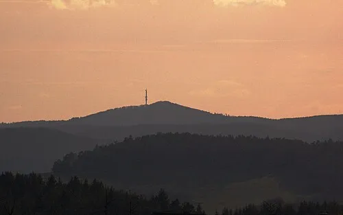 Hochkelberg Mountain, Kelberg1.4 km W
-
Holzberg Mountain, Retterath1.4 km SE
-
Geisberg Mountain, Mannebach1.5 km NE
-
Beil-Stein Mountain, Bereborn1.7 km N
-
Rosen-Berg Mountain, Kelberg2 km NW
Sources & licences
Data last updated: · 2 independent sources