- Elevation
- 675 m
- above sea level
- Local time
- UTC+01:00
- Europe/Berlin · UTC+01:00
- Airports
- HHN Frankfurt-Hahn Airport43 km
- CGN Cologne Bonn Airport67 km
About Hochkelberg
Hochkelberg is a mountain. Location: Kelberg, Vulkaneifel. Elevation: 675 m.
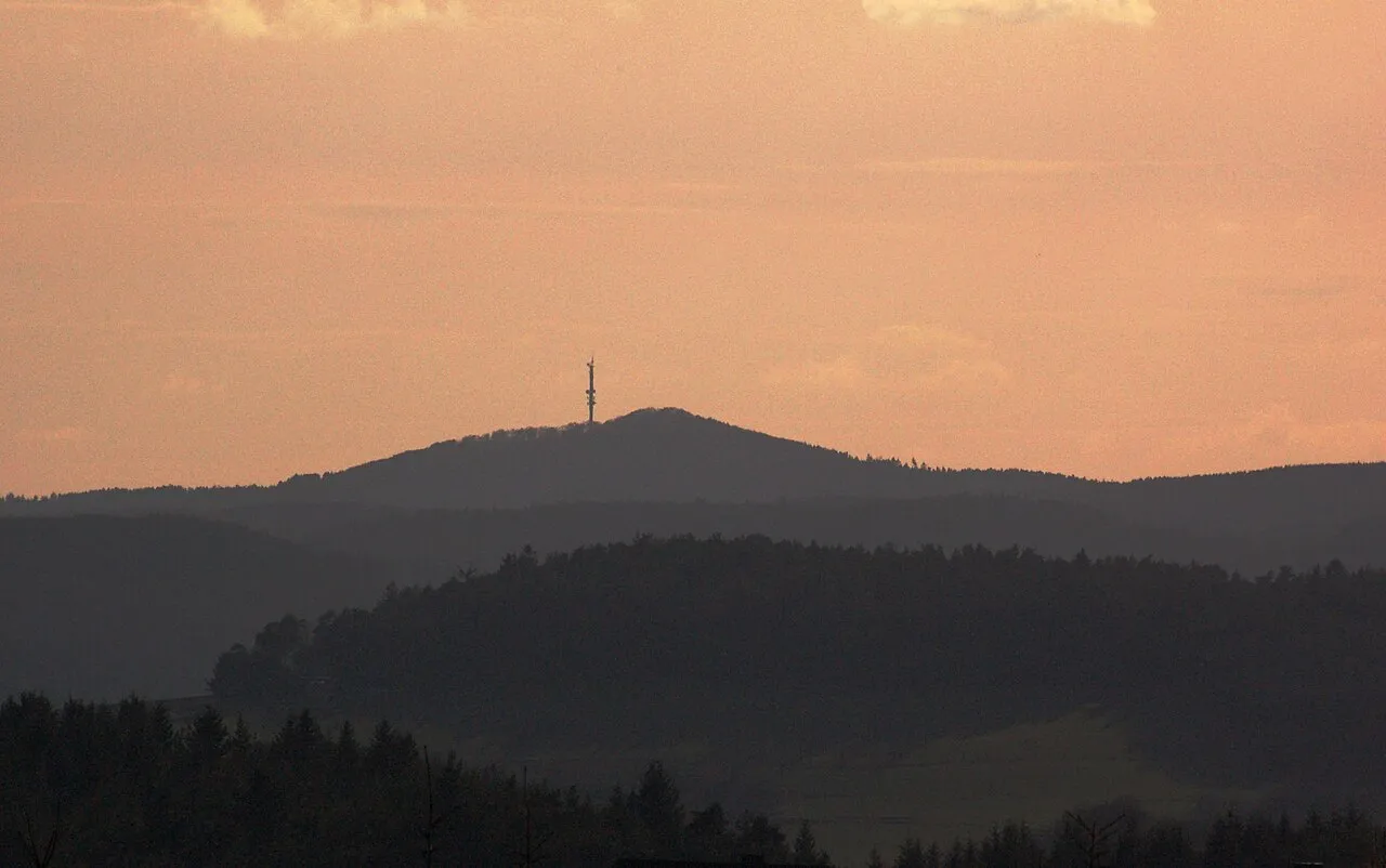
At 674.9 metres (2,214 ft) the Hochkelberg is one of the ten highest mountains in the Vulkan Eifel in Germany. It is a former stratovolcano, at the southern foot of which lies the Mosbrucher Weiher, an explosion crater lake or maar. Below the summit of the Hochkelberg is a transmission tower. Originally the mountain which is visible today lay 200 metres below the surface. When the region was uplifted the outer layers were carried away leaving the hard basaltic core.
Source: Wikipedia · CC BY-SA 4.0
Climate of Hochkelberg
Best months for sightseeingBest months for sightseeing: June–August.
This month · November
A cold month
Day 5° · Night 0° · Rain 91 mm
- Hottest month
- July (day 20°)
- Coldest month
- February (night -4°)
- Wettest month
- December (104 mm)
- Driest month
- August (62 mm)
Bars: average monthly low and high temperature. Below: precipitation. Monthly averages for 1970–2000 at about 18 km resolution, adjusted for elevation. Highlighted months are mild and relatively dry. Source: WorldClim 2.1 (CC BY 4.0).
Show values as a table
| Month | Jan | Feb | Mar | Apr | May | Jun | Jul | Aug | Sep | Oct | Nov | Dec |
|---|---|---|---|---|---|---|---|---|---|---|---|---|
| Average high (°C) | 1° | 2° | 6° | 10° | 15° | 18° | 20° | 20° | 15° | 10° | 5° | 2° |
| Average low (°C) | -4° | -4° | -1° | 1° | 5° | 8° | 10° | 10° | 7° | 3° | 0° | -3° |
| Precipitation (mm) | 94 | 73 | 85 | 65 | 72 | 77 | 73 | 62 | 77 | 80 | 91 | 104 |
How to get to Hochkelberg
The nearest airport is Frankfurt-Hahn Airport (HHN), 43 km to the southeast as the crow flies. The nearest large city is Koblenz, 45 km to the east.
Airports
- Frankfurt-Hahn Airport (HHN) Frankfurt am Main (Lautzenhausen) 43 kmsoutheast
- Cologne Bonn Airport (CGN) Köln (Cologne) 67 kmnorth
- Luxembourg-Findel International Airport (LUX) Luxembourg 89 kmsouthwest
Nearby large cities
- Koblenz Population: 107.3K 45 kmeast
- Bonn Population: 330.6K 52 kmnorth
- Trier Population: 100.1K 62 kmsouth
- Cologne Population: 1M 73 kmnorth
- Bergisch Gladbach Population: 106.2K 80 kmnorth
Straight-line distances; road distances are longer. Airport data: OurAirports.
Day trips from Hochkelberg
Within 100 km: 594 historic and cultural sites, 3,160 natural sites, 865 lakes, rivers and coasts.
0–25 km485 places
- Weinfelder Maar Lake 13 kmSW
- Pulvermaar Lake 16 kmS
- Meerfelder Maar Lake 24 kmSW
- Gemündener Maar Lake 14 kmSW
25–60 km1,714 places
- Steinkopf Mountain 56 kmW
- Schartenknopf Mountain 40 kmW
- Roderhöhe Mountain 53 kmW
- Reinersberg Mountain 59 kmW
60–100 km2,420 places
- Lac de la Gileppe Lake 77 kmNW
- Lac d'Eupen Lake 72 kmNW
- Lac de Nisramont Lake 93 kmW
- Lac de Robertville Lake 62 kmW
Straight-line distances.
Nearest towns and villages


Nearby attractions & nature
Everything nearby-
Rosen-Berg Mountain, Kelberg1 km N
-
Kläppchen Mountain, Sassen1.9 km SE
-
Beil-Stein Mountain, Bereborn1.9 km NE
-
Schildwacht Mountain, Mannebach2.1 km N
-
Ringelbachberg Mountain, Mosbruch1.6 km SW
-
Geisberg Mountain, Mannebach2.4 km NE
-
Jonas-Hübel Mountain, Bereborn2.1 km N
-
Schwarzenberg Mountain, Kelberg2.7 km NW
Sources & licences
Data last updated: · 2 independent sources