- Population
- 333,149
- 333.1K
- Elevation
- 310 m
- above sea level
- Local time
- UTC+01:00
- Europe/Berlin · UTC+01:00
- Places inside
- 10
- listed under Regionalverband Saarbrücken
- Airports
- SCN Saarbrücken Airport12 km
- ETZ Metz-Nancy-Lorraine Airport62 km
About Regionalverband Saarbrücken
Regionalverband Saarbrücken is a municipality. Location: Saarland, Germany. Population: 333,149. Elevation: 310 m. The best months to visit are June–August. The nearest airport is Saarbrücken Airport (12 km). Nearby sights include Forst Saarbrücken and Köllertaler Wald.
Climate of Regionalverband Saarbrücken
Best months for sightseeingBest months for sightseeing: June–August.
This month · November
A cold month
Day 7° · Night 2° · Rain 88 mm
- Hottest month
- July (day 23°)
- Coldest month
- January (night -2°)
- Wettest month
- December (102 mm)
- Driest month
- April (61 mm)
Bars: average monthly low and high temperature. Below: precipitation. Monthly averages for 1970–2000 at about 18 km resolution, adjusted for elevation. Highlighted months are mild and relatively dry. Source: WorldClim 2.1 (CC BY 4.0).
Show values as a table
| Month | Jan | Feb | Mar | Apr | May | Jun | Jul | Aug | Sep | Oct | Nov | Dec |
|---|---|---|---|---|---|---|---|---|---|---|---|---|
| Average high (°C) | 3° | 5° | 9° | 13° | 18° | 21° | 23° | 23° | 19° | 13° | 7° | 4° |
| Average low (°C) | -2° | -1° | 1° | 3° | 8° | 11° | 13° | 12° | 9° | 5° | 2° | 0° |
| Precipitation (mm) | 81 | 72 | 72 | 61 | 78 | 77 | 73 | 61 | 69 | 85 | 88 | 102 |
How to get to Regionalverband Saarbrücken
The nearest airport is Saarbrücken Airport (SCN), 12 km to the southeast as the crow flies. For international flights: Luxembourg-Findel International Airport (LUX) (67 km). The nearest large city is Saarbrücken, 6 km to the southeast.
Airports
- Saarbrücken Airport (SCN) Saarbrücken 12 kmsoutheast
- Metz-Nancy-Lorraine Airport (ETZ) Goin 62 kmsouthwest
- Luxembourg-Findel International Airport (LUX) Luxembourg 67 kmnorthwest
Nearby large cities
- Saarbrücken Population: 183K 6 kmsoutheast
- Trier Population: 100.1K 58 kmnorthwest
- Metz Population: 123.9K 61 kmwest
- Nancy Population: 105.1K 87 kmsouthwest
- Strasbourg Population: 274.8K 96 kmsoutheast
Straight-line distances; road distances are longer. Airport data: OurAirports.
Day trips from Regionalverband Saarbrücken
Within 100 km: 321 historic and cultural sites, 2,267 natural sites, 528 lakes, rivers and coasts.
0–25 km312 places
- Ottweiler Wingertsweier Lake 21 kmNE
- Bomberg Mountain 22 kmNE
- Ziegelberg Mountain 21 kmNE
- Wackenberg Mountain 12 kmN
25–60 km1,033 places
- Gelterswoog Lake 54 kmE
- Talsperre Nonnweiler Lake 38 kmN
- Steinbachtalsperre Lake 58 kmN
- Bostalsee Lake 33 kmN
60–100 km1,771 places
- Montagne de Stockem Mountain 99 kmNW
- Bois de Willancourt Natural site 99 kmW
- Pryre Natural site 99 kmW
- Bois Pertot Natural site 96 kmW
Straight-line distances.
Regionalverband Saarbrücken and similar cities
Side by side with cities of similar size in the same country: population, elevation and climate.
| Measure | Regionalverband Saarbrücken | Bielefeld | Bonn | Münster |
|---|---|---|---|---|
| Population | 333.1K | 331.9K | 330.6K | 308.3K |
| Elevation | 310 m | 111 m | 64 m | 64 m |
| Summer day (hottest month) | 23° | 23° | 24° | 23° |
| Winter night (coldest month) | -2° | -1° | 0° | -1° |
| Annual rainfall | 919 mm | 833 mm | 717 mm | 768 mm |
| Best months | Jun–Aug | Jun–Aug | May–Sep | Jun–Aug |
| Distance | — | 326 km | 162 km | 302 km |
Climate values are 1970–2000 monthly averages; straight-line distance.
Places in Regionalverband Saarbrücken
10 places- 1 Saarbrücken, Landeshauptstadt 183K
- 2 Völklingen 41K
- 3 Heusweiler 18.4K
- 4 Püttlingen 18.4K
- 5 Sulzbach/Saar 16.4K
- 6 Riegelsberg 14.3K
- 7 Quierschied 12.9K
- 8 Kleinblittersdorf 10.9K
- 9 Friedrichsthal 10.2K
- 10 Großrosseln 7.8K
Bar: population relative to the most populous place in this list.
Nearby attractions & nature
Everything nearby-
Forst Saarbrücken Natural site, Saarland0.9 km S
-
Köllertaler Wald Natural site, Saarland2.6 km N
-
Forst Fischbach Natural site, Saarland5.2 km NE
-
Stadtwald Sankt Johann Natural site, Saarland5.3 km SE
-
Stadtwald Alt-Saarbrücken Natural site, Saarland5.9 km S
-
Köllertal Natural site, Saarland6.4 km NW
-
Saarkohlenwald Natural site, Saarland8.3 km E
-
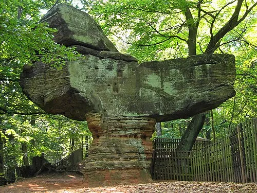 Großer Stiefel Mountain, St. Ingbert9 km E
Sources & licences
Data last updated: