- Elevation
- 324 m
- above sea level
- Local time
- UTC+01:00
- Europe/Berlin · UTC+01:00
- Airports
- SCN Saarbrücken Airport17 km
- FKB Karlsruhe Baden-Baden Airport69 km
About Riesweiler
Riesweiler is a village. Location: Blieskastel, Saarpfalz-Kreis. Elevation: 324 m. The best months to visit are June–August. The nearest airport is Saarbrücken Airport (17 km). Nearby sights include Kahlenberg and Kahlenberg.
Climate of Riesweiler
Best months for sightseeingBest months for sightseeing: June–August.
This month · November
A cold month
Day 7° · Night 1° · Rain 86 mm
- Hottest month
- July (day 23°)
- Coldest month
- January (night -2°)
- Wettest month
- December (96 mm)
- Driest month
- April (58 mm)
Bars: average monthly low and high temperature. Below: precipitation. Monthly averages for 1970–2000 at about 18 km resolution, adjusted for elevation. Highlighted months are mild and relatively dry. Source: WorldClim 2.1 (CC BY 4.0).
Show values as a table
| Month | Jan | Feb | Mar | Apr | May | Jun | Jul | Aug | Sep | Oct | Nov | Dec |
|---|---|---|---|---|---|---|---|---|---|---|---|---|
| Average high (°C) | 3° | 5° | 9° | 13° | 18° | 21° | 23° | 23° | 19° | 13° | 7° | 4° |
| Average low (°C) | -2° | -2° | 1° | 3° | 7° | 10° | 12° | 12° | 8° | 5° | 1° | -1° |
| Precipitation (mm) | 75 | 69 | 68 | 58 | 78 | 79 | 73 | 60 | 68 | 82 | 86 | 96 |
How to get to Riesweiler
The nearest airport is Saarbrücken Airport (SCN), 17 km to the northwest as the crow flies. For international flights: Karlsruhe Baden-Baden Airport (FKB) (69 km). The nearest large city is Saarbrücken, 24 km to the northwest.
Airports
- Saarbrücken Airport (SCN) Saarbrücken 17 kmnorthwest
- Karlsruhe Baden-Baden Airport (FKB) Rheinmünster 69 kmsoutheast
- Strasbourg Airport (SXB) Strasbourg 71 kmsouth
Nearby large cities
- Saarbrücken Population: 183K 24 kmnorthwest
- Strasbourg Population: 274.8K 70 kmsoutheast
- Karlsruhe Population: 283.8K 81 kmeast
- Metz Population: 123.9K 83 kmwest
- Trier Population: 100.1K 84 kmnorthwest
Straight-line distances; road distances are longer. Airport data: OurAirports.
Day trips from Riesweiler
Within 100 km: 492 historic and cultural sites, 2,525 natural sites, 603 lakes, rivers and coasts.
0–25 km258 places
- Sonnenberg Mountain 23 kmW
- Schwobacher Berg Mountain 23 kmN
- Kahler Berg Mountain 7 kmN
- Kahlenberg Mountain 4 kmNE
25–60 km1,376 places
- Gelterswoog Lake 40 kmNE
- Talsperre Nonnweiler Lake 58 kmNW
- Bostalsee Lake 50 kmN
- Ottweiler Wingertsweier Lake 32 kmN
60–100 km1,986 places
- Sauer River 87 kmNW
- Unditz River 87 kmSE
- Rench River 71 kmSE
- Friesenheimer Insel Island 93 kmNE
Straight-line distances.
Nearby attractions & nature
Everything nearby-
Kahlenberg Mountain, Blieskastel4 km NE
-
Kahlenberg Mountain, Blieskastel5.8 km NW
-
Klosterwald Natural site, Saarland4.5 km W
-
Hochwald Natural site, Saarland4.9 km NW
-
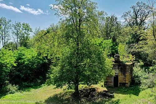 Kalbenberg Mountain, Blieskastel9.2 km NW
-
Kahler Berg Mountain, Blieskastel7.2 km N
Other cities and towns in Blieskastel
-
 Altheim Village, Blieskastel3.6 km N
-
 Böckweiler Village, Blieskastel4.9 km N
-
 Breitfurt Village, Blieskastel7.8 km NW
-
 Wolfersheim Village, Blieskastel8.3 km NW
-
 Blickweiler Village, Blieskastel9.2 km NW
-
Pinningen Village, Blieskastel3.5 km NW
Sources & licences
Data last updated: