
- Population
- 583
- 583
- Elevation
- 500 m
- above sea level
- Local time
- UTC+01:00
- Europe/Berlin · UTC+01:00
- Airports
- ERF Erfurt-Weimar Airport87 km
- KSF Kassel Airport97 km
About Elend
Elend is a village. Location: Oberharz am Brocken, Landkreis Harz. Population: 583. Elevation: 500 m.
Elend (German pronunciation: [ˈeːlɛnt] ) is a district of the town of Oberharz am Brocken in the Harz District, in Saxony-Anhalt, Germany. It lies in the Bode valley in the High Harz in central Germany, at a height of 505 m above NN. This part of the valley is known locally as Elendstal. Elend is located near the former Inner German Border between West and East Germany. Its population is 318 (2021).
Source: Wikipedia · CC BY-SA 4.0
Photos of Elend
-

Jörg Ostheimer · CC BY-SA 2.0 -

SeriousAugust · CC BY-SA 4.0 -

Lukas Beck · CC BY 4.0 -

Greifen · CC BY-SA 4.0 -

GrimKatharsis · CC BY-SA 3.0


Climate of Elend
Best months for sightseeingBest months for sightseeing: June–August.
This month · November
A wet month
Day 5° · Night 0° · Rain 102 mm
- Hottest month
- July (day 20°)
- Coldest month
- February (night -4°)
- Wettest month
- December (120 mm)
- Driest month
- May (70 mm)
Bars: average monthly low and high temperature. Below: precipitation. Monthly averages for 1970–2000 at about 18 km resolution, adjusted for elevation. Highlighted months are mild and relatively dry. Source: WorldClim 2.1 (CC BY 4.0).
Show values as a table
| Month | Jan | Feb | Mar | Apr | May | Jun | Jul | Aug | Sep | Oct | Nov | Dec |
|---|---|---|---|---|---|---|---|---|---|---|---|---|
| Average high (°C) | 2° | 2° | 5° | 9° | 15° | 18° | 20° | 20° | 16° | 11° | 5° | 2° |
| Average low (°C) | -4° | -4° | -2° | 1° | 6° | 9° | 11° | 10° | 7° | 4° | 0° | -2° |
| Precipitation (mm) | 103 | 75 | 99 | 72 | 70 | 92 | 87 | 80 | 79 | 87 | 102 | 120 |
How to get to Elend
The nearest airport is Erfurt-Weimar Airport (ERF), 87 km to the south as the crow flies. The nearest large city is Salzgitter, 50 km to the north.
Airports
- Erfurt-Weimar Airport (ERF) Erfurt 87 kmsouth
- Kassel Airport (KSF) Calden 97 kmwest
- Hannover Airport (HAJ) Hannover 105 kmnorthwest
Nearby large cities
- Salzgitter Population: 105K 50 kmnorth
- Göttingen Population: 122.1K 57 kmsouthwest
- Braunschweig Population: 244.7K 59 kmnorth
- Wolfsburg Population: 123.1K 76 kmnorth
- Magdeburg Population: 244.3K 78 kmnortheast
Straight-line distances; road distances are longer. Airport data: OurAirports.
Day trips from Elend
Within 100 km: 529 historic and cultural sites, 3,813 natural sites, 783 lakes, rivers and coasts.
0–25 km579 places
- Schalk River 20 kmNW
- Bere River 22 kmS
- Zillerbachtalsperre Lake 8 kmNE
- Talsperre Wendefurth Lake 15 kmE
25–60 km1,721 places
- Sarre River 55 kmNE
- Aue River 35 kmN
- Aue River 27 kmN
- Tietal Lake 43 kmNE
60–100 km2,825 places
- Buchenwald concentration camp Historic site 89 kmSE
- Wiehe River 95 kmN
- Ohe River 82 kmNW
- Frieda River 73 kmSW
Straight-line distances.
Nearby attractions & nature
Everything nearby-
Barenberg Mountain, Oberharz am Brocken1.5 km NW
-
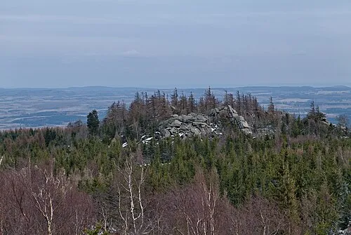 Hohnekopf Mountain, Oberharz am Brocken2.6 km N
-
Forst Elend Natural site, Saxony-Anhalt1.5 km SE
-
Amkenberg Mountain, Oberharz am Brocken2.9 km SW
-
Rauher Jakob Mountain, Oberharz am Brocken2.6 km SE
-
Ahrensklint Mountain, Wernigerode2.8 km NW
Other cities and towns in Oberharz am Brocken
-
 Elbingerode Village, Oberharz am Brocken8.6 km E
-
 Benneckenstein Village, Oberharz am Brocken8.8 km S
-
 Hasselfelde Village, Oberharz am Brocken13 km SE
-
 Rübeland Village, Oberharz am Brocken11 km E
-
 Stiege Village, Oberharz am Brocken16 km SE
-
Wietfeld Village, Oberharz am Brocken3.4 km SW
Sources & licences
Data last updated: · 2 independent sources