
- Population
- 1,086
- 1.1K
- Elevation
- 146 m
- above sea level
- Local time
- UTC+01:00
- Europe/Berlin · UTC+01:00
- Airports
- ERF Erfurt-Weimar Airport88 km
- LEJ Leipzig/Halle Airport88 km
About Weddersleben
Weddersleben is a village. Location: Thale, Landkreis Harz. Population: 1,086. Elevation: 146 m.
Weddersleben (German pronunciation: [ˈvɛdɐsleːbn̩]) is a village and a former municipality in the district of Harz, Saxony-Anhalt, in the Harz area. Since 1 January 2009, it is part of the town Thale. The village is well known for being located adjacent to the famed natural rock formation known as the Teufelsmauer, or "Devil's Wall" in English. Surrounding forest area has numerous paths for biking and hiking, making it a popular tourist destination for nature seekers.
Source: Wikipedia · CC BY-SA 4.0
At a glance
- Area
- 6.4 km²
Source: Wikidata
Photos of Weddersleben
-
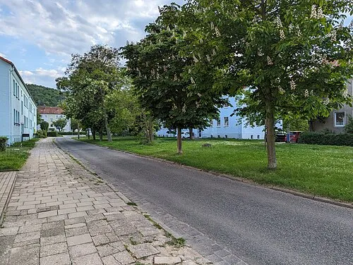
Mühlenberg Molgreen · CC BY-SA 4.0

Climate of Weddersleben
Best months for sightseeingBest months for sightseeing: June–August.
This month · November
A cold month
Day 8° · Night 2° · Rain 50 mm
- Hottest month
- August (day 23°)
- Coldest month
- February (night -2°)
- Wettest month
- June (67 mm)
- Driest month
- February (35 mm)
Bars: average monthly low and high temperature. Below: precipitation. Monthly averages for 1970–2000 at about 18 km resolution, adjusted for elevation. Highlighted months are mild and relatively dry. Source: WorldClim 2.1 (CC BY 4.0).
Show values as a table
| Month | Jan | Feb | Mar | Apr | May | Jun | Jul | Aug | Sep | Oct | Nov | Dec |
|---|---|---|---|---|---|---|---|---|---|---|---|---|
| Average high (°C) | 3° | 4° | 8° | 12° | 18° | 20° | 23° | 23° | 18° | 13° | 8° | 5° |
| Average low (°C) | -2° | -2° | 1° | 3° | 8° | 11° | 12° | 12° | 9° | 5° | 2° | 0° |
| Precipitation (mm) | 42 | 35 | 47 | 46 | 60 | 67 | 63 | 60 | 51 | 43 | 50 | 51 |
How to get to Weddersleben
The nearest airport is Erfurt-Weimar Airport (ERF), 88 km to the south as the crow flies. The nearest large city is Magdeburg, 55 km to the northeast.
Airports
- Erfurt-Weimar Airport (ERF) Erfurt 88 kmsouth
- Leipzig/Halle Airport (LEJ) Schkeuditz 88 kmsoutheast
- Hannover Airport (HAJ) Hannover 123 kmnorthwest
Nearby large cities
- Magdeburg Population: 244.3K 55 kmnortheast
- Salzgitter Population: 105K 63 kmnorthwest
- Braunschweig Population: 244.7K 68 kmnorthwest
- Halle Population: 237.9K 70 kmsoutheast
- Wolfsburg Population: 123.1K 76 kmnorth
Straight-line distances; road distances are longer. Airport data: OurAirports.
Day trips from Weddersleben
Within 100 km: 508 historic and cultural sites, 3,253 natural sites, 740 lakes, rivers and coasts.
0–25 km339 places
- Tietal Lake 20 kmNE
- Zillerbachtalsperre Lake 22 kmW
- Talsperre Wendefurth Lake 13 kmW
- Teufelsteich Lake 17 kmS
25–60 km1,600 places
- Schalk River 46 kmW
- Sarre River 32 kmNE
- Ehle River 34 kmNE
- Bere River 33 kmSW
60–100 km2,562 places
- Buchenwald concentration camp Historic site 83 kmS
- Frieda River 92 kmSW
- Ehle River 65 kmNE
- Rabeninsel Island 68 kmSE
Straight-line distances.
Nearby attractions & nature
Everything nearby-
Mühlenberg Mountain, Thale3 km SW
-
Münchenberg Mountain, Thale3.7 km S
-
Reineckenberg Mountain, Thale3.8 km S
-
Roßhöhe Mountain, Thale4.1 km NW
-
Elzeberg Mountain, Thale3.8 km S
-
Schmiedeberg Mountain, Thale4.3 km SW
Other cities and towns in Thale
-
 Friedrichsbrunn Village, Thale9 km S
-
 Treseburg Village, Thale9.6 km SW
-
 Altenbrak Village, Thale11 km SW
-
Benneckenrode Village, Thale5 km W
-
Allrode Village, Thale13 km SW
-
 Wendefurth Village, Thale12 km W
Sources & licences
Data last updated: · 2 independent sources