Bahretal
Located in Sächsische Schweiz-Osterzgebirge, Saxony Coordinates: 50°53′15″ N 13°54′00″ E

- Population
- 2,082
- 2.1K
- Elevation
- 299 m
- above sea level
- Local time
- UTC+01:00
- Europe/Berlin · UTC+01:00
- Places inside
- 20
- listed under Bahretal
- Airports
- DRS Dresden Airport29 km
- PRG Václav Havel Airport Prague91 km
About Bahretal
Bahretal is a village. Location: Sächsische Schweiz-Osterzgebirge, Saxony. Population: 2,082. Elevation: 299 m.
Bahretal (German pronunciation: [ˈbaːʁətaːl], lit. 'Bahre Valley') is a municipality in the Sächsische Schweiz-Osterzgebirge district in Saxony, Germany. It is situated in the northeastern foothills of the Ore Mountains, between Bad Gottleuba-Berggießhübel and Dohna. It consists of several small villages, situated in the valleys of the rivers Bahre and Seidewitz as well as on the heights between the valleys. The municipality is named after the small river Bahre which flows through it.
Source: Wikipedia · CC BY-SA 4.0
Photos of Bahretal
-
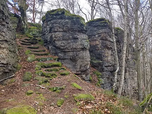
Hochstein Singlespeedfahrer · CC0

Places bordering Bahretal
- Pirna
- Dohma
- Liebstadt
Population of Bahretal over time
| 2017 | 2,204 | |
|---|---|---|
| 2019 | 2,169 | |
| 2021 | 2,120 | |
| 2022 | 2,149 | |
| 2023 | 2,130 | |
| 2024 | 2,082 | |
| 2025 | 2,076 |
Censuses and official estimates; source: Wikidata.
Climate of Bahretal
Best months for sightseeingBest months for sightseeing: June–August.
This month · November
A cold month
Day 6° · Night 1° · Rain 54 mm
- Hottest month
- August (day 23°)
- Coldest month
- January (night -3°)
- Wettest month
- July (87 mm)
- Driest month
- February (41 mm)
Bars: average monthly low and high temperature. Below: precipitation. Monthly averages for 1970–2000 at about 18 km resolution, adjusted for elevation. Highlighted months are mild and relatively dry. Source: WorldClim 2.1 (CC BY 4.0).
Show values as a table
| Month | Jan | Feb | Mar | Apr | May | Jun | Jul | Aug | Sep | Oct | Nov | Dec |
|---|---|---|---|---|---|---|---|---|---|---|---|---|
| Average high (°C) | 2° | 3° | 8° | 12° | 18° | 21° | 23° | 23° | 18° | 13° | 6° | 3° |
| Average low (°C) | -3° | -3° | 0° | 3° | 8° | 11° | 13° | 13° | 9° | 5° | 1° | -1° |
| Precipitation (mm) | 45 | 41 | 51 | 41 | 64 | 77 | 87 | 82 | 56 | 49 | 54 | 53 |
How to get to Bahretal
The nearest airport is Dresden Airport (DRS), 29 km to the north as the crow flies. The nearest large city is Dresden, 21 km to the northwest.
Airports
- Dresden Airport (DRS) Dresden 29 kmnorth
- Václav Havel Airport Prague (PRG) Prague 91 kmsouth
- Karlovy Vary Airport (KLV) Karlovy Vary 103 kmsouthwest
Nearby large cities
- Dresden Population: 564.9K 21 kmnorthwest
- Chemnitz Population: 247.2K 69 kmwest
- Prague Population: 1.2M 96 kmsoutheast
- Leipzig Population: 505K 118 kmnorthwest
- Gera Population: 104.7K 128 kmwest
Straight-line distances; road distances are longer. Airport data: OurAirports.
Day trips from Bahretal
Within 100 km: 274 historic and cultural sites, 1,839 natural sites, 389 lakes, rivers and coasts.
0–25 km364 places
- Erzgebirge Mountain 6 kmW
- Pirna-Sonnenstein Mountain 8 kmNE
- Taubenteich Lake 17 kmE
- Rückhaltebecken Reinhardtsgrimma Lake 12 kmW
25–60 km951 places
- Hořidla Mountain 47 kmSE
- Vosí vrch Mountain 35 kmE
- Weißiger Großteich Lake 52 kmN
- Vierteich Lake 44 kmN
60–100 km1,187 places
- Lysá Mountain 74 kmSE
- Stoličná Mountain 83 kmSW
- Svatý Prokop Landmark 86 kmSW
- Buschteich Lake 70 kmNE
Straight-line distances.
Places in Bahretal
20 placesCities & villages12
- Borna · Neighbourhood
- Borna-Gersdorf · Village
- Friedrichswalde · Village
- Gersdorf · Neighbourhood
- Göppersdorf · Village
- Laurich · Village
- Nentmannsdorf · Village
- Niederseidewitz · Village
- Oberseidewitz · Village
- Ottendorf · Village
- Seidewitzthal · Village
- Wingendorf · Village
Mountains & nature8
- Bahre-Berg · Mountain
- Brand · Mountain
- Cottaer Busch · Mountain
- Hallstein · Mountain
- Herbstberg · Mountain
- Purpurberg · Mountain
- Roter Berg · Mountain
- Schärfling · Mountain
Nearby attractions & nature
Everything nearby-
Rückhaltebecken Friedrichswalde-Ottendorf Lake, Saxony0.9 km NE
-
Bahrebach River, Saxony1.4 km S
-
Hochstein Mountain, Bad Gottleuba-Berggießhübel3.2 km SE
-
Cottaer Busch Natural site, Saxony2.8 km E
-
Kanitz-Berg Mountain, Müglitztal4.1 km NW
-
Eichleite Mountain, Liebstadt4.1 km W
Other cities and towns in Sächsische Schweiz-Osterzgebirge
-
Herbergen Village, Liebstadt3.1 km SW
-
 Biensdorf Village, Liebstadt4 km NW
-
Großcotta Village, Dohma4.7 km E
-
Burkhardswalde Village, Müglitztal4.9 km NW
-
Meusegast Village, Dohna5 km N
-
Zuschendorf Village, Pirna5.2 km N
Sources & licences
Data last updated: · 2 independent sources