Burg Hohnstein
Located in Hohnstein, Sächsische Schweiz-Osterzgebirge Coordinates: 50°58′46″ N 14°06′32″ E
- Local time
- UTC+01:00
- Europe/Berlin · UTC+01:00
- Elevation
- 285 m
- above sea level
- Airports
- DRS Dresden Airport29 km
- PRG Václav Havel Airport Prague98 km
About Burg Hohnstein
Burg Hohnstein is a historic site. Location: Hohnstein, Sächsische Schweiz-Osterzgebirge. The best months to visit are June–August. The nearest airport is Dresden Airport (29 km). Nearby sights include Early Camp Hohnstein and Galgenberg.
Photos of Burg Hohnstein
-
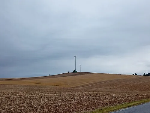
Haselberg Gumideck · CC BY-SA 4.0 -
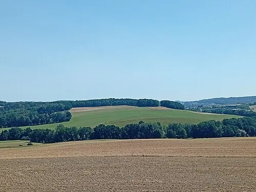
Forkersberg Gumideck · CC BY-SA 4.0 -
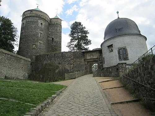
Burg Stolpen Dickelbers · CC BY-SA 3.0 -
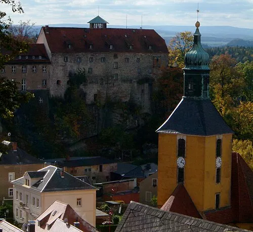
Early Camp Hohnstein Hedwig Storch · CC BY-SA 3.0


Climate of Burg Hohnstein
Best months for sightseeingBest months for sightseeing: June–August.
This month · November
A cold month
Day 6° · Night 1° · Rain 59 mm
- Hottest month
- August (day 23°)
- Coldest month
- January (night -3°)
- Wettest month
- July (90 mm)
- Driest month
- April (38 mm)
Bars: average monthly low and high temperature. Below: precipitation. Monthly averages for 1970–2000 at about 18 km resolution, adjusted for elevation. Highlighted months are mild and relatively dry. Source: WorldClim 2.1 (CC BY 4.0).
Show values as a table
| Month | Jan | Feb | Mar | Apr | May | Jun | Jul | Aug | Sep | Oct | Nov | Dec |
|---|---|---|---|---|---|---|---|---|---|---|---|---|
| Average high (°C) | 2° | 3° | 7° | 12° | 18° | 21° | 23° | 23° | 18° | 13° | 6° | 3° |
| Average low (°C) | -3° | -3° | 1° | 4° | 8° | 11° | 13° | 13° | 10° | 6° | 1° | -1° |
| Precipitation (mm) | 49 | 45 | 53 | 38 | 65 | 80 | 90 | 88 | 61 | 53 | 59 | 54 |
How to get to Burg Hohnstein
The nearest airport is Dresden Airport (DRS), 29 km to the northwest as the crow flies. The nearest large city is Dresden, 27 km to the west.
Airports
- Dresden Airport (DRS) Dresden 29 kmnorthwest
- Václav Havel Airport Prague (PRG) Prague 98 kmsouth
- Karlovy Vary Airport (KLV) Karlovy Vary 121 kmsouthwest
Nearby large cities
- Dresden Population: 564.9K 27 kmwest
- Chemnitz Population: 247.2K 85 kmwest
- Prague Population: 1.2M 102 kmsouth
- Leipzig Population: 505K 128 kmwest
- Gera Population: 104.7K 143 kmwest
Straight-line distances; road distances are longer. Airport data: OurAirports.
Day trips from Burg Hohnstein
Within 100 km: 250 historic and cultural sites, 1,658 natural sites, 379 lakes, rivers and coasts.
0–25 km329 places
- Erzgebirge Mountain 23 kmSW
- Pirna-Sonnenstein Mountain 11 kmW
- Vosí vrch Mountain 23 kmSE
- Taubenteich Lake 16 kmS
25–60 km989 places
- Hořidla Mountain 50 kmS
- Buschteich Lake 54 kmNE
- Obersee Lake 56 kmNE
- Winkelteich Lake 53 kmNE
60–100 km969 places
- Lysá Mountain 69 kmSE
- Jastrzębiec Mountain 99 kmE
- Wergteich Lake 78 kmN
- Unterteich Lake 97 kmN
Straight-line distances.
Nearby attractions & nature
Everything nearby-
Early Camp Hohnstein Historic site, Hohnstein0.3 km E
-
Galgenberg Mountain, Hohnstein1 km NE
-
Schanzberg Mountain, Hohnstein1 km SE
-
Schulzengrund Natural site, Saxony1.5 km S
-
Forst Hohnstein Natural site, Saxony1.5 km S
-
Hohburkersdorfer Rundblick Mountain, Hohnstein2.9 km NW
-
Tiefer Grund Natural site, Saxony2.6 km SE
-
Waitzdorfer Höhe Mountain, Hohnstein3.1 km SE
Nearest towns and villages
-
Hohnstein Village, Hohnstein0.4 km E
-
 Waltersdorf Village, Bad Schandau3.1 km S
-
Rathen Village, Rathen, Kurort2.8 km SW
-
Rathen, Kurort Village, Sächsische Schweiz-Osterzgebirge3.1 km SW
Sources & licences
Data last updated: